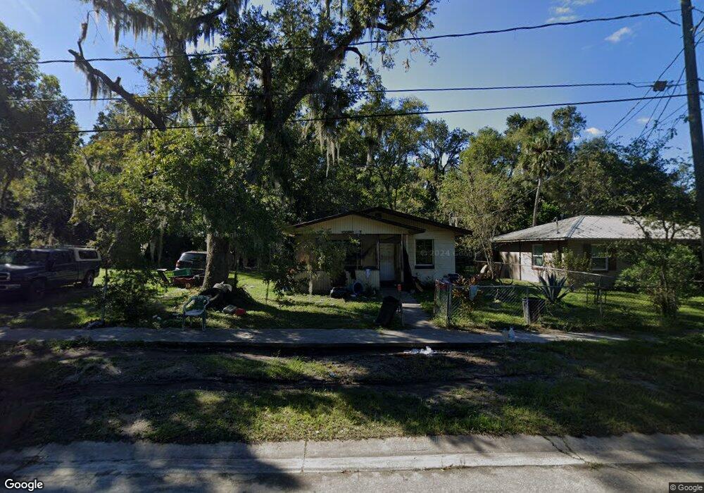
1008 N 12th St Palatka, FL 32177
Estimated Value: $87,749 - $140,000
2
Beds
1
Bath
975
Sq Ft
$116/Sq Ft
Est. Value
About This Home
This home is located at 1008 N 12th St, Palatka, FL 32177 and is currently estimated at $113,187, approximately $116 per square foot. 1008 N 12th St is a home located in Putnam County with nearby schools including Kelley Smith Elementary School, Palatka Jr.-Sr. High School, and Putnam EDGE High School.
Ownership History
Date
Name
Owned For
Owner Type
Purchase Details
Closed on
Dec 26, 2012
Sold by
The Latest Dirt Llc
Bought by
Brooks Tifiny and Brooks Ollie
Current Estimated Value
Home Financials for this Owner
Home Financials are based on the most recent Mortgage that was taken out on this home.
Original Mortgage
$53,000
Outstanding Balance
$45,881
Interest Rate
10%
Mortgage Type
Seller Take Back
Estimated Equity
$67,306
Purchase Details
Closed on
Jun 2, 2009
Sold by
Floyd Matthew James
Bought by
The Latest Dirt Llc
Create a Home Valuation Report for This Property
The Home Valuation Report is an in-depth analysis detailing your home's value as well as a comparison with similar homes in the area
Home Values in the Area
Average Home Value in this Area
Purchase History
| Date | Buyer | Sale Price | Title Company |
|---|---|---|---|
| Brooks Tifiny | $53,000 | Attorney | |
| The Latest Dirt Llc | $30,000 | Attorney |
Source: Public Records
Mortgage History
| Date | Status | Borrower | Loan Amount |
|---|---|---|---|
| Open | Brooks Tifiny | $53,000 |
Source: Public Records
Tax History Compared to Growth
Tax History
| Year | Tax Paid | Tax Assessment Tax Assessment Total Assessment is a certain percentage of the fair market value that is determined by local assessors to be the total taxable value of land and additions on the property. | Land | Improvement |
|---|---|---|---|---|
| 2024 | $699 | $37,260 | -- | -- |
| 2023 | $660 | $36,180 | $0 | $0 |
| 2022 | $609 | $35,130 | $0 | $0 |
| 2021 | $604 | $34,110 | $0 | $0 |
| 2020 | $599 | $33,640 | $0 | $0 |
| 2019 | $608 | $32,890 | $32,310 | $580 |
| 2018 | $605 | $32,280 | $31,830 | $450 |
| 2017 | $586 | $31,620 | $31,170 | $450 |
| 2016 | $777 | $30,970 | $0 | $0 |
| 2015 | $365 | $31,120 | $0 | $0 |
| 2014 | $436 | $31,700 | $0 | $0 |
Source: Public Records
Map
Nearby Homes
- 0 Bronson St Unit 2109003
- 518 N 10th St
- 1701 Wapalaw St
- 1511 Bronson St
- 512 N 18th St
- 2024 Eagle St
- 413 Bronson St Unit 1
- 000 ADDRESS 0 Unassigned Address
- 412 Madison St
- 505 N 4th St
- 506 E Bay St
- 656 State Road 20
- 406 Cedar Ave
- 313 Madison St
- 402 E Harris St
- 2009B Laurel St
- 1412 Laurel St
- 220 S 14th St
- 210 S 15th St
- 419 Mulholland Park