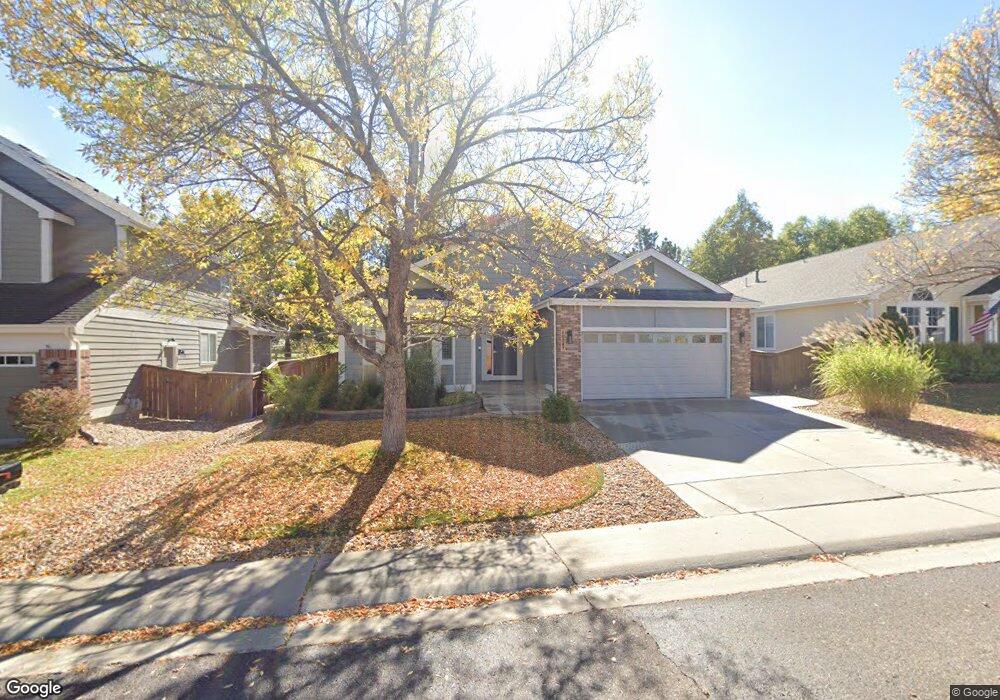
10087 Andrush Ct Lone Tree, CO 80124
Estimated Value: $654,940 - $732,000
3
Beds
2
Baths
2,050
Sq Ft
$345/Sq Ft
Est. Value
About This Home
This home is located at 10087 Andrush Ct, Lone Tree, CO 80124 and is currently estimated at $706,735, approximately $344 per square foot. 10087 Andrush Ct is a home located in Douglas County with nearby schools including Acres Green Elementary School, Cresthill Middle School, and Highlands Ranch High School.
Ownership History
Date
Name
Owned For
Owner Type
Purchase Details
Closed on
Jun 29, 2006
Sold by
Heinert George
Bought by
Heinert George L
Current Estimated Value
Home Financials for this Owner
Home Financials are based on the most recent Mortgage that was taken out on this home.
Original Mortgage
$259,900
Outstanding Balance
$150,845
Interest Rate
6.63%
Mortgage Type
Unknown
Estimated Equity
$555,890
Purchase Details
Closed on
Nov 30, 2001
Sold by
Bures Steve and Bures Margaret
Bought by
Quintero Jaime and Quintero Mary Yolanda
Purchase Details
Closed on
Nov 11, 1997
Sold by
U S Home Corp
Bought by
Bures Steve and Bures Margaret
Purchase Details
Closed on
Nov 29, 1996
Sold by
U S Home Corp
Bought by
Bures Steve and Bures Margaret
Home Financials for this Owner
Home Financials are based on the most recent Mortgage that was taken out on this home.
Original Mortgage
$160,498
Interest Rate
11.3%
Create a Home Valuation Report for This Property
The Home Valuation Report is an in-depth analysis detailing your home's value as well as a comparison with similar homes in the area
Home Values in the Area
Average Home Value in this Area
Purchase History
| Date | Buyer | Sale Price | Title Company |
|---|---|---|---|
| Heinert George L | -- | Utc Colorado | |
| Heinert George | $324,900 | Utc Colorado | |
| Quintero Jaime | $240,000 | -- | |
| Bures Steve | $178,332 | -- | |
| Bures Steve | $178,332 | -- |
Source: Public Records
Mortgage History
| Date | Status | Borrower | Loan Amount |
|---|---|---|---|
| Open | Heinert George | $259,900 | |
| Previous Owner | Bures Steve | $160,498 |
Source: Public Records
Tax History
| Year | Tax Paid | Tax Assessment Tax Assessment Total Assessment is a certain percentage of the fair market value that is determined by local assessors to be the total taxable value of land and additions on the property. | Land | Improvement |
|---|---|---|---|---|
| 2025 | $2,981 | $46,310 | $9,280 | $37,030 |
| 2024 | $2,981 | $42,210 | $10,880 | $31,330 |
| 2023 | $3,011 | $42,210 | $10,880 | $31,330 |
| 2022 | $2,690 | $36,540 | $7,420 | $29,120 |
| 2021 | $2,798 | $36,540 | $7,420 | $29,120 |
| 2020 | $2,703 | $36,440 | $7,760 | $28,680 |
| 2019 | $2,712 | $36,440 | $7,760 | $28,680 |
| 2018 | $2,200 | $32,610 | $6,780 | $25,830 |
| 2017 | $2,868 | $32,610 | $6,780 | $25,830 |
| 2016 | $2,912 | $32,440 | $6,450 | $25,990 |
| 2015 | $2,976 | $32,440 | $6,450 | $25,990 |
| 2014 | $2,548 | $26,040 | $7,510 | $18,530 |
Source: Public Records
Map
Nearby Homes
- 10091 Astoria Ct
- 7755 Barkway Ct
- 9838 Cypress Point Cir
- 9853 Greensview Cir
- 9943 Cottoncreek Dr
- 9873 Greensview Cir
- 9835 Firestone Cir
- 10456 Carriage Club Dr
- 8561 Colonial Dr
- 9631 Kemper Dr
- 9888 Falcon Creek Dr
- 8356 Green Island Cir
- 7459 La Quinta Place
- 10064 Bluffmont Ct
- 7053 Leopard Dr
- 10653 Lieter Place
- 10205 Bluffmont Dr
- 10098 Bluffmont Ln
- 7085 Leopard Gate
- 10357 Bluffmont Dr
- 10097 Andrush Ct
- 10077 Andrush Ct
- 10064 Andrush Ct
- 10067 Andrush Ct
- 7701 Barkway Ct
- 10092 Astoria Ct
- 10038 Andrush Ct
- 10057 Andrush Ct
- 10047 Andrush Ct
- 7711 Barkway Ct
- 10022 Andrush Ct
- 10084 Astoria Ct
- 7891 Barkway Ct
- 10037 Andrush Ct
- 10076 Teton Ct
- 7797 Barkway Ct
- 10086 Teton Ct
- 10028 Andrush Ct
- 10081 Astoria Ct
- 7877 Barkway Ct
Your Personal Tour Guide
Ask me questions while you tour the home.