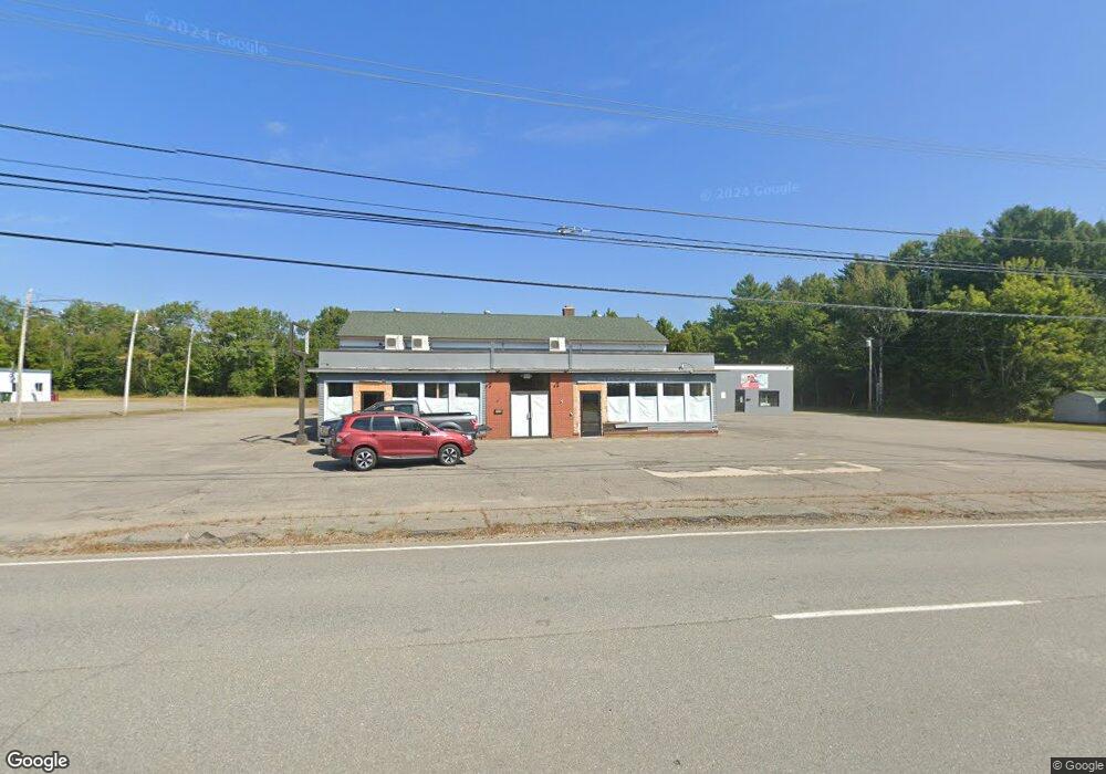
1009 Central St Millinocket, ME 04462
Estimated Value: $397,000 - $409,827
Studio
--
Bath
10,286
Sq Ft
$39/Sq Ft
Est. Value
About This Home
This home is located at 1009 Central St, Millinocket, ME 04462 and is currently estimated at $403,414, approximately $39 per square foot. 1009 Central St is a home located in Penobscot County with nearby schools including Granite Street School and Stearns Junior/Senior High School.
Ownership History
Date
Name
Owned For
Owner Type
Purchase Details
Closed on
Nov 23, 2022
Sold by
Weeks Diem M
Bought by
Awj Properties Inc
Current Estimated Value
Purchase Details
Closed on
Jun 13, 2018
Sold by
Lapierre Wayne Est and Lapierre
Bought by
Lapierre Diem M
Purchase Details
Closed on
Feb 24, 2011
Sold by
M J Brown Cabinet Makers
Bought by
Maine Rural Dev Auth
Purchase Details
Closed on
Jan 18, 2011
Sold by
M J Brown Cabinet Makers and M J Brown Cabinet Makers
Bought by
Maine Rural Dev Authority
Create a Home Valuation Report for This Property
The Home Valuation Report is an in-depth analysis detailing your home's value as well as a comparison with similar homes in the area
Home Values in the Area
Average Home Value in this Area
Purchase History
| Date | Buyer | Sale Price | Title Company |
|---|---|---|---|
| Awj Properties Inc | $330,000 | None Available | |
| Lapierre Diem M | -- | -- | |
| Lapierre Diem M | -- | -- | |
| Lapierre Diem M | -- | -- | |
| Maine Rural Dev Auth | -- | -- | |
| Maine Rural Dev Auth | -- | -- | |
| Maine Rural Dev Auth | -- | -- | |
| Maine Rural Dev Authority | -- | -- | |
| Maine Rural Dev Authority | -- | -- |
Source: Public Records
Tax History
| Year | Tax Paid | Tax Assessment Tax Assessment Total Assessment is a certain percentage of the fair market value that is determined by local assessors to be the total taxable value of land and additions on the property. | Land | Improvement |
|---|---|---|---|---|
| 2025 | $10,175 | $442,400 | $126,000 | $316,400 |
| 2024 | $10,720 | $388,400 | $72,000 | $316,400 |
| 2023 | $9,168 | $325,100 | $72,000 | $253,100 |
| 2022 | $8,732 | $296,000 | $72,000 | $224,000 |
| 2021 | $8,957 | $275,600 | $72,000 | $203,600 |
| 2020 | $8,979 | $264,100 | $72,000 | $192,100 |
| 2019 | $8,715 | $264,100 | $72,000 | $192,100 |
| 2018 | $8,583 | $264,100 | $72,000 | $192,100 |
| 2017 | $8,530 | $264,100 | $72,000 | $192,100 |
| 2016 | $8,266 | $264,100 | $72,000 | $192,100 |
| 2015 | $7,833 | $264,100 | $72,000 | $192,100 |
| 2014 | $7,817 | $264,100 | $72,000 | $192,100 |
Source: Public Records
Map
Nearby Homes
- 899 Central St
- 43 Heritage St
- 79 Pamola Park
- Lot # Fern St
- 47 New Jersey St
- 34 Ohio St
- 86 Ohio St
- 92 Ohio St
- 44 New York St
- 102 Connecticut Ave
- 45 Vermont St
- 6 Colony Place
- 43 Westwood Ave
- 13 Colony Place
- 22 Colony Place
- 73 Forest Ave
- 18 Winter St
- 30 New Hampshire St
- 6 & 6A Forest Ave
- 68 Prospect St
- 1030 Central St
- 944 Central St
- 991 Central St
- 1024 Central St
- 973 Central St
- 936 Central St
- 935 Central St
- 239 Massachusetts Ave
- 10 Balsam Dr
- 247 Massachusetts Ave
- 261 Massachusetts Ave
- 3 Pamola Park
- 267 Massachusetts Ave
- 905 Central St
- 275 Massachusetts Ave
- 26 Balsam Dr
- 20 Balsam Dr Unit 7
- 304 Alder St
- 27 Pamola Park
- 17 Pamola Park
Your Personal Tour Guide
Ask me questions while you tour the home.