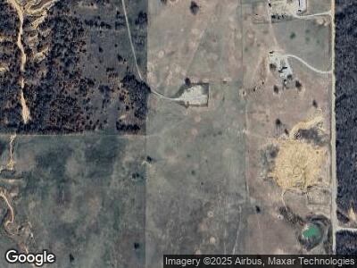
1009 Dillard Rd Wilson, OK 73463
Estimated Value: $201,015 - $391,000
3
Beds
2
Baths
2,196
Sq Ft
$115/Sq Ft
Est. Value
About This Home
This home is located at 1009 Dillard Rd, Wilson, OK 73463 and is currently estimated at $252,754, approximately $115 per square foot. 1009 Dillard Rd is a home located in Carter County with nearby schools including Wilson Elementary School and Wilson High School.
Ownership History
Date
Name
Owned For
Owner Type
Purchase Details
Closed on
Oct 23, 2024
Sold by
Yale Oil Association Inc
Bought by
Comanche Oil & Gas Inc and Redhawk Resources-Fund Ii Lp
Current Estimated Value
Purchase Details
Closed on
Jan 1, 2022
Sold by
Ballance Lenwood E
Bought by
Sierra Madre Natural Resources Llc
Purchase Details
Closed on
Feb 9, 2017
Sold by
Gardner Sandra and Howard Darla Kay
Bought by
Gardner Sandra and Howard Darla Kay
Create a Home Valuation Report for This Property
The Home Valuation Report is an in-depth analysis detailing your home's value as well as a comparison with similar homes in the area
Home Values in the Area
Average Home Value in this Area
Purchase History
| Date | Buyer | Sale Price | Title Company |
|---|---|---|---|
| Comanche Oil & Gas Inc | -- | None Listed On Document | |
| Sierra Madre Natural Resources Llc | -- | None Listed On Document | |
| Sierra Madre Natural Resources Llc | -- | None Listed On Document | |
| Gardner Sandra | -- | None Available |
Source: Public Records
Mortgage History
| Date | Status | Borrower | Loan Amount |
|---|---|---|---|
| Previous Owner | Gardner Sandra Kay | $66,638 | |
| Previous Owner | Gardner Sandra Kay | $65,022 |
Source: Public Records
Tax History Compared to Growth
Tax History
| Year | Tax Paid | Tax Assessment Tax Assessment Total Assessment is a certain percentage of the fair market value that is determined by local assessors to be the total taxable value of land and additions on the property. | Land | Improvement |
|---|---|---|---|---|
| 2024 | $747 | $8,873 | $712 | $8,161 |
| 2023 | $747 | $8,614 | $704 | $7,910 |
| 2022 | $785 | $8,614 | $704 | $7,910 |
| 2021 | $790 | $8,614 | $704 | $7,910 |
| 2020 | $813 | $8,614 | $704 | $7,910 |
| 2019 | $817 | $8,614 | $422 | $8,192 |
| 2018 | $779 | $8,809 | $422 | $8,387 |
| 2017 | $804 | $8,845 | $264 | $8,581 |
| 2016 | $866 | $8,962 | $192 | $8,770 |
| 2015 | $881 | $8,962 | $192 | $8,770 |
| 2014 | $870 | $8,962 | $192 | $8,770 |
Source: Public Records
Map
Nearby Homes
- 0 Anshultz Rd Unit 2517150
- 0 Anshultz Rd Unit 2434159
- 0 Anshultz Rd Unit 2434153
- 2173 State Highway 76
- 204 Bear Hollow Rd
- 3084 Anshultz Rd
- TBD Bull Run Rd
- 0 Bronco Rd
- 1796 Bronco Rd
- 29020 Oswalt Rd
- 0 Bronco Tbd Rd
- 7412 Buck Skin Rd
- 236 Fresno Rd
- 795 6th St
- 823 5th St
- 955 7th St
- 1080 7th St
- 7 14th St
- 332 E Pine St
- 21 14th St
