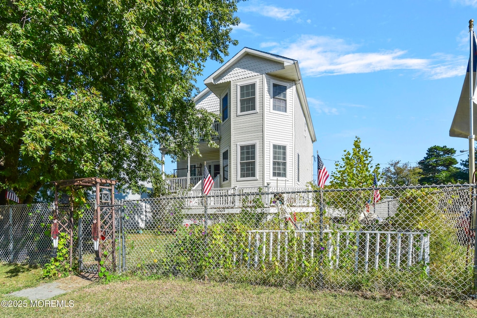
1009 Edmunds Ave Union Beach, NJ 07735
Estimated payment $3,960/month
Highlights
- Above Ground Pool
- Deck
- 1 Fireplace
- Colonial Architecture
- Attic
- Corner Lot
About This Home
Welcome to a beautiful spot in the up and coming town of Union Beach. Boasts an OPEN floor plan, elevator for easy access, beautiful decks on every level for amazing views. Completely new REBUILD in 2013, raised and ready to be delivered. Elevator for easy access to living space. Priced below current appraised value for a quick and easy transition to its new owners!
Home Details
Home Type
- Single Family
Est. Annual Taxes
- $11,201
Year Built
- Built in 2014
Lot Details
- 4,792 Sq Ft Lot
- Lot Dimensions are 50x100
- Fenced
- Corner Lot
Parking
- 1 Car Attached Garage
- Double-Wide Driveway
- Off-Street Parking
Home Design
- Colonial Architecture
- Shingle Roof
- Vinyl Siding
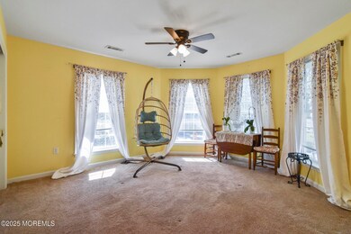
Interior Spaces
- 2,040 Sq Ft Home
- 3-Story Property
- Elevator
- Crown Molding
- Ceiling height of 9 feet on the main level
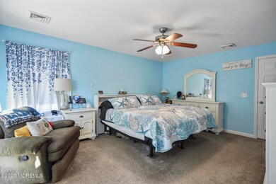
- Ceiling Fan
- Light Fixtures
- 1 Fireplace
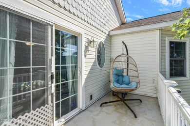
- Awning
- Sliding Doors
- Living Room
- Dining Room
- Pull Down Stairs to Attic
- Home Security System
Kitchen
- Stove
- Dishwasher
- Granite Countertops
Flooring
- Wall to Wall Carpet
- Linoleum
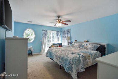
Bedrooms and Bathrooms
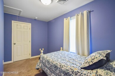
- 3 Bedrooms
- Primary bedroom located on second floor
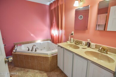
- 3 Full Bathrooms
Laundry
- Dryer
- Washer
Accessible Home Design
- Handicap Accessible
- Stair Lift
- Chairlift
Outdoor Features
- Above Ground Pool
- Balcony
- Deck
- Covered Patio or Porch
Schools
- Memorial Elementary And Middle School
- Keyport High School
Utilities
- Central Air
- Heating System Uses Natural Gas
- Natural Gas Water Heater
Community Details
- No Home Owners Association
Listing and Financial Details
- Exclusions: personal items
- Assessor Parcel Number 50-00075-0000-00001
Map
Home Values in the Area
Average Home Value in this Area
Tax History
| Year | Tax Paid | Tax Assessment Tax Assessment Total Assessment is a certain percentage of the fair market value that is determined by local assessors to be the total taxable value of land and additions on the property. | Land | Improvement |
|---|---|---|---|---|
| 2025 | $11,201 | $582,100 | $183,900 | $398,200 |
| 2024 | $11,019 | $543,200 | $160,100 | $383,100 |
| 2023 | $11,019 | $514,900 | $139,200 | $375,700 |
| 2022 | $9,354 | $456,200 | $111,400 | $344,800 |
| 2021 | $9,354 | $381,000 | $101,300 | $279,700 |
| 2020 | $8,907 | $354,000 | $89,300 | $264,700 |
| 2019 | $8,702 | $337,400 | $85,000 | $252,400 |
| 2018 | $8,655 | $322,600 | $75,000 | $247,600 |
| 2017 | $8,856 | $317,300 | $70,000 | $247,300 |
| 2016 | $8,755 | $313,900 | $70,000 | $243,900 |
| 2015 | $8,433 | $307,900 | $75,000 | $232,900 |
| 2014 | $2,585 | $77,800 | $77,800 | $0 |
Property History
| Date | Event | Price | List to Sale | Price per Sq Ft |
|---|---|---|---|---|
| 10/15/2025 10/15/25 | Pending | -- | -- | -- |
| 10/08/2025 10/08/25 | For Sale | $575,000 | -- | $282 / Sq Ft |
Purchase History
| Date | Type | Sale Price | Title Company |
|---|---|---|---|
| Interfamily Deed Transfer | -- | None Available |
Source: MOREMLS (Monmouth Ocean Regional REALTORS®)
MLS Number: 22530493
APN: 50-00075-0000-00001
Disclaimer: Certain information contained herein is derived from information provided by parties other than Homes.com. All information provided is deemed reliable, but is not guaranteed to be accurate and should be independently verified.
![]() IDX information is provided exclusively for personal, non-commercial use, and may not be used for any purpose other than to identify prospective properties consumers may be interested in purchasing.
IDX information is provided exclusively for personal, non-commercial use, and may not be used for any purpose other than to identify prospective properties consumers may be interested in purchasing.
Information is deemed reliable but not guaranteed.
