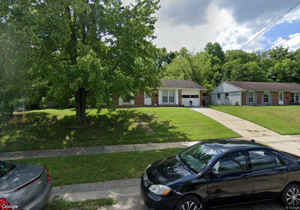
1009 Huffman Ct Cincinnati, OH 45231
Winton Lake NeighborhoodEstimated Value: $169,000 - $200,000
3
Beds
1
Bath
950
Sq Ft
$191/Sq Ft
Est. Value
About This Home
This home is located at 1009 Huffman Ct, Cincinnati, OH 45231 and is currently estimated at $181,336, approximately $190 per square foot. 1009 Huffman Ct is a home located in Hamilton County with nearby schools including Mt Healthy High School, John Paul II Catholic School, and Central Baptist Academy.
Ownership History
Date
Name
Owned For
Owner Type
Purchase Details
Closed on
Oct 23, 2001
Sold by
Joseph Robinson
Bought by
The 1009 Huffman Land Trust
Current Estimated Value
Purchase Details
Closed on
Jun 28, 2000
Sold by
Artis Michael L and Artis Vivian
Bought by
Robinson Joseph
Home Financials for this Owner
Home Financials are based on the most recent Mortgage that was taken out on this home.
Original Mortgage
$59,800
Interest Rate
8.64%
Mortgage Type
Balloon
Create a Home Valuation Report for This Property
The Home Valuation Report is an in-depth analysis detailing your home's value as well as a comparison with similar homes in the area
Home Values in the Area
Average Home Value in this Area
Purchase History
| Date | Buyer | Sale Price | Title Company |
|---|---|---|---|
| The 1009 Huffman Land Trust | $47,000 | All Ohio Title | |
| Robinson Joseph | $56,200 | Performance Title Agency Inc |
Source: Public Records
Mortgage History
| Date | Status | Borrower | Loan Amount |
|---|---|---|---|
| Previous Owner | Robinson Joseph | $59,800 |
Source: Public Records
Tax History Compared to Growth
Tax History
| Year | Tax Paid | Tax Assessment Tax Assessment Total Assessment is a certain percentage of the fair market value that is determined by local assessors to be the total taxable value of land and additions on the property. | Land | Improvement |
|---|---|---|---|---|
| 2024 | $2,070 | $33,803 | $8,652 | $25,151 |
| 2023 | $1,932 | $33,803 | $8,652 | $25,151 |
| 2022 | $1,973 | $24,910 | $7,270 | $17,640 |
| 2021 | $1,963 | $24,910 | $7,270 | $17,640 |
| 2020 | $1,939 | $24,910 | $7,270 | $17,640 |
| 2019 | $1,771 | $21,109 | $6,160 | $14,949 |
| 2018 | $1,780 | $21,109 | $6,160 | $14,949 |
| 2017 | $1,715 | $21,109 | $6,160 | $14,949 |
| 2016 | $1,596 | $19,114 | $6,685 | $12,429 |
| 2015 | $1,583 | $19,114 | $6,685 | $12,429 |
| 2014 | $1,573 | $19,114 | $6,685 | $12,429 |
| 2013 | $1,510 | $18,740 | $6,556 | $12,184 |
Source: Public Records
Map
Nearby Homes
- 1100 Gracewind Ct
- 9413 Stoneybrooke
- 831 Compton Rd
- 820 Compton Rd
- 9132 Millcliff Dr
- 1190 Sugartree Ct
- 8925 Monsanto Dr
- 8491 Daly Rd
- 958 Hollytree Dr
- 954 Hollytree Dr
- 9319 Winton Rd
- 8950 Daly Rd
- 9315 Winton Rd
- 1013 Vacationland Dr
- 8831 Daly Rd
- 8622 Mockingbird Ln
- 8627 Mockingbird Ln
- 8772 Balboa Dr
- 8840 Grenada Dr
- 729 Fleming Rd
- 1005 Huffman Ct
- 1013 Huffman Ct
- 1001 Huffman Ct
- 1017 Huffman Ct
- 1016 Huffman Ct
- 1129 Huffman Ct Unit L
- 997 Huffman Ct
- 1021 Huffman Ct
- 1008 Huffman Ct
- 1012 Huffman Ct
- 1007 Compton Rd
- 1004 Huffman Ct
- 1013 Compton Rd
- 1020 Huffman Ct
- 993 Huffman Ct
- 1025 Huffman Ct
- 1000 Huffman Ct
- 1017 Compton Rd
- 996 Huffman Ct
- 1024 Huffman Ct