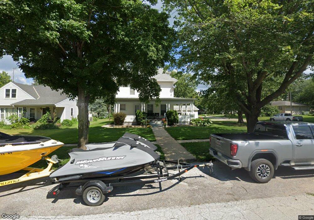
1009 Montague St Dunlap, IA 51529
Estimated Value: $157,000 - $266,000
4
Beds
2
Baths
1,866
Sq Ft
$109/Sq Ft
Est. Value
About This Home
This home is located at 1009 Montague St, Dunlap, IA 51529 and is currently estimated at $203,478, approximately $109 per square foot. 1009 Montague St is a home located in Harrison County with nearby schools including Boyer Valley Elementary School and Boyer Valley Middle/High School.
Ownership History
Date
Name
Owned For
Owner Type
Purchase Details
Closed on
May 7, 2013
Sold by
Leaders Richard Lynn and Leaders Mark A
Bought by
Soma Todd M and Soma Erin M
Current Estimated Value
Home Financials for this Owner
Home Financials are based on the most recent Mortgage that was taken out on this home.
Original Mortgage
$150,000
Outstanding Balance
$105,495
Interest Rate
3.39%
Mortgage Type
Future Advance Clause Open End Mortgage
Estimated Equity
$97,983
Create a Home Valuation Report for This Property
The Home Valuation Report is an in-depth analysis detailing your home's value as well as a comparison with similar homes in the area
Home Values in the Area
Average Home Value in this Area
Purchase History
| Date | Buyer | Sale Price | Title Company |
|---|---|---|---|
| Soma Todd M | $124,500 | None Available |
Source: Public Records
Mortgage History
| Date | Status | Borrower | Loan Amount |
|---|---|---|---|
| Open | Soma Todd M | $150,000 |
Source: Public Records
Tax History Compared to Growth
Tax History
| Year | Tax Paid | Tax Assessment Tax Assessment Total Assessment is a certain percentage of the fair market value that is determined by local assessors to be the total taxable value of land and additions on the property. | Land | Improvement |
|---|---|---|---|---|
| 2025 | $2,816 | $183,790 | $12,470 | $171,320 |
| 2024 | $2,816 | $166,570 | $12,470 | $154,100 |
| 2023 | $2,702 | $166,570 | $12,470 | $154,100 |
| 2022 | $2,580 | $143,931 | $12,474 | $131,457 |
| 2021 | $2,580 | $143,931 | $12,474 | $131,457 |
| 2020 | $2,284 | $121,792 | $12,474 | $109,318 |
| 2019 | $2,740 | $121,792 | $12,474 | $109,318 |
| 2018 | $2,720 | $135,787 | $0 | $0 |
| 2017 | $2,800 | $135,787 | $0 | $0 |
| 2016 | $2,760 | $135,787 | $0 | $0 |
| 2015 | $2,760 | $122,330 | $0 | $0 |
| 2014 | $1,502 | $74,517 | $0 | $0 |
Source: Public Records
Map
Nearby Homes
- 1403 Eaton St
- 202 Y St
- 32055 Spruce Ave
- 1110 Street F16
- 2074 U Ave
- 211 Brookview Dr
- 2590 220th St
- 37 10th St
- 808 Park St
- 42 6th St
- 406 Weare St
- 102 Bluegrass Ln
- 101 Bluegrass Ln
- 907 Harvest Hills Dr
- 106 Bluegrass Ln
- 905 Harvest Hills Dr
- 903 Harvest Hills Dr
- 111 Ridgeline Rd
- 906 Harvest Hills Dr
- 305 Normal St
- 1007 Montague St
- 1005 Montague St
- 1101 Montague St
- 307 N 11th St
- 211 N 11th St
- 1001 Montague St
- 1103 Montague St
- 1006 Clinton St
- 308 N 10th St
- 308 N 11th St
- 1006 Montague St
- 1107 Montague St
- 1002 Montague St
- 1102 Montague St
- 207 N 11th St
- 307 N 12th St
- 1002 Clinton St
- 1106 Montague St
- 1109 Montague St
- 208 N 10th St