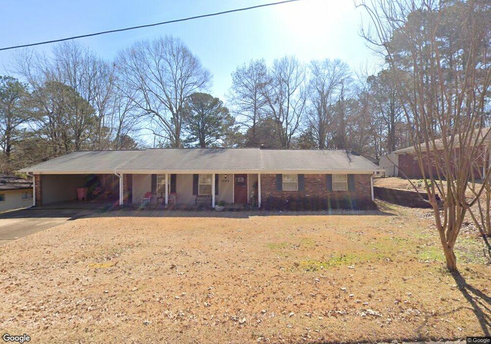
1009 Normandy Dr Clinton, MS 39056
Estimated Value: $192,000 - $210,000
3
Beds
2
Baths
1,776
Sq Ft
$114/Sq Ft
Est. Value
About This Home
This home is located at 1009 Normandy Dr, Clinton, MS 39056 and is currently estimated at $203,132, approximately $114 per square foot. 1009 Normandy Dr is a home located in Hinds County with nearby schools including Clinton Park Elementary School, Eastside Elementary School, and Northside Elementary School.
Ownership History
Date
Name
Owned For
Owner Type
Purchase Details
Closed on
May 21, 2010
Sold by
Tharpe Emily Elizabeth Cook and Sykes Erin Leigh Cook
Bought by
Copeland Robin L
Current Estimated Value
Home Financials for this Owner
Home Financials are based on the most recent Mortgage that was taken out on this home.
Original Mortgage
$90,777
Outstanding Balance
$60,695
Interest Rate
5%
Estimated Equity
$142,437
Create a Home Valuation Report for This Property
The Home Valuation Report is an in-depth analysis detailing your home's value as well as a comparison with similar homes in the area
Home Values in the Area
Average Home Value in this Area
Purchase History
| Date | Buyer | Sale Price | Title Company |
|---|---|---|---|
| Copeland Robin L | -- | -- |
Source: Public Records
Mortgage History
| Date | Status | Borrower | Loan Amount |
|---|---|---|---|
| Open | Copeland Robin L | $90,777 |
Source: Public Records
Tax History
| Year | Tax Paid | Tax Assessment Tax Assessment Total Assessment is a certain percentage of the fair market value that is determined by local assessors to be the total taxable value of land and additions on the property. | Land | Improvement |
|---|---|---|---|---|
| 2025 | $899 | $7,987 | $2,500 | $5,487 |
| 2024 | $899 | $7,811 | $2,500 | $5,311 |
| 2023 | $899 | $7,811 | $2,500 | $5,311 |
| 2022 | $1,187 | $7,811 | $2,500 | $5,311 |
| 2021 | $887 | $7,811 | $2,500 | $5,311 |
| 2020 | $871 | $7,756 | $2,500 | $5,256 |
| 2019 | $894 | $7,756 | $2,500 | $5,256 |
| 2018 | $894 | $7,756 | $2,500 | $5,256 |
| 2017 | $850 | $7,756 | $2,500 | $5,256 |
| 2016 | $850 | $7,756 | $2,500 | $5,256 |
| 2015 | $827 | $7,629 | $2,500 | $5,129 |
| 2014 | $827 | $7,629 | $2,500 | $5,129 |
Source: Public Records
Map
Nearby Homes
- 1013 Normandy Dr
- 1011 Laurelwood Dr
- 1206 Shady Glen Dr
- 1301 Beverly Dr
- 809 Normandy Dr
- 1416 Post Rd
- 807 Normandy Dr
- 114A Crestwood Cove
- 114B Crestwood Cove
- 457 E Northside Dr
- 1201 Rockingham Dr
- 1708 Rosemont Cir
- 1110 Post Rd
- 1502 Hawthorne Place
- 1504 Hawthorne Place
- 708 Tanglewood Dr
- 1419 Huntcliff Way
- 6 Shore Dr
- 5 Shore Dr
- 52 Cascades Cir W
- 1007 Normandy Dr
- 1011 Normandy Dr
- 1010 Normandy Dr
- 1006 Normandy Dr
- 1005 Normandy Dr
- 1008 Laurelwood Dr
- 1010 Laurelwood Dr
- 1012 Normandy Dr
- 1006 Laurelwood Dr
- 1004 Normandy Dr
- 1012 Laurelwood Dr
- 1015 Normandy Dr
- 1003 Normandy Dr
- 1004 Laurelwood Dr
- 1014 Normandy Dr
- 1002 Laurelwood Dr
- 1002 Normandy Dr
- 1011 Briarwood Dr
- 1009 Laurelwood Dr
- 1014 Laurelwood Dr
Your Personal Tour Guide
Ask me questions while you tour the home.