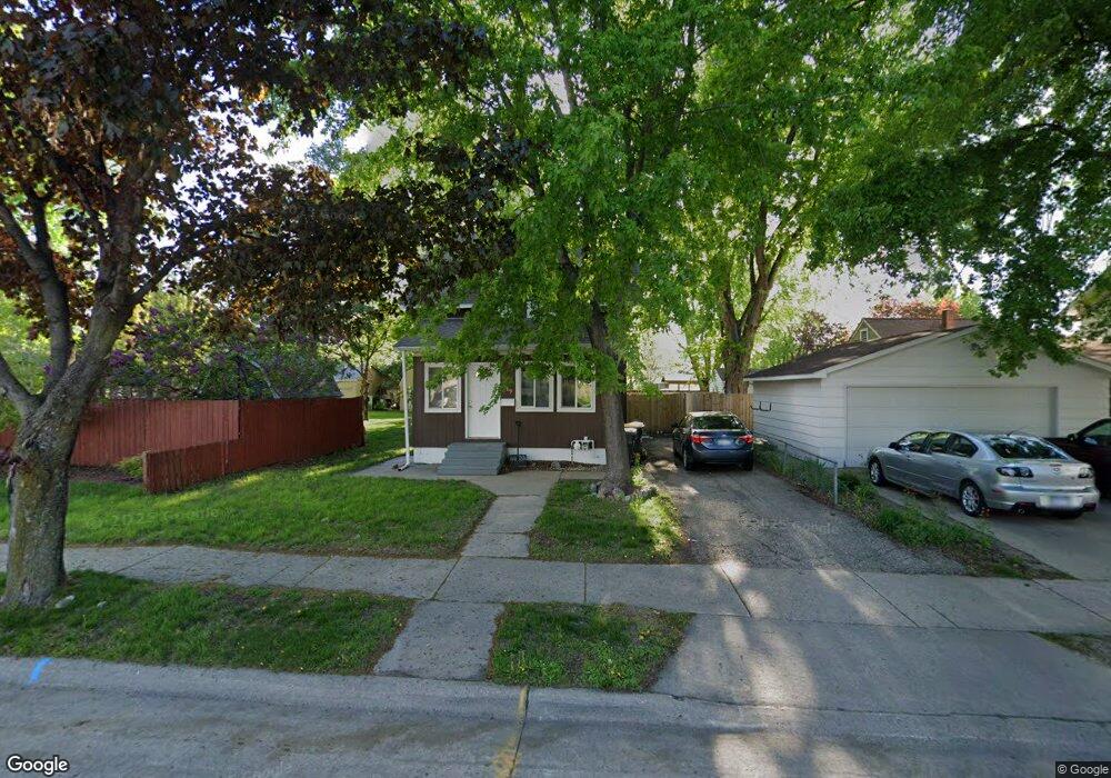
1009 Range St North Mankato, MN 56003
Estimated Value: $209,695 - $283,000
3
Beds
2
Baths
1,040
Sq Ft
$228/Sq Ft
Est. Value
About This Home
This home is located at 1009 Range St, North Mankato, MN 56003 and is currently estimated at $236,674, approximately $227 per square foot. 1009 Range St is a home located in Nicollet County with nearby schools including Monroe Elementary School, Dakota Meadows Middle School, and Mankato West Senior High School.
Ownership History
Date
Name
Owned For
Owner Type
Purchase Details
Closed on
Nov 30, 2023
Sold by
Forsyth Andrea and Forsyth David
Bought by
Ramirez Cantu Cristian and Ramirez Mazariegos Ingrid
Current Estimated Value
Home Financials for this Owner
Home Financials are based on the most recent Mortgage that was taken out on this home.
Original Mortgage
$163,975
Outstanding Balance
$161,320
Interest Rate
7.63%
Mortgage Type
New Conventional
Estimated Equity
$75,354
Purchase Details
Closed on
Mar 11, 2011
Sold by
Us Bank National Association
Bought by
Growth Holdings Llc
Create a Home Valuation Report for This Property
The Home Valuation Report is an in-depth analysis detailing your home's value as well as a comparison with similar homes in the area
Home Values in the Area
Average Home Value in this Area
Purchase History
| Date | Buyer | Sale Price | Title Company |
|---|---|---|---|
| Ramirez Cantu Cristian | $167,000 | -- | |
| Growth Holdings Llc | $39,900 | -- |
Source: Public Records
Mortgage History
| Date | Status | Borrower | Loan Amount |
|---|---|---|---|
| Open | Ramirez Cantu Cristian | $163,975 |
Source: Public Records
Tax History Compared to Growth
Tax History
| Year | Tax Paid | Tax Assessment Tax Assessment Total Assessment is a certain percentage of the fair market value that is determined by local assessors to be the total taxable value of land and additions on the property. | Land | Improvement |
|---|---|---|---|---|
| 2025 | $2,292 | $204,000 | $36,300 | $167,700 |
| 2024 | $2,164 | $204,000 | $36,300 | $167,700 |
| 2023 | $2,014 | $184,700 | $36,300 | $148,400 |
| 2022 | $1,886 | $173,400 | $36,300 | $137,100 |
| 2021 | $1,876 | $150,500 | $28,700 | $121,800 |
| 2020 | $1,690 | $145,500 | $28,700 | $116,800 |
| 2019 | $1,626 | $135,800 | $28,700 | $107,100 |
| 2011 | -- | $0 | $0 | $0 |
Source: Public Records
Map
Nearby Homes
- 954 Range St
- 1024 Center St
- 725 Wall St
- 532 Range St
- 536 Garfield Ave
- 512 Page Ave
- 245 W Wheeler Ave
- 726 Garfield Ave
- 1810 Mary Ln
- 1932 4th Ave
- 415 Sherman St
- 538 Belgrade Ave
- 126 Cross St
- 541 Nicollet Ave
- 712 N Broad St
- 0 Tbd Belvista Dr
- 217 E Spring St
- 701 Nicollet Ave
- 1577 Sherwood Dr
- 411 N Broad St
- 305 Pierce Ave
- 301 Pierce Ave
- 1001 Range St
- 309 Pierce Ave
- 310 Mckinley Ave
- 1009 1009 Range
- 314 Mckinley Ave
- 1012 Range St
- 1016 Range St
- 1008 Range St
- 1008 1008 Range St
- 318 Mckinley Ave
- 1021 Range St
- 1004 Range St
- 941 Range St
- 324 Mckinley Ave
- 327 Pierce Ave
- 338 Pierce Ave
- 309 Mckinley Ave
- 954 954 Range-Street-