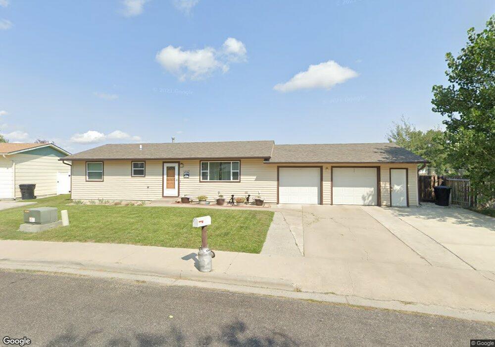
1009 W 12th St Laurel, MT 59044
Estimated Value: $297,000 - $371,000
2
Beds
1
Bath
1,008
Sq Ft
$314/Sq Ft
Est. Value
About This Home
This home is located at 1009 W 12th St, Laurel, MT 59044 and is currently estimated at $316,449, approximately $313 per square foot. 1009 W 12th St is a home located in Yellowstone County with nearby schools including West School, Fred W. Graff School, and Laurel Middle School.
Ownership History
Date
Name
Owned For
Owner Type
Purchase Details
Closed on
Feb 28, 2024
Sold by
Robinson Sandra D
Bought by
Bramble Allen T
Current Estimated Value
Purchase Details
Closed on
Jul 11, 2007
Sold by
Larrabee Michael W
Bought by
Robinson Sandra D
Home Financials for this Owner
Home Financials are based on the most recent Mortgage that was taken out on this home.
Original Mortgage
$115,000
Interest Rate
6.41%
Mortgage Type
Purchase Money Mortgage
Create a Home Valuation Report for This Property
The Home Valuation Report is an in-depth analysis detailing your home's value as well as a comparison with similar homes in the area
Home Values in the Area
Average Home Value in this Area
Purchase History
| Date | Buyer | Sale Price | Title Company |
|---|---|---|---|
| Bramble Allen T | -- | Chicago Title | |
| Robinson Sandra D | -- | None Available |
Source: Public Records
Mortgage History
| Date | Status | Borrower | Loan Amount |
|---|---|---|---|
| Previous Owner | Robinson Sandra D | $115,000 |
Source: Public Records
Tax History Compared to Growth
Tax History
| Year | Tax Paid | Tax Assessment Tax Assessment Total Assessment is a certain percentage of the fair market value that is determined by local assessors to be the total taxable value of land and additions on the property. | Land | Improvement |
|---|---|---|---|---|
| 2025 | $2,648 | $309,600 | $78,076 | $231,524 |
| 2024 | $2,648 | $268,400 | $71,674 | $196,726 |
| 2023 | $2,143 | $230,900 | $71,674 | $159,226 |
| 2022 | $1,537 | $184,200 | $0 | $0 |
| 2021 | $1,841 | $184,200 | $0 | $0 |
| 2020 | $1,761 | $172,400 | $0 | $0 |
| 2019 | $1,764 | $172,400 | $0 | $0 |
| 2018 | $1,750 | $167,000 | $0 | $0 |
| 2017 | $1,620 | $167,000 | $0 | $0 |
| 2016 | $1,574 | $162,800 | $0 | $0 |
| 2015 | $1,555 | $162,800 | $0 | $0 |
| 2014 | $1,346 | $72,716 | $0 | $0 |
Source: Public Records
Map
Nearby Homes
- 1013 W 12th St
- 1106 W 12th St
- 1109 10th Ave
- 1036 9th Ave
- 1013 Rochelle Dr
- TBD Block 3 Lot 9
- 1014 Rochelle Ln
- TBD Block 1 Lot 2
- TBD Block 3 Lot 1
- TBD Block 1 Lot 3
- 512 W 14th St
- TBD Block 3 Lot 4
- 403 Grandview Blvd
- TBD Block 3 Lot 6
- 109 E 12th St
- 1018 Els Dr
- 1712 Paynes Place
- 1003 Montana Ave
- 1336 Pennsylvania Ave
- 102 8th Ave Unit B