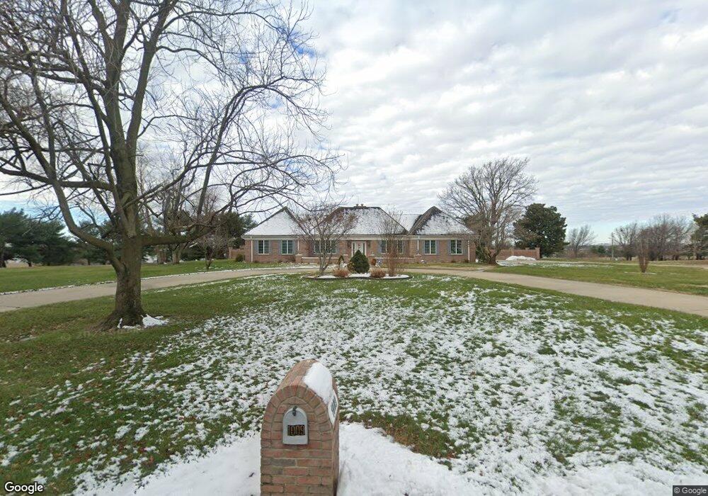
1009 Westview Dr Sikeston, MO 63801
Estimated Value: $420,000 - $707,882
Studio
--
Bath
3,371
Sq Ft
$156/Sq Ft
Est. Value
About This Home
This home is located at 1009 Westview Dr, Sikeston, MO 63801 and is currently estimated at $526,971, approximately $156 per square foot. 1009 Westview Dr is a home with nearby schools including Sikeston Senior High School, St. Francis Xavier School, and The Christian Academy.
Ownership History
Date
Name
Owned For
Owner Type
Purchase Details
Closed on
Jan 11, 2013
Sold by
Schuerenberg Fred H and Schuerenberg Trust Fred H
Bought by
Bedell Pamela D and Bedell Trust Pamela D
Current Estimated Value
Home Financials for this Owner
Home Financials are based on the most recent Mortgage that was taken out on this home.
Original Mortgage
$500,000
Outstanding Balance
$347,000
Interest Rate
3.33%
Estimated Equity
$179,971
Purchase Details
Closed on
Sep 7, 2012
Sold by
Schuerenberg Fred H
Bought by
Schuerenberg Fred H
Create a Home Valuation Report for This Property
The Home Valuation Report is an in-depth analysis detailing your home's value as well as a comparison with similar homes in the area
Home Values in the Area
Average Home Value in this Area
Purchase History
| Date | Buyer | Sale Price | Title Company |
|---|---|---|---|
| Bedell Pamela D | -- | -- | |
| Schuerenberg Fred H | -- | -- |
Source: Public Records
Mortgage History
| Date | Status | Borrower | Loan Amount |
|---|---|---|---|
| Open | Schuerenberg Fred H | $500,000 |
Source: Public Records
Tax History
| Year | Tax Paid | Tax Assessment Tax Assessment Total Assessment is a certain percentage of the fair market value that is determined by local assessors to be the total taxable value of land and additions on the property. | Land | Improvement |
|---|---|---|---|---|
| 2025 | $4,182 | $94,870 | $0 | $0 |
| 2024 | $42 | $86,190 | $0 | $0 |
| 2023 | $4,167 | $86,190 | $0 | $0 |
| 2022 | $4,195 | $83,300 | $0 | $0 |
| 2021 | $4,192 | $83,300 | $0 | $0 |
| 2020 | $3,486 | $80,410 | $0 | $0 |
| 2019 | -- | $80,410 | $0 | $0 |
| 2018 | -- | $80,040 | $0 | $0 |
| 2017 | -- | $80,040 | $0 | $0 |
| 2014 | -- | $77,280 | $0 | $0 |
| 2011 | -- | $75,810 | $0 | $0 |
Source: Public Records
Map
Nearby Homes
- 202 N Brushwick Ave
- 126 Linda Dr
- 511 W Lindenwood Ave
- 123 Holmes Dr
- 105 Linda Dr
- 111 Holmes Dr
- 106 Holmes Dr
- 719 N West St
- 4 N West St
- 918 Hawthorn Dr
- 103 Groves Estates Ct
- 307 Circle Dr
- 1300 N Main St Unit 204
- 10 Dement Rd
- 1601 N Main St
- 1304 Primrose Dr
- 216 Sherrie Dr
- 723 Kendall St
- 170 Lee Ave
- 114 W North St
- 1008 Westview Dr
- 1006 Westview Dr
- 1005 Westview Dr
- 101 Ridge Dr
- 1004 Westview Dr
- 102 Ridge Dr
- 617 W Salcedo Rd
- 1003 Westview Dr
- 618 W Salcedo Rd
- 615 W Salcedo Rd
- 218 Thomas Dr
- 678 State Highway Y
- 103 Ridge Dr
- 104 Ridge Dr
- 616 W Salcedo Rd
- 1001 Westview Dr
- 219 Thomas Dr
- 216 Thomas Dr
- 613 W Lindenwood Ave
- 217 Thomas Dr
Your Personal Tour Guide
Ask me questions while you tour the home.