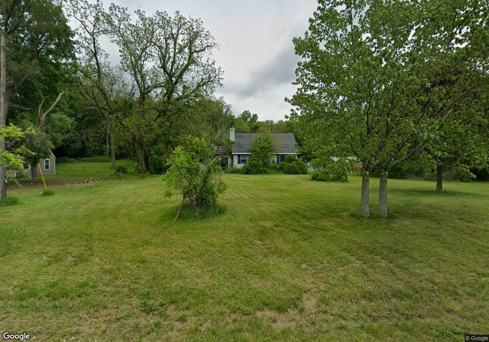
10091 Gorsline Rd Battle Creek, MI 49014
Estimated Value: $177,000 - $237,000
3
Beds
1
Bath
1,200
Sq Ft
$165/Sq Ft
Est. Value
About This Home
This home is located at 10091 Gorsline Rd, Battle Creek, MI 49014 and is currently estimated at $198,069, approximately $165 per square foot. 10091 Gorsline Rd is a home located in Calhoun County with nearby schools including Pennfield Dunlap Elementary School, Pennfield Purdy School, and Pennfield Middle School.
Ownership History
Date
Name
Owned For
Owner Type
Purchase Details
Closed on
Feb 28, 1995
Sold by
Manwarren Ronnie and Manwarren Gloria
Bought by
Graham Douglas and Graham Carol
Current Estimated Value
Purchase Details
Closed on
May 1, 1993
Create a Home Valuation Report for This Property
The Home Valuation Report is an in-depth analysis detailing your home's value as well as a comparison with similar homes in the area
Home Values in the Area
Average Home Value in this Area
Purchase History
| Date | Buyer | Sale Price | Title Company |
|---|---|---|---|
| Graham Douglas | $28,000 | -- | |
| -- | $15,000 | -- |
Source: Public Records
Tax History Compared to Growth
Tax History
| Year | Tax Paid | Tax Assessment Tax Assessment Total Assessment is a certain percentage of the fair market value that is determined by local assessors to be the total taxable value of land and additions on the property. | Land | Improvement |
|---|---|---|---|---|
| 2025 | $1,701 | $66,300 | $0 | $0 |
| 2024 | $774 | $57,000 | $0 | $0 |
| 2023 | $1,500 | $50,700 | $0 | $0 |
| 2022 | $702 | $45,480 | $0 | $0 |
| 2021 | $1,474 | $43,410 | $0 | $0 |
| 2020 | $1,449 | $38,900 | $0 | $0 |
| 2019 | $1,400 | $36,720 | $0 | $0 |
| 2018 | $1,289 | $35,800 | $4,370 | $31,430 |
| 2017 | $0 | $32,710 | $0 | $0 |
| 2016 | $0 | $32,170 | $0 | $0 |
| 2015 | -- | $35,040 | $17,591 | $17,449 |
| 2014 | -- | $30,700 | $17,591 | $13,109 |
Source: Public Records
Map
Nearby Homes
- Integrity 1605 Plan at Loganwood Acres - North
- Integrity 1250 Plan at Loganwood Acres - North
- Elements 2390 Plan at Loganwood Acres - North
- integrity 2280 Plan at Loganwood Acres - North
- Integrity 2061 V8.1a Plan at Loganwood Acres - North
- Elements 2090 Plan at Loganwood Acres - North
- Integrity 2060 Plan at Loganwood Acres - North
- Elements 2200 Plan at Loganwood Acres - North
- Integrity 2190 Plan at Loganwood Acres - North
- Integrity 1530 Plan at Loganwood Acres - North
- Elements 2700 Plan at Loganwood Acres - North
- Integrity 1610 Plan at Loganwood Acres - North
- 18248 Loganwood Trail
- 18264 Loganwood Trail
- 9604 Natala Ln
- 19016 11 Mile Rd
- 0 Gavin Ln Unit 17
- 20259 Pine Lake Rd
- 20291 Chippewa Trail
- 8671 Gorsline Rd
- 10069 Gorsline Rd
- 10205 Gorsline Rd
- 10201 Gorsline Rd
- 10094 Gorsline Rd
- 10164 Gorsline Rd
- 10211 Gorsline Rd
- 10058 Gorsline Rd
- 19102 Jessup Rd
- 10231 Gorsline Rd
- 10216 Gorsline Rd
- 10251 Gorsline Rd
- 9911 Gorsline Rd
- 19240 Jessup Rd
- 10293 Gorsline Rd
- 19260 Jessup Rd
- 9833 Gorsline Rd
- 19276 Jessup Rd
- 10391 Gorsline Rd
- 10391 Gorsline Rd
- 9801 Gorsline Rd