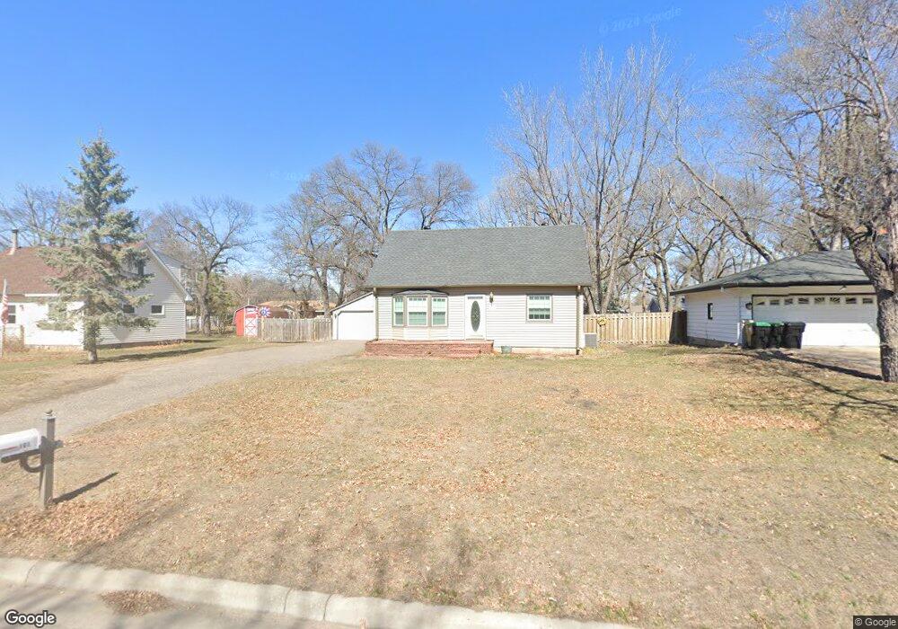
101 102nd Ln NW Coon Rapids, MN 55448
Estimated Value: $283,000 - $320,000
3
Beds
3
Baths
1,358
Sq Ft
$227/Sq Ft
Est. Value
About This Home
This home is located at 101 102nd Ln NW, Coon Rapids, MN 55448 and is currently estimated at $307,938, approximately $226 per square foot. 101 102nd Ln NW is a home located in Anoka County with nearby schools including Lucile Bruner Elementary School, University Elementary School, and Laughlin Junior/Senior High School.
Ownership History
Date
Name
Owned For
Owner Type
Purchase Details
Closed on
Apr 12, 2018
Sold by
Gooden David Charles and Gooden Carol L
Bought by
Gooden David Charles and Gooden Carol L
Current Estimated Value
Home Financials for this Owner
Home Financials are based on the most recent Mortgage that was taken out on this home.
Original Mortgage
$174,000
Interest Rate
4.43%
Mortgage Type
New Conventional
Create a Home Valuation Report for This Property
The Home Valuation Report is an in-depth analysis detailing your home's value as well as a comparison with similar homes in the area
Home Values in the Area
Average Home Value in this Area
Purchase History
| Date | Buyer | Sale Price | Title Company |
|---|---|---|---|
| Gooden David Charles | -- | Partners Title Llc |
Source: Public Records
Mortgage History
| Date | Status | Borrower | Loan Amount |
|---|---|---|---|
| Closed | Gooden David Charles | $174,000 |
Source: Public Records
Tax History Compared to Growth
Tax History
| Year | Tax Paid | Tax Assessment Tax Assessment Total Assessment is a certain percentage of the fair market value that is determined by local assessors to be the total taxable value of land and additions on the property. | Land | Improvement |
|---|---|---|---|---|
| 2025 | $3,181 | $276,300 | $90,000 | $186,300 |
| 2024 | $3,181 | $289,100 | $86,000 | $203,100 |
| 2023 | $3,025 | $292,500 | $79,000 | $213,500 |
| 2022 | $2,933 | $290,800 | $65,000 | $225,800 |
| 2021 | $2,807 | $251,900 | $69,000 | $182,900 |
| 2020 | $2,780 | $236,000 | $65,000 | $171,000 |
| 2019 | $2,446 | $224,800 | $61,000 | $163,800 |
| 2018 | $2,257 | $193,400 | $0 | $0 |
| 2017 | $1,789 | $174,200 | $0 | $0 |
| 2016 | $1,831 | $153,900 | $0 | $0 |
| 2015 | $1,735 | $153,900 | $46,000 | $107,900 |
| 2014 | -- | $132,800 | $36,900 | $95,900 |
Source: Public Records
Map
Nearby Homes
- 150 104th Ln NW
- 228 104th Ln NW
- 10419 Goldenrod St NW
- 122 106th Ave NW
- 10200 Pleasure Creek Pkwy W
- 10248 Washington Ct NE
- 10011 Pleasure Creek Cir NE
- 9830 6th St NE
- 424 106th Ave NW
- 361 Territorial Rd NE
- 9872 7th St NE
- 9896 Clover Leaf Pkwy NE
- 10647 Washington Blvd NE
- 10728 Ilex St NW
- 484 98th Ln NE
- 413 Territorial Rd NE
- 103 96th Ln NE Unit 103
- 111 96th Ln NE
- 10252 Jackson St NE
- 10650 Kumquat St NW Unit 504
- 69 102nd Ln NW
- 109 102nd Ln NW
- 38 103rd Ave NW
- 44 103rd Ave NW
- 55 102nd Ln NW
- 115 102nd Ln NW
- 100 102nd Ln NW
- 100 102nd Ln NW
- 100 100 102nd-Lane-nw
- 34 103rd Ave NW
- 50 103rd Ave NW
- 58 102nd Ln NW
- 30 103rd Ave NW
- 56 103rd Ave NW
- 121 102nd Ln NW
- 66 103rd Ave NW
- 52 102nd Ln NW
- 41 103rd Ave NW
- 35 103rd Ave NW
- 117 102nd Ave NW