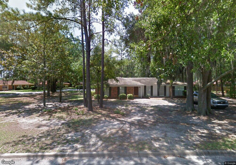
101 Backshell Rd Savannah, GA 31404
East Savannah NeighborhoodEstimated Value: $300,124 - $413,000
3
Beds
2
Baths
1,717
Sq Ft
$220/Sq Ft
Est. Value
About This Home
This home is located at 101 Backshell Rd, Savannah, GA 31404 and is currently estimated at $377,031, approximately $219 per square foot. 101 Backshell Rd is a home located in Chatham County with nearby schools including Marshpoint Elementary School, Coastal Middle School, and Islands High School.
Ownership History
Date
Name
Owned For
Owner Type
Purchase Details
Closed on
Apr 18, 2023
Sold by
Klein Ronda
Bought by
Peachtree Investment Llc
Current Estimated Value
Purchase Details
Closed on
Oct 16, 2006
Sold by
Not Provided
Bought by
Whinery Deanna G
Home Financials for this Owner
Home Financials are based on the most recent Mortgage that was taken out on this home.
Original Mortgage
$132,000
Interest Rate
6.39%
Mortgage Type
New Conventional
Create a Home Valuation Report for This Property
The Home Valuation Report is an in-depth analysis detailing your home's value as well as a comparison with similar homes in the area
Home Values in the Area
Average Home Value in this Area
Purchase History
| Date | Buyer | Sale Price | Title Company |
|---|---|---|---|
| Peachtree Investment Llc | -- | -- | |
| Klein Ronda | -- | -- | |
| Whinery Deanna G | $165,000 | -- |
Source: Public Records
Mortgage History
| Date | Status | Borrower | Loan Amount |
|---|---|---|---|
| Previous Owner | Whinery Deanna G | $132,000 |
Source: Public Records
Tax History
| Year | Tax Paid | Tax Assessment Tax Assessment Total Assessment is a certain percentage of the fair market value that is determined by local assessors to be the total taxable value of land and additions on the property. | Land | Improvement |
|---|---|---|---|---|
| 2025 | $4,637 | $77,360 | $26,000 | $51,360 |
| 2024 | $25 | $65,480 | $24,000 | $41,480 |
| 2023 | $2,470 | $42,840 | $7,200 | $35,640 |
| 2022 | $1,677 | $53,680 | $7,200 | $46,480 |
| 2021 | $2,637 | $47,080 | $7,200 | $39,880 |
| 2020 | $1,541 | $42,240 | $7,200 | $35,040 |
| 2019 | $2,423 | $42,240 | $7,200 | $35,040 |
| 2018 | $1,644 | $41,640 | $7,200 | $34,440 |
| 2017 | $1,675 | $42,680 | $7,200 | $35,480 |
| 2016 | $1,508 | $42,920 | $7,200 | $35,720 |
| 2015 | $2,259 | $43,520 | $7,200 | $36,320 |
| 2014 | $2,258 | $44,280 | $0 | $0 |
Source: Public Records
Map
Nearby Homes
- 325 Manor Dr
- 202 John Wesley Way
- 0 Riverview Dr
- 135 Backshell Rd
- 210 John Wesley Way
- 217 John Wesley Way
- 2231 Causton Bluff Rd
- 2217 Beech St
- 2227 Utah St
- 21 Pipers Pond Ln
- 0 Mosley St Unit SA345182
- 0 Mosley St Unit 10657096
- 2232 E Gwinnett St
- 2031 Utah St
- 2231 E Gwinnett St
- 2509 Louisiana Ave
- 2413 Mississippi Ave
- 2130 Hanson St
- 2301 Alaska St
- 2118 E Gwinnett St
- 112 Runaway Point Rd
- 103 Backshell Rd
- 105 Backshell Rd
- 108 Runaway Point Rd
- 1 Delford Ct
- 2 Delford Ct
- 109 Runaway Point Rd
- 113 Runaway Point Rd
- 3 Delford Ct
- 107 Backshell Rd
- 106 Runaway Point Rd
- 105 Runaway Point Rd
- 115 Runaway Point Rd
- 104 Backshell Rd
- 103 Runaway Point Rd
- 109 Backshell Rd
- 104 Runaway Point Rd
- 117 Runaway Point Rd
- 4 Delford Ct
- 106 Backshell Rd
Your Personal Tour Guide
Ask me questions while you tour the home.