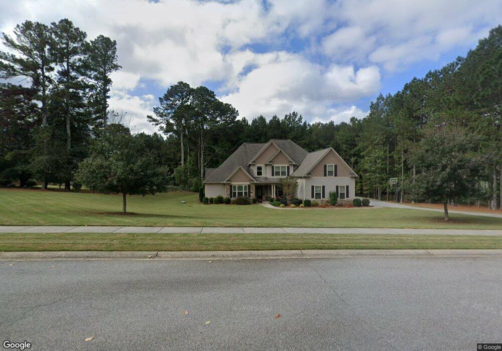
101 Beresford Rd Tyrone, GA 30290
Estimated Value: $798,279 - $859,000
Studio
4
Baths
3,848
Sq Ft
$216/Sq Ft
Est. Value
About This Home
This home is located at 101 Beresford Rd, Tyrone, GA 30290 and is currently estimated at $830,820, approximately $215 per square foot. 101 Beresford Rd is a home located in Fayette County with nearby schools including Crabapple Lane Elementary School, Flat Rock Middle School, and Sandy Creek High School.
Ownership History
Date
Name
Owned For
Owner Type
Purchase Details
Closed on
May 31, 2017
Sold by
Robert Graham Homes Inc
Bought by
Samuels Bennett T
Current Estimated Value
Home Financials for this Owner
Home Financials are based on the most recent Mortgage that was taken out on this home.
Original Mortgage
$179,900
Outstanding Balance
$89,275
Interest Rate
4.02%
Mortgage Type
VA
Estimated Equity
$741,545
Purchase Details
Closed on
Apr 26, 2016
Sold by
Don Brent Llc
Bought by
Robert Graham Homes Inc
Home Financials for this Owner
Home Financials are based on the most recent Mortgage that was taken out on this home.
Original Mortgage
$78,333
Interest Rate
3.71%
Mortgage Type
New Conventional
Create a Home Valuation Report for This Property
The Home Valuation Report is an in-depth analysis detailing your home's value as well as a comparison with similar homes in the area
Home Values in the Area
Average Home Value in this Area
Purchase History
| Date | Buyer | Sale Price | Title Company |
|---|---|---|---|
| Samuels Bennett T | $479,900 | -- | |
| Robert Graham Homes Inc | $78,333 | -- |
Source: Public Records
Mortgage History
| Date | Status | Borrower | Loan Amount |
|---|---|---|---|
| Open | Samuels Bennett T | $179,900 | |
| Previous Owner | Robert Graham Homes Inc | $78,333 |
Source: Public Records
Tax History
| Year | Tax Paid | Tax Assessment Tax Assessment Total Assessment is a certain percentage of the fair market value that is determined by local assessors to be the total taxable value of land and additions on the property. | Land | Improvement |
|---|---|---|---|---|
| 2025 | $7,312 | $310,223 | $44,940 | $265,283 |
| 2024 | $7,120 | $289,928 | $42,000 | $247,928 |
| 2023 | $5,344 | $277,840 | $42,000 | $235,840 |
| 2022 | $6,586 | $244,200 | $42,000 | $202,200 |
| 2021 | $6,183 | $212,120 | $30,000 | $182,120 |
| 2020 | $6,199 | $201,000 | $30,000 | $171,000 |
| 2019 | $6,168 | $198,080 | $30,000 | $168,080 |
| 2018 | $5,885 | $187,160 | $30,000 | $157,160 |
| 2017 | $4,455 | $139,280 | $30,000 | $109,280 |
| 2016 | $744 | $22,800 | $22,800 | $0 |
| 2015 | $757 | $22,800 | $22,800 | $0 |
| 2014 | $770 | $22,800 | $22,800 | $0 |
| 2013 | -- | $22,800 | $0 | $0 |
Source: Public Records
Map
Nearby Homes
- 130 Windchime Way Unit 9
- 150 Kylemore Pass
- 100 Clydesdale Ct
- 121 Northwoods Rd
- 135 Arabian
- 80 Northwoods Rd
- 28 Border Point
- 200 Chaparral Trace
- 321 Cottonwood Cir
- 108 Tullamore Trail
- 100 Leisure Trail
- 235 Ashmere Ct
- 152 Ardenlee Dr
- 1103 Maybeck Way
- 135 French Village Blvd
- 100 Sycamore Way
- 95 Tyler Woods Dr
- 113 Creggan Hill Ct
- 134 Ardenlee Dr
- 208 Silver Maple Ct
- 101 Beresford Rd Unit 26
- 100 Beresford Rd Unit 5
- 100 Beresford Rd
- 103 Beresford Rd
- 102 Beresford Rd
- 588 Mcdade St Unit 27
- 588 Mcdade St
- 583 Mcdade St
- 104 Beresford Rd
- 586 Mcdade St
- 105 Beresford Rd
- 581 Mcdade St Unit 54
- 581 Mcdade St
- 592 Mcdade St
- 303 Roundstone Rock Unit 87
- 303 Roundstone Rock
- 114 Kenmare Row
- 585 Mcdade St
- 104 O Connell St Unit 90
- 104 O Connell St
Your Personal Tour Guide
Ask me questions while you tour the home.