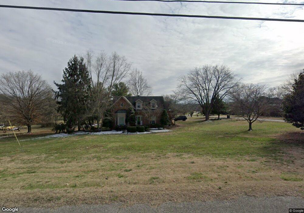
101 Buchanan Cir Hendersonville, TN 37075
Estimated Value: $597,000 - $763,000
--
Bed
4
Baths
2,406
Sq Ft
$272/Sq Ft
Est. Value
About This Home
This home is located at 101 Buchanan Cir, Hendersonville, TN 37075 and is currently estimated at $654,065, approximately $271 per square foot. 101 Buchanan Cir is a home located in Sumner County with nearby schools including Beech Elementary School, T.W. Hunter Middle School, and Beech High School.
Ownership History
Date
Name
Owned For
Owner Type
Purchase Details
Closed on
Nov 15, 2022
Sold by
Wfc Durham Farm Owner Vii Llc
Bought by
Df Hendersonville Sfr Owner Llc
Current Estimated Value
Purchase Details
Closed on
Oct 24, 2012
Sold by
Watkins Staphnie Palmer
Bought by
Crain Justin M and Crain Hailey J
Home Financials for this Owner
Home Financials are based on the most recent Mortgage that was taken out on this home.
Original Mortgage
$234,179
Interest Rate
3.3%
Mortgage Type
FHA
Purchase Details
Closed on
Apr 2, 2004
Sold by
Cooke Larry E and Stanfill Cynthia G
Bought by
Palmer Stephanie
Purchase Details
Closed on
Jun 25, 1999
Sold by
Puerto Otomiel David and Puerto Kathleen M
Bought by
Cooke Larry E and Cooke Cynthia G
Home Financials for this Owner
Home Financials are based on the most recent Mortgage that was taken out on this home.
Original Mortgage
$110,000
Interest Rate
7.27%
Create a Home Valuation Report for This Property
The Home Valuation Report is an in-depth analysis detailing your home's value as well as a comparison with similar homes in the area
Home Values in the Area
Average Home Value in this Area
Purchase History
| Date | Buyer | Sale Price | Title Company |
|---|---|---|---|
| Df Hendersonville Sfr Owner Llc | $3,734,864 | -- | |
| Crain Justin M | $238,500 | Freedom Title | |
| Palmer Stephanie | $190,000 | -- | |
| Cooke Larry E | $175,000 | -- |
Source: Public Records
Mortgage History
| Date | Status | Borrower | Loan Amount |
|---|---|---|---|
| Previous Owner | Crain Justin M | $234,179 | |
| Previous Owner | Cooke Larry E | $110,000 |
Source: Public Records
Tax History Compared to Growth
Tax History
| Year | Tax Paid | Tax Assessment Tax Assessment Total Assessment is a certain percentage of the fair market value that is determined by local assessors to be the total taxable value of land and additions on the property. | Land | Improvement |
|---|---|---|---|---|
| 2024 | $1,744 | $122,700 | $31,250 | $91,450 |
| 2023 | $1,977 | $87,775 | $23,750 | $64,025 |
| 2022 | $1,985 | $87,775 | $23,750 | $64,025 |
| 2021 | $1,985 | $87,775 | $23,750 | $64,025 |
| 2020 | $1,985 | $87,775 | $23,750 | $64,025 |
| 2019 | $1,985 | $0 | $0 | $0 |
| 2018 | $1,614 | $0 | $0 | $0 |
| 2017 | $1,614 | $0 | $0 | $0 |
| 2016 | $1,614 | $0 | $0 | $0 |
| 2015 | -- | $0 | $0 | $0 |
| 2014 | -- | $0 | $0 | $0 |
Source: Public Records
Map
Nearby Homes
- 1003 Thistle Ct
- 1022 Tower Hill Ln
- 1002 W Stirling Ct
- 1111 Stirlingshire Dr
- 967 Luxborough Dr
- 1063 Gadwall Cir
- 1016 Luxborough Dr
- 106B Timber Hills Rd
- 0 New Hope Rd Unit RTC3000799
- 0 New Hope Rd Unit RTC2582441
- 210 the Hollows Ct
- 588 Gingerwood Ln
- 1032 Luxborough Dr
- 1039 Parsons Way
- 420 Gingerwood Ln
- 2712 Long Hollow Pike
- 1043 Dorset Dr
- Kingfisher Plan at Durham Farms
- Saybrook Plan at Durham Farms
- Shearwater Plan at Durham Farms
- 103 Buchanan Cir
- 2939 Long Hollow Pike
- 102 Buchanan Cir
- 2950 Long Hollow Pike
- 2935 Long Hollow Pike
- 105 Buchanan Cir
- 104 Buchanan Cir
- 2931 Long Hollow Pike
- 107 Buchanan Cir
- 1004 Thistle Ct
- 1014 Stirlingshire Dr
- 1004 Tower Hill Ln
- 1002 Tower Hill Ln
- 1006 Tower Hill Ln
- 106 Buchanan Cir
- 1012 Stirlingshire Dr
- 1002 Thistle Ct
- 1006 Thistle Ct
- 1016 Stirlingshire Dr
- 1008 Tower Hill Ln