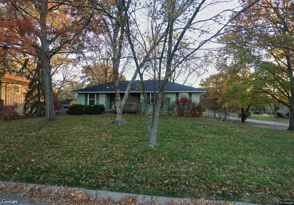
101 Daisy St Lansing, KS 66043
Estimated Value: $288,000 - $307,000
3
Beds
3
Baths
1,454
Sq Ft
$202/Sq Ft
Est. Value
About This Home
This home is located at 101 Daisy St, Lansing, KS 66043 and is currently estimated at $294,018, approximately $202 per square foot. 101 Daisy St is a home located in Leavenworth County with nearby schools including Lansing Elementary School, Lansing Middle 6-8, and Lansing High 9-12.
Ownership History
Date
Name
Owned For
Owner Type
Purchase Details
Closed on
Apr 1, 2004
Bought by
Usera Liberty A and Usera Robin M
Current Estimated Value
Home Financials for this Owner
Home Financials are based on the most recent Mortgage that was taken out on this home.
Original Mortgage
$143,781
Outstanding Balance
$89,509
Interest Rate
5.52%
Mortgage Type
FHA
Estimated Equity
$204,509
Create a Home Valuation Report for This Property
The Home Valuation Report is an in-depth analysis detailing your home's value as well as a comparison with similar homes in the area
Home Values in the Area
Average Home Value in this Area
Purchase History
| Date | Buyer | Sale Price | Title Company |
|---|---|---|---|
| Usera Liberty A | $131,900 | -- |
Source: Public Records
Mortgage History
| Date | Status | Borrower | Loan Amount |
|---|---|---|---|
| Open | Usera Liberty A | $143,781 |
Source: Public Records
Tax History
| Year | Tax Paid | Tax Assessment Tax Assessment Total Assessment is a certain percentage of the fair market value that is determined by local assessors to be the total taxable value of land and additions on the property. | Land | Improvement |
|---|---|---|---|---|
| 2025 | $3,980 | $31,032 | $4,630 | $26,402 |
| 2024 | $3,619 | $29,838 | $3,687 | $26,151 |
| 2023 | $3,619 | $28,033 | $3,687 | $24,346 |
| 2022 | $3,480 | $25,484 | $2,983 | $22,501 |
| 2021 | $3,369 | $23,471 | $2,983 | $20,488 |
| 2020 | $3,257 | $22,333 | $2,983 | $19,350 |
| 2019 | $3,034 | $20,799 | $2,983 | $17,816 |
| 2018 | $2,762 | $18,968 | $2,508 | $16,460 |
| 2017 | $2,611 | $17,910 | $2,508 | $15,402 |
| 2016 | $2,586 | $17,733 | $2,508 | $15,225 |
| 2015 | $2,579 | $17,733 | $2,508 | $15,225 |
| 2014 | $2,487 | $17,468 | $2,508 | $14,960 |
Source: Public Records
Map
Nearby Homes
- 20958 Ida St
- 00000 Brookwood St
- 130 Hampton Ct
- 530 Holiday Ct
- 950 Holiday Dr
- 124 S Main St
- 202 S Main St
- 1017 Pebble Beach Dr
- 114 Emile St
- 26731 147th St
- 1101 Pebble Beach Dr
- 134 Debra St
- 218 E Kay St
- Lot 2 Eisenhower Rd
- 1102 N Main St
- 215 E Mary St
- 4 Eisenhower Rd
- 728 Eisenhower Rd
- 1100 N 4th St
- 1102 N 4th St
- 103 Daisy St
- 122 Brookridge St
- 102 Gilbert St
- 100 Daisy St
- 104 Gilbert St
- 102 Daisy St
- 114 Brookridge St
- 105 Daisy St
- 106 Gilbert St
- 104 Daisy St
- 107 Daisy St
- 124 Brookridge St
- 119 Ferncliff St
- 119 Brookridge St
- 103 Ferncliff St
- 121 Brookridge St
- 105 Ferncliff St
- 117 Brookridge St
- 112 Brookridge St
- 123 Brookridge St
Your Personal Tour Guide
Ask me questions while you tour the home.