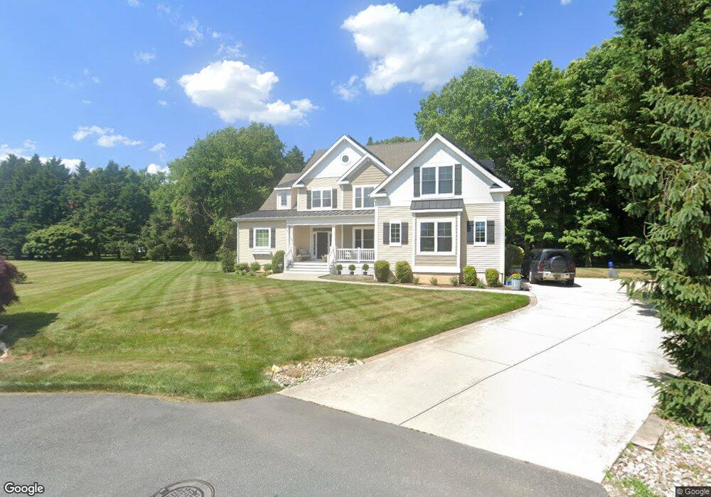
101 Deer Path Ct Rehoboth Beach, DE 19971
Estimated Value: $662,000 - $1,060,000
4
Beds
--
Bath
3,558
Sq Ft
$247/Sq Ft
Est. Value
About This Home
This home is located at 101 Deer Path Ct, Rehoboth Beach, DE 19971 and is currently estimated at $880,323, approximately $247 per square foot. 101 Deer Path Ct is a home with nearby schools including Rehoboth Elementary School, Mariner Middle School, and Cape Henlopen High School.
Ownership History
Date
Name
Owned For
Owner Type
Purchase Details
Closed on
Nov 19, 2014
Sold by
Carenl Carenl
Bought by
Schell Properties Llc
Current Estimated Value
Purchase Details
Closed on
Nov 1, 2013
Sold by
Cedar Southworth C and Cedar Southworth Donna M
Bought by
Tasch Caren L
Home Financials for this Owner
Home Financials are based on the most recent Mortgage that was taken out on this home.
Original Mortgage
$100,000
Outstanding Balance
$51,197
Interest Rate
4.25%
Estimated Equity
$829,126
Create a Home Valuation Report for This Property
The Home Valuation Report is an in-depth analysis detailing your home's value as well as a comparison with similar homes in the area
Home Values in the Area
Average Home Value in this Area
Purchase History
| Date | Buyer | Sale Price | Title Company |
|---|---|---|---|
| Schell Properties Llc | $130,000 | -- | |
| Tasch Caren L | $120,000 | -- |
Source: Public Records
Mortgage History
| Date | Status | Borrower | Loan Amount |
|---|---|---|---|
| Open | Tasch Caren L | $100,000 |
Source: Public Records
Tax History Compared to Growth
Tax History
| Year | Tax Paid | Tax Assessment Tax Assessment Total Assessment is a certain percentage of the fair market value that is determined by local assessors to be the total taxable value of land and additions on the property. | Land | Improvement |
|---|---|---|---|---|
| 2025 | $1,808 | $57,850 | $8,900 | $48,950 |
| 2024 | $2,851 | $57,850 | $8,900 | $48,950 |
| 2023 | $2,849 | $57,850 | $8,900 | $48,950 |
| 2022 | $2,750 | $57,850 | $8,900 | $48,950 |
| 2021 | $2,724 | $57,850 | $8,900 | $48,950 |
| 2020 | $2,716 | $57,850 | $8,900 | $48,950 |
| 2019 | $2,720 | $57,850 | $8,900 | $48,950 |
| 2018 | $2,540 | $57,850 | $0 | $0 |
| 2017 | $2,433 | $57,850 | $0 | $0 |
| 2016 | $2,311 | $57,850 | $0 | $0 |
| 2015 | $340 | $57,850 | $0 | $0 |
| 2014 | $337 | $8,900 | $0 | $0 |
Source: Public Records
Map
Nearby Homes
- 8 Curlew Ct
- 12 Black Walnut Ct
- 110 Whisperwood Ln
- 19773 Old Landing Rd
- 35560 Dry Brook Dr
- 19666 Princess St Unit 131
- 35518 Betsy Ross Blvd
- 19695 Prince St
- 20 Deerfield Ln
- 109 Strawberry Way
- 24 Avebury Ct
- 19627 Queen St Unit 22
- 19935 Sea Air Ave Unit 3263
- 19606 Queen St Unit 31
- 18 Avebury Ct
- 31733 Carmine Dr
- 108 Loganberry Ln
- 19961 Center Ave Unit 20473
- 111 Loganberry Ln
- 36106 Palace Ln Unit 67
- 102 Deer Path Ct
- 107 White Oak Rd
- 109 White Oak Rd
- 113 White Oak Rd
- 105 White Oak Rd
- 111 White Oak Rd
- 103 White Oak Rd
- 130 Landing Dr
- 114 White Oak Rd
- 132 Landing Dr
- 117 Kings Creek Rd
- 128 Landing Dr
- 112 White Oak Rd
- 115 Kings Creek Rd
- 121 Kings Creek Rd
- 134 Landing Dr
- 116 White Oak Rd
- 110 White Oak Rd
- 108 White Oak Rd
- 122 White Oak Rd