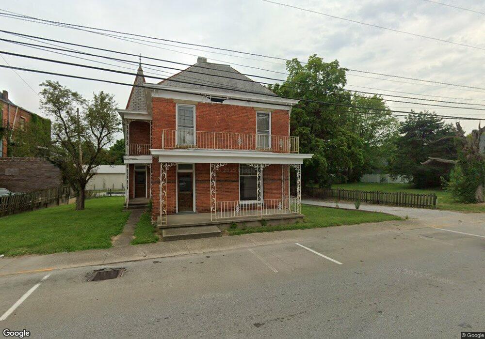
101 E Main St Mount Orab, OH 45154
Estimated Value: $177,000 - $260,000
3
Beds
2
Baths
1,596
Sq Ft
$138/Sq Ft
Est. Value
About This Home
This home is located at 101 E Main St, Mount Orab, OH 45154 and is currently estimated at $220,255, approximately $138 per square foot. 101 E Main St is a home located in Brown County with nearby schools including Western Brown High School.
Ownership History
Date
Name
Owned For
Owner Type
Purchase Details
Closed on
Nov 7, 2019
Bought by
Sloas Brett and Sloas Patricia
Current Estimated Value
Home Financials for this Owner
Home Financials are based on the most recent Mortgage that was taken out on this home.
Interest Rate
3.69%
Purchase Details
Closed on
Oct 16, 2019
Bought by
Hutchinson Marcella Ann
Home Financials for this Owner
Home Financials are based on the most recent Mortgage that was taken out on this home.
Interest Rate
3.69%
Create a Home Valuation Report for This Property
The Home Valuation Report is an in-depth analysis detailing your home's value as well as a comparison with similar homes in the area
Home Values in the Area
Average Home Value in this Area
Purchase History
| Date | Buyer | Sale Price | Title Company |
|---|---|---|---|
| Sloas Brett | $78,000 | -- | |
| Hutchinson Marcella Ann | -- | -- |
Source: Public Records
Mortgage History
| Date | Status | Borrower | Loan Amount |
|---|---|---|---|
| Closed | Sloas Brett | -- | |
| Closed | Sloas Brett | -- |
Source: Public Records
Tax History
| Year | Tax Paid | Tax Assessment Tax Assessment Total Assessment is a certain percentage of the fair market value that is determined by local assessors to be the total taxable value of land and additions on the property. | Land | Improvement |
|---|---|---|---|---|
| 2024 | $1,153 | $36,240 | $7,360 | $28,880 |
| 2023 | $1,153 | $31,630 | $6,180 | $25,450 |
| 2022 | $1,089 | $31,630 | $6,180 | $25,450 |
| 2021 | $1,046 | $31,630 | $6,180 | $25,450 |
| 2020 | $919 | $26,370 | $5,160 | $21,210 |
| 2019 | $980 | $26,370 | $5,160 | $21,210 |
| 2018 | $969 | $26,370 | $5,160 | $21,210 |
| 2017 | $845 | $22,430 | $5,160 | $17,270 |
| 2016 | $846 | $22,430 | $5,160 | $17,270 |
| 2015 | $810 | $22,430 | $5,160 | $17,270 |
| 2014 | $810 | $21,960 | $4,690 | $17,270 |
| 2013 | $808 | $21,960 | $4,690 | $17,270 |
Source: Public Records
Map
Nearby Homes
- 329 E Main St
- 402 E Main St
- 311 Smith Ave
- 506 E Main St
- 414 Castle Ave
- 108 Lonny St
- 106 Lonny St
- 102 Lonny St
- 317 Robin Ave
- 203 Bingaman Ln
- 206 Bingaman Ln
- 102 Tom's Turnaround
- 419 Liming Farm Rd
- 781 S High St
- 0 State Route 32 Unit 1795308
- 110 Nathans Ln
- 106 Nathans Ln
- 105 Maple Ridge Ave
- 14059 Boyd Rd
- 3517 Bardwell Buford Rd
- 106 N High St
- 105 E Main St
- 100 S High St
- 102 E Main St
- 114 N High St
- 114 N North High St
- 107 E Main St
- 0 Tri County Hwy Unit 1594225
- 62.32ac Tri County Hwy
- 0 Tri County Hwy Unit 875355
- 0 Tri County Hwy Unit 1630272
- 0 Us Route 68 Unit 1778367
- 0 Us Route 68
- 111 N High St
- 202 E Main St
- 121 S High St
- 111 E Main St
- 102 W Main St
- 115 N High St
- 109 S High St
Your Personal Tour Guide
Ask me questions while you tour the home.