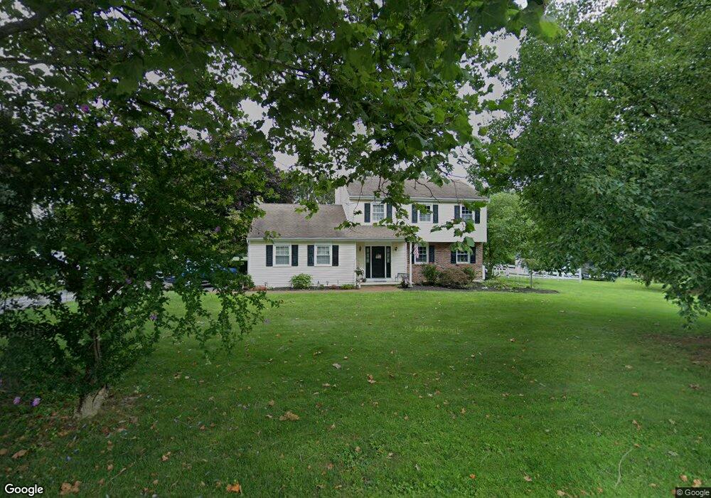
101 Helm Way Downingtown, PA 19335
Estimated Value: $413,000 - $561,251
4
Beds
3
Baths
1,802
Sq Ft
$283/Sq Ft
Est. Value
About This Home
This home is located at 101 Helm Way, Downingtown, PA 19335 and is currently estimated at $510,313, approximately $283 per square foot. 101 Helm Way is a home located in Chester County with nearby schools including Beaver Creek Elementary School, Downingtown Middle School, and Downingtown High School West.
Ownership History
Date
Name
Owned For
Owner Type
Purchase Details
Closed on
Feb 12, 2015
Sold by
Smith Kristopher K
Bought by
Smith Kristopher K and Smith Christine
Current Estimated Value
Home Financials for this Owner
Home Financials are based on the most recent Mortgage that was taken out on this home.
Original Mortgage
$196,000
Outstanding Balance
$149,565
Interest Rate
3.66%
Mortgage Type
New Conventional
Estimated Equity
$360,748
Purchase Details
Closed on
Aug 20, 2012
Sold by
Shaw Kenneth E
Bought by
Smith Kristopher K
Home Financials for this Owner
Home Financials are based on the most recent Mortgage that was taken out on this home.
Original Mortgage
$220,000
Interest Rate
3.61%
Mortgage Type
Seller Take Back
Purchase Details
Closed on
Oct 21, 2000
Sold by
Shaw Kenneth E and Shaw Frances M
Bought by
Shaw Kenneth E
Create a Home Valuation Report for This Property
The Home Valuation Report is an in-depth analysis detailing your home's value as well as a comparison with similar homes in the area
Home Values in the Area
Average Home Value in this Area
Purchase History
| Date | Buyer | Sale Price | Title Company |
|---|---|---|---|
| Smith Kristopher K | -- | None Available | |
| Smith Kristopher K | $220,000 | General Title Insurance Co | |
| Shaw Kenneth E | -- | -- |
Source: Public Records
Mortgage History
| Date | Status | Borrower | Loan Amount |
|---|---|---|---|
| Open | Smith Kristopher K | $196,000 | |
| Closed | Smith Kristopher K | $220,000 |
Source: Public Records
Tax History Compared to Growth
Tax History
| Year | Tax Paid | Tax Assessment Tax Assessment Total Assessment is a certain percentage of the fair market value that is determined by local assessors to be the total taxable value of land and additions on the property. | Land | Improvement |
|---|---|---|---|---|
| 2025 | $6,401 | $172,350 | $54,890 | $117,460 |
| 2024 | $6,401 | $172,350 | $54,890 | $117,460 |
| 2023 | $6,229 | $172,350 | $54,890 | $117,460 |
| 2022 | $5,994 | $172,350 | $54,890 | $117,460 |
| 2021 | $5,972 | $172,350 | $54,890 | $117,460 |
| 2020 | $5,941 | $172,350 | $54,890 | $117,460 |
| 2019 | $5,932 | $172,350 | $54,890 | $117,460 |
| 2018 | $5,932 | $172,350 | $54,890 | $117,460 |
| 2017 | $5,869 | $172,350 | $54,890 | $117,460 |
| 2016 | $5,086 | $172,350 | $54,890 | $117,460 |
| 2015 | $5,086 | $172,350 | $54,890 | $117,460 |
| 2014 | $5,086 | $172,350 | $54,890 | $117,460 |
Source: Public Records
Map
Nearby Homes
- 105 Helm Way
- 114 Governors Cir
- 1708 Hydrangea Way
- 2101 Jacobs Mill Cir
- 4701 Edges Mill Rd
- 16 Parkside Ave
- 320 Dawson Place
- 110 Crawford Rd
- 184 Race St
- 141 Crawford Rd
- 340 Carlyn Ct
- 350 Carlyn Ct
- 335 Stuart Ave
- 402 Norwood Rd
- 6 Holleran Dr
- 117 Nichols Mill Rd
- 390 Mary St
- 266 Carlyn Ct
- 301 Corner Ketch Rd
- 115 Whelen Ave
- 103 Helm Way
- 102 Helm Way
- 400 Rock Raymond Rd
- 410 Rock Raymond Rd
- 415 Rock Raymond Rd
- 399 Rock Raymond Rd
- 104 Helm Way
- 397 Rock Raymond Rd
- 385 Rock Raymond Rd
- 4 Hessian Ct
- 107 Helm Way
- 9 Harrowsgate Ave
- 1 Harrowsgate Ave
- 13 Harrowsgate Ave
- 5 Harrowsgate Ave
- 21 Harrowsgate Ave
- 250 W Route 113
- 101 Littlewashingtonlyndellrd
- 390 Rock Raymond Rd
- 420 Rock Raymond Rd