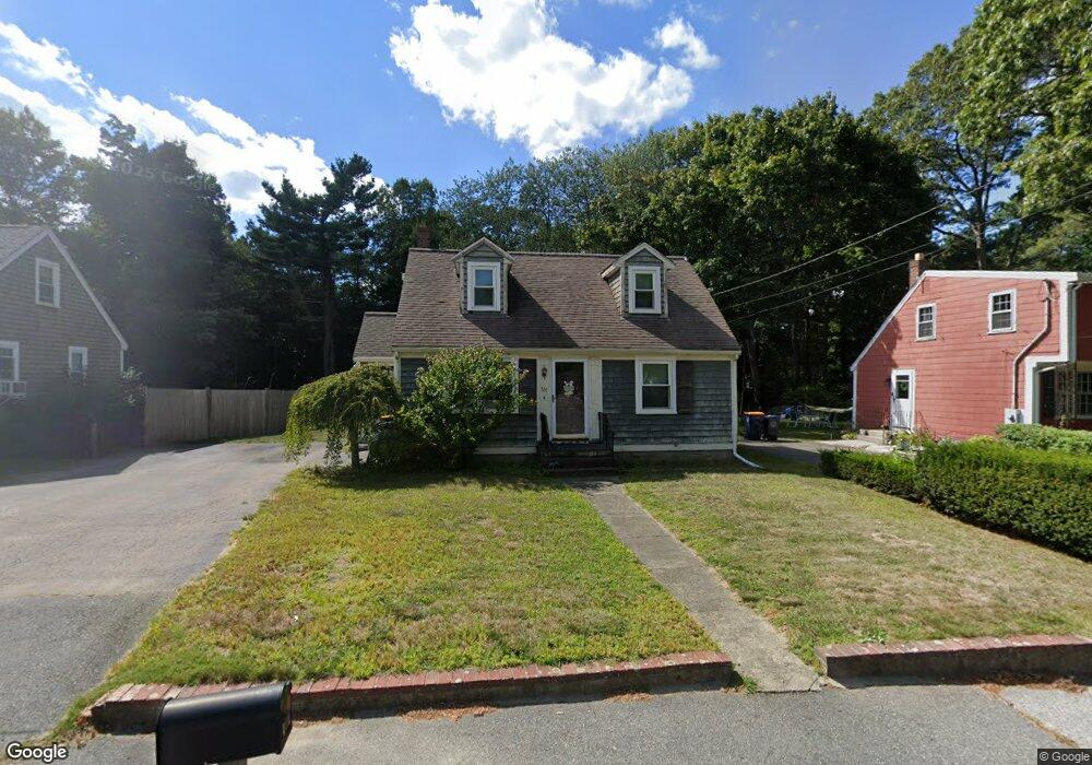
101 High St Norwell, MA 02061
Estimated Value: $629,000 - $807,000
3
Beds
2
Baths
1,044
Sq Ft
$669/Sq Ft
Est. Value
About This Home
This home is located at 101 High St, Norwell, MA 02061 and is currently estimated at $698,171, approximately $668 per square foot. 101 High St is a home located in Plymouth County with nearby schools including Grace Farrar Cole Elementary School, Norwell Middle School, and Norwell High School.
Ownership History
Date
Name
Owned For
Owner Type
Purchase Details
Closed on
Dec 17, 2025
Sold by
First Landing Invs Llc
Bought by
Macauley Development Llc
Current Estimated Value
Home Financials for this Owner
Home Financials are based on the most recent Mortgage that was taken out on this home.
Original Mortgage
$400,000
Outstanding Balance
$399,618
Interest Rate
6.22%
Mortgage Type
Purchase Money Mortgage
Estimated Equity
$298,553
Purchase Details
Closed on
Dec 11, 2025
Sold by
Raymond Shawn and Raymond Karin
Bought by
First Landing Invs Llc
Home Financials for this Owner
Home Financials are based on the most recent Mortgage that was taken out on this home.
Original Mortgage
$400,000
Outstanding Balance
$399,618
Interest Rate
6.22%
Mortgage Type
Purchase Money Mortgage
Estimated Equity
$298,553
Purchase Details
Closed on
Aug 14, 2006
Sold by
Mariano Janice E
Bought by
Raymond Shawn and Lachance Karin
Home Financials for this Owner
Home Financials are based on the most recent Mortgage that was taken out on this home.
Original Mortgage
$288,000
Interest Rate
6.8%
Mortgage Type
Purchase Money Mortgage
Purchase Details
Closed on
Mar 12, 2001
Sold by
Sander Michael E and Sanders Jeanine A
Bought by
Mariano Janice E and Mariano James C
Purchase Details
Closed on
Jun 18, 1998
Sold by
Watson John A and Watson Elsie A
Bought by
Watson Jeanine A and Sander Michael E
Create a Home Valuation Report for This Property
The Home Valuation Report is an in-depth analysis detailing your home's value as well as a comparison with similar homes in the area
Home Values in the Area
Average Home Value in this Area
Purchase History
| Date | Buyer | Sale Price | Title Company |
|---|---|---|---|
| Macauley Development Llc | $581,123 | -- | |
| First Landing Invs Llc | $535,000 | -- | |
| Raymond Shawn | $360,000 | -- | |
| Raymond Shawn | $360,000 | -- | |
| Mariano Janice E | $260,000 | -- | |
| Mariano Janice E | $260,000 | -- | |
| Watson Jeanine A | $75,000 | -- | |
| Watson Jeanine A | $75,000 | -- |
Source: Public Records
Mortgage History
| Date | Status | Borrower | Loan Amount |
|---|---|---|---|
| Open | Macauley Development Llc | $400,000 | |
| Previous Owner | Watson Jeanine A | $270,000 | |
| Previous Owner | Watson Jeanine A | $288,000 |
Source: Public Records
Tax History
| Year | Tax Paid | Tax Assessment Tax Assessment Total Assessment is a certain percentage of the fair market value that is determined by local assessors to be the total taxable value of land and additions on the property. | Land | Improvement |
|---|---|---|---|---|
| 2025 | $6,768 | $517,800 | $299,300 | $218,500 |
| 2024 | $6,914 | $513,700 | $298,100 | $215,600 |
| 2023 | $6,822 | $446,200 | $265,500 | $180,700 |
| 2022 | $6,153 | $370,200 | $209,800 | $160,400 |
| 2021 | $6,674 | $381,300 | $220,900 | $160,400 |
| 2020 | $6,600 | $372,300 | $220,900 | $151,400 |
| 2019 | $0 | $367,900 | $216,500 | $151,400 |
| 2018 | $5,464 | $334,400 | $200,800 | $133,600 |
| 2017 | $0 | $314,700 | $200,800 | $113,900 |
| 2016 | $5,297 | $321,000 | $200,800 | $120,200 |
| 2015 | $4,889 | $296,300 | $197,000 | $99,300 |
| 2014 | $4,675 | $285,600 | $186,600 | $99,000 |
Source: Public Records
Map
Nearby Homes
- 214 Washington St Unit 24
- 214 Washington St Unit 28
- 8 Blueberry Ct
- 18 Colby St
- 303 Pond St
- 55 Turner Rd
- 17 Pine Haven Cir
- 18 Winterberry Ln
- 49 Washington Park Dr
- 738 Whiting St
- 100 Whiting St
- 108 Deerfield Ln
- 46 Brookwood Rd
- 535 Webster St
- 183 Gardner St
- 4 Kerri Ln
- 1 Kerri Ln
- 251 Prospect St
- 26 Hobart Ln Unit 26,C
- 225 Prospect St
Your Personal Tour Guide
Ask me questions while you tour the home.