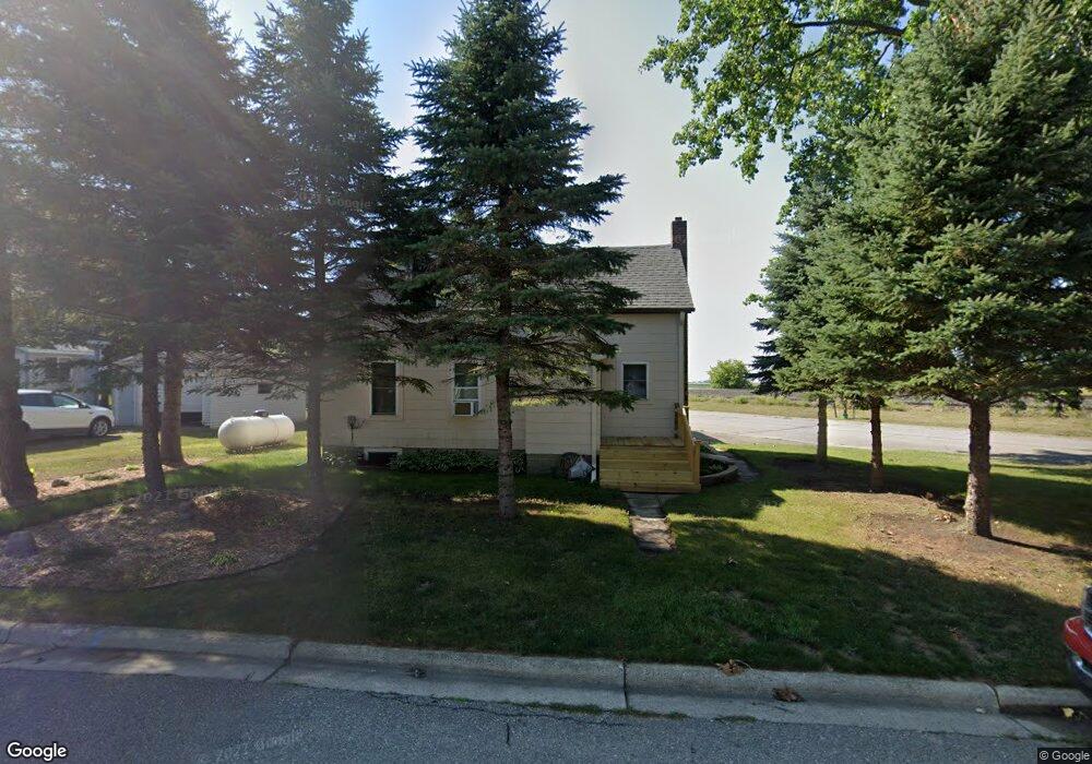
101 Kentucky Ave Hoffman, MN 56339
Estimated Value: $89,000 - $124,000
3
Beds
2
Baths
852
Sq Ft
$119/Sq Ft
Est. Value
About This Home
This home is located at 101 Kentucky Ave, Hoffman, MN 56339 and is currently estimated at $101,449, approximately $119 per square foot. 101 Kentucky Ave is a home located in Grant County with nearby schools including West Central Area Secondary School.
Ownership History
Date
Name
Owned For
Owner Type
Purchase Details
Closed on
Mar 4, 2022
Sold by
Scharnowske and Kathy
Bought by
Otto Jordin
Current Estimated Value
Home Financials for this Owner
Home Financials are based on the most recent Mortgage that was taken out on this home.
Original Mortgage
$88,888
Outstanding Balance
$83,050
Interest Rate
3.92%
Mortgage Type
New Conventional
Estimated Equity
$18,399
Purchase Details
Closed on
Jun 25, 2020
Sold by
Saathoff Ronnie Ronnie
Bought by
Scharnowske Michael Michael
Create a Home Valuation Report for This Property
The Home Valuation Report is an in-depth analysis detailing your home's value as well as a comparison with similar homes in the area
Purchase History
| Date | Buyer | Sale Price | Title Company |
|---|---|---|---|
| Otto Jordin | $88,000 | New Title Company Name | |
| Scharnowske Michael Michael | $35,000 | -- |
Source: Public Records
Mortgage History
| Date | Status | Borrower | Loan Amount |
|---|---|---|---|
| Open | Otto Jordin | $88,888 |
Source: Public Records
Tax History
| Year | Tax Paid | Tax Assessment Tax Assessment Total Assessment is a certain percentage of the fair market value that is determined by local assessors to be the total taxable value of land and additions on the property. | Land | Improvement |
|---|---|---|---|---|
| 2025 | $616 | $81,900 | $6,700 | $75,200 |
| 2024 | $616 | $73,600 | $3,400 | $70,200 |
| 2023 | $632 | $76,800 | $3,400 | $73,400 |
| 2022 | $416 | $40,500 | $2,300 | $38,200 |
| 2021 | $284 | $41,100 | $2,300 | $38,800 |
| 2020 | $362 | $26,100 | $2,300 | $23,800 |
| 2019 | $264 | $24,200 | $2,300 | $21,900 |
| 2018 | $390 | $23,100 | $2,300 | $20,800 |
| 2017 | $408 | $0 | $0 | $0 |
| 2016 | $404 | $0 | $0 | $0 |
| 2015 | $416 | $0 | $0 | $0 |
| 2014 | -- | $0 | $0 | $0 |
Source: Public Records
Map
Nearby Homes
- 117 N Memorial Dr
- 702 Dakota Ave
- TBD 1st St N
- 406 1st St N
- 17024 County Road 5
- 5011 County Road 25 SW
- 64.4 acres Westridge Ln SW
- 23146 Red Rock Shores Dr SW
- 000 Red Rock Shores Dr SW
- 3354 Shorewood Dr SW
- 16 Tower St
- 20575 Tower Hill Rd SW
- 701 3rd St
- 205 Front St
- 106 Rich Ave
- 12590 County Road 3
- 4931 Honeysuckle Ln SW
- 12267 Crooked Lake Ln SW
- 25839 122nd Ave
- 2221 Reubens Ln SW Unit 35
- 103 Kentucky Ave
- 105 Kentucky Ave
- 107 Kentucky Ave
- 102 Kentucky Ave
- 102 102 Kentucky Ave
- 506 1st St S
- 108 Kentucky Ave
- 501 4th St S
- 505 4th St S
- 413 4th St S
- 508 1st St S
- 507 507 4th St S
- 507 4th St S
- 411 411 4th St S
- 411 4th St S
- 409 4th St S
- 114 Louisiana Ave
- 114 114 Louisiana Ave
- 312 3rd St S
- 407 4th St S
Your Personal Tour Guide
Ask me questions while you tour the home.