Estimated Value: $233,790 - $266,000
3
Beds
2
Baths
1,544
Sq Ft
$159/Sq Ft
Est. Value
About This Home
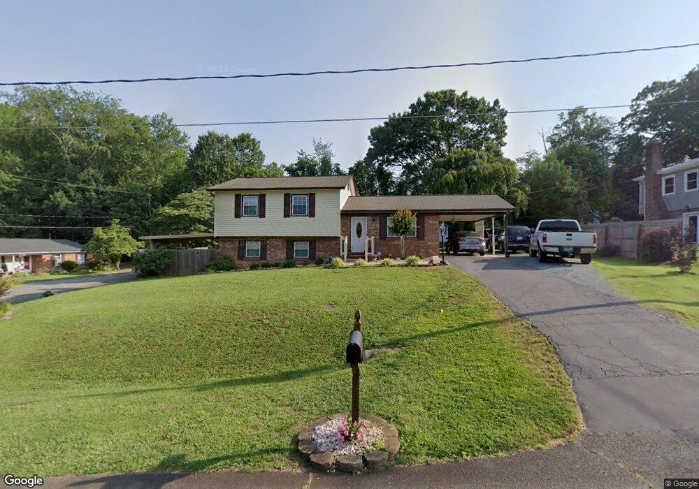
This home is located at 101 Laurel Ln, King, NC 27021 and is currently estimated at $245,948, approximately $159 per square foot. 101 Laurel Ln is a home located in Stokes County with nearby schools including Poplar Springs Elementary School, Chestnut Grove Middle, and West Stokes High.
Ownership History
Date
Name
Owned For
Owner Type
Purchase Details
Closed on
Mar 31, 2009
Sold by
Burton Walter A and Burton Liddie G
Bought by
Skipper Donna Hayden
Current Estimated Value
Home Financials for this Owner
Home Financials are based on the most recent Mortgage that was taken out on this home.
Original Mortgage
$107,142
Outstanding Balance
$68,311
Interest Rate
5.1%
Mortgage Type
Purchase Money Mortgage
Estimated Equity
$177,637
Create a Home Valuation Report for This Property
The Home Valuation Report is an in-depth analysis detailing your home's value as well as a comparison with similar homes in the area
Home Values in the Area
Average Home Value in this Area
Purchase History
| Date | Buyer | Sale Price | Title Company |
|---|---|---|---|
| Skipper Donna Hayden | $105,000 | None Available |
Source: Public Records
Mortgage History
| Date | Status | Borrower | Loan Amount |
|---|---|---|---|
| Open | Skipper Donna Hayden | $107,142 |
Source: Public Records
Tax History
| Year | Tax Paid | Tax Assessment Tax Assessment Total Assessment is a certain percentage of the fair market value that is determined by local assessors to be the total taxable value of land and additions on the property. | Land | Improvement |
|---|---|---|---|---|
| 2025 | $1,932 | $176,400 | $35,000 | $141,400 |
| 2024 | $1,932 | $123,100 | $30,000 | $93,100 |
| 2023 | $1,453 | $123,100 | $30,000 | $93,100 |
| 2022 | $1,391 | $123,100 | $30,000 | $93,100 |
| 2021 | $1,391 | $123,100 | $30,000 | $93,100 |
| 2020 | $1,159 | $107,100 | $25,000 | $82,100 |
| 2019 | $1,159 | $107,100 | $25,000 | $82,100 |
| 2018 | $1,159 | $107,100 | $25,000 | $82,100 |
| 2017 | $1,159 | $107,100 | $25,000 | $82,100 |
| 2016 | $1,122 | $103,700 | $25,000 | $78,700 |
| 2015 | $1,122 | $103,700 | $25,000 | $78,700 |
| 2014 | $1,156 | $103,700 | $25,000 | $78,700 |
Source: Public Records
Map
Nearby Homes
- Lot 18 Glen Brooke Ln
- Lot 19 Glen Brooke Ln
- 218 Maverick Trail Dr
- 119 Red Leaf Dr
- 109 Glen Brooke Ln
- 225 Maverick Trail Dr
- 125 Rocky Maple Dr
- 117 Rocky Maple Dr
- 104 Palomino Dr
- 0 Mountain View Rd Unit 1173137
- 254 Winfield Dr
- 224 Winfield Dr
- 157 Leeds Ln
- 307 Highland Cir
- 110 Vine Maple Ct
- 164 Red Maple Way
- 172 Plumtree Ct
- 223 Plumtree Ct
- 167 Plumtree Ct
- 252 Plumtree Ct
- 105 Laurel Ln
- 109 Laurel Ln
- 205 Partridge Ln
- 201 Partridge Ln
- 102 Laurel Ln
- 104 Laurel Ln
- 109 Partridge Ln
- 110 Laurel Ln
- 106 Partridge Ln
- 218 Misty Ct
- 105 Partridge Ln
- 214 Misty Ct
- 102 Partridge Ln
- 101 Partridge Ln
- 213 Misty Ct
- 304 Merriweather Dr
- 210 Misty Ct
- 204 Merriweather Dr
- 406 Merriweather Dr
- 206 Misty Ct
Your Personal Tour Guide
Ask me questions while you tour the home.