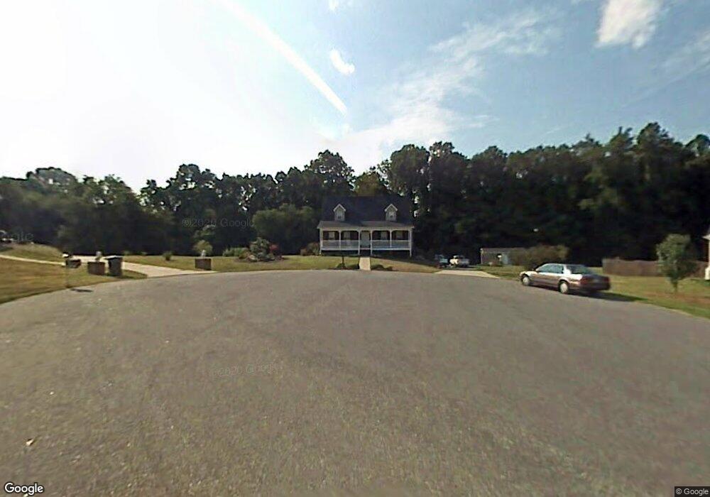
101 Lois Reich Ct Lexington, NC 27295
Estimated Value: $301,283 - $523,000
3
Beds
3
Baths
1,708
Sq Ft
$216/Sq Ft
Est. Value
About This Home
This home is located at 101 Lois Reich Ct, Lexington, NC 27295 and is currently estimated at $369,571, approximately $216 per square foot. 101 Lois Reich Ct is a home located in Davidson County with nearby schools including Friedberg Elementary School, Oak Grove Middle School, and Oak Grove High School.
Ownership History
Date
Name
Owned For
Owner Type
Purchase Details
Closed on
May 16, 2003
Sold by
Countrywide Home Loans Inc
Bought by
Simmons Billy E
Current Estimated Value
Purchase Details
Closed on
Apr 24, 2003
Sold by
Byerly Tommy Dean and Byerly Rhonda B
Bought by
Countrywide Home Loans Inc
Purchase Details
Closed on
Apr 5, 2001
Sold by
Bbj Building Inc
Bought by
Byerly Tommy Dean and Byerly Rhonda B
Purchase Details
Closed on
Aug 21, 2000
Sold by
Hubbard Realty Of Ws Inc
Bought by
Bbj Building Inc
Create a Home Valuation Report for This Property
The Home Valuation Report is an in-depth analysis detailing your home's value as well as a comparison with similar homes in the area
Home Values in the Area
Average Home Value in this Area
Purchase History
| Date | Buyer | Sale Price | Title Company |
|---|---|---|---|
| Simmons Billy E | $143,500 | -- | |
| Countrywide Home Loans Inc | $115,500 | -- | |
| Byerly Tommy Dean | $145,000 | -- | |
| Bbj Building Inc | $192,000 | -- |
Source: Public Records
Tax History Compared to Growth
Tax History
| Year | Tax Paid | Tax Assessment Tax Assessment Total Assessment is a certain percentage of the fair market value that is determined by local assessors to be the total taxable value of land and additions on the property. | Land | Improvement |
|---|---|---|---|---|
| 2025 | $1,230 | $189,160 | $0 | $0 |
| 2024 | $1,192 | $189,160 | $0 | $0 |
| 2023 | $1,192 | $189,160 | $0 | $0 |
| 2022 | $1,155 | $189,160 | $0 | $0 |
| 2021 | $1,155 | $189,160 | $0 | $0 |
| 2020 | $1,085 | $177,730 | $0 | $0 |
| 2019 | $1,102 | $177,730 | $0 | $0 |
| 2018 | $1,102 | $177,730 | $0 | $0 |
| 2017 | $1,102 | $177,730 | $0 | $0 |
| 2016 | $1,071 | $172,800 | $0 | $0 |
| 2015 | $1,071 | $172,800 | $0 | $0 |
| 2014 | $1,071 | $172,770 | $0 | $0 |
Source: Public Records
Map
Nearby Homes
- 618 Widaustin Dr
- 748 Widaustin Dr
- 395 Widaustin Dr
- 224 Old Doc Ct
- 411 Falcon Ln
- 403 Falcon Ln
- 281 Collingswood Dr
- 418 Falcon Ln
- 397 Falcon Ln
- 429 Mendenhall Dr
- 249 Pipers Ridge E
- 400 Falcon Ln
- 389 Falcon Ln
- 164 Candytuft Ct
- 156 Candytuft Ct
- 382 Falcon Ln
- 140 Candytuft Ct
- 381 Falcon Ln
- 167 Candytuft Ct
- 159 Candytuft Ct
- 123 Lois Reich Ct
- 100 Lois Reich Ct
- 122 Lois Reich Ct
- 356 Leonard Berrier Rd
- 380 Leonard Berrier Rd
- 330 Leonard Berrier Rd
- 380 Rd
- 404 Leonard Berrier Rd
- 428 Leonard Berrier Rd
- 304 Leonard Berrier Rd
- 155 Lois Reich Ct
- 177 Knouse Dr
- 154 Lois Reich Ct
- 263 Mockwood Dr
- 158 Knouse Dr
- 379 Leonard Berrier Rd
- 355 Leonard Berrier Rd
- 276 Leonard Berrier Rd
- 179 Lois Reich Ct
- 460 Leonard Berrier Rd