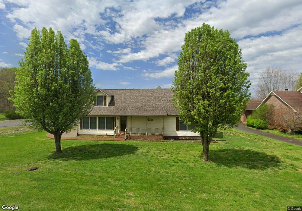
101 Macintosh Dr Springfield, TN 37172
Estimated Value: $347,447 - $433,000
Studio
2
Baths
2,038
Sq Ft
$194/Sq Ft
Est. Value
About This Home
This home is located at 101 Macintosh Dr, Springfield, TN 37172 and is currently estimated at $395,862, approximately $194 per square foot. 101 Macintosh Dr is a home located in Robertson County with nearby schools including Cheatham Park Elementary School, Westside Elementary School, and Innovation Academy.
Ownership History
Date
Name
Owned For
Owner Type
Purchase Details
Closed on
Dec 17, 1998
Sold by
Leavell Duncan E
Bought by
Leavell Duncan E and Leavell Robbie
Current Estimated Value
Home Financials for this Owner
Home Financials are based on the most recent Mortgage that was taken out on this home.
Original Mortgage
$137,598
Outstanding Balance
$37,489
Interest Rate
6.87%
Estimated Equity
$358,373
Purchase Details
Closed on
Feb 22, 1996
Sold by
Spears Samuel D
Bought by
Roberts Virginia Lynn
Purchase Details
Closed on
Nov 27, 1995
Bought by
Spears Samuel D
Purchase Details
Closed on
Apr 7, 1995
Sold by
Sneed Enoch Burns
Bought by
Pratt Charles Allen
Purchase Details
Closed on
May 11, 1993
Bought by
Sneed Enoch Burns and Sneed Michael B
Purchase Details
Closed on
Jul 9, 1990
Bought by
Macmac Savage Thomas Mac and Baggett Mary Od
Purchase Details
Closed on
Apr 22, 1932
Create a Home Valuation Report for This Property
The Home Valuation Report is an in-depth analysis detailing your home's value as well as a comparison with similar homes in the area
Home Values in the Area
Average Home Value in this Area
Purchase History
| Date | Buyer | Sale Price | Title Company |
|---|---|---|---|
| Leavell Duncan E | $134,900 | -- | |
| Roberts Virginia Lynn | $65,000 | -- | |
| Spears Samuel D | $10,800 | -- | |
| Pratt Charles Allen | $10,000 | -- | |
| Sneed Enoch Burns | $44,000 | -- | |
| Macmac Savage Thomas Mac | -- | -- | |
| -- | -- | -- |
Source: Public Records
Mortgage History
| Date | Status | Borrower | Loan Amount |
|---|---|---|---|
| Open | Not Available | $137,598 |
Source: Public Records
Tax History
| Year | Tax Paid | Tax Assessment Tax Assessment Total Assessment is a certain percentage of the fair market value that is determined by local assessors to be the total taxable value of land and additions on the property. | Land | Improvement |
|---|---|---|---|---|
| 2025 | -- | $85,875 | $13,750 | $72,125 |
| 2024 | -- | $85,875 | $13,750 | $72,125 |
| 2023 | $2,152 | $85,875 | $13,750 | $72,125 |
| 2022 | $2,086 | $57,200 | $4,375 | $52,825 |
| 2021 | $2,086 | $57,200 | $4,375 | $52,825 |
| 2020 | $2,062 | $57,200 | $4,375 | $52,825 |
| 2019 | $62,056 | $56,525 | $4,375 | $52,150 |
| 2018 | $2,062 | $56,525 | $4,375 | $52,150 |
| 2017 | $1,781 | $41,550 | $3,850 | $37,700 |
| 2016 | $1,781 | $41,550 | $3,850 | $37,700 |
| 2015 | $1,728 | $41,550 | $3,850 | $37,700 |
| 2014 | $1,728 | $41,550 | $3,850 | $37,700 |
Source: Public Records
Map
Nearby Homes
- 103 Macintosh Dr
- 1 Crestview Dr
- 105 Macintosh Dr
- 100 Macintosh Dr
- 102 Macintosh Dr
- 802 Crestview Dr
- 716 Crestview Dr
- 104 Macintosh Dr
- 107 Macintosh Dr
- 714 Crestview Dr
- 106 Macintosh Dr
- 713 Crestview Dr
- 109 Macintosh Dr
- 712 Crestview Dr
- 800 3rd Ave W
- 711 Crestview Dr
- 710 Crestview Dr
- 805 3rd Ave W
- 803 3rd Ave W
- 708 3rd Ave W
Your Personal Tour Guide
Ask me questions while you tour the home.