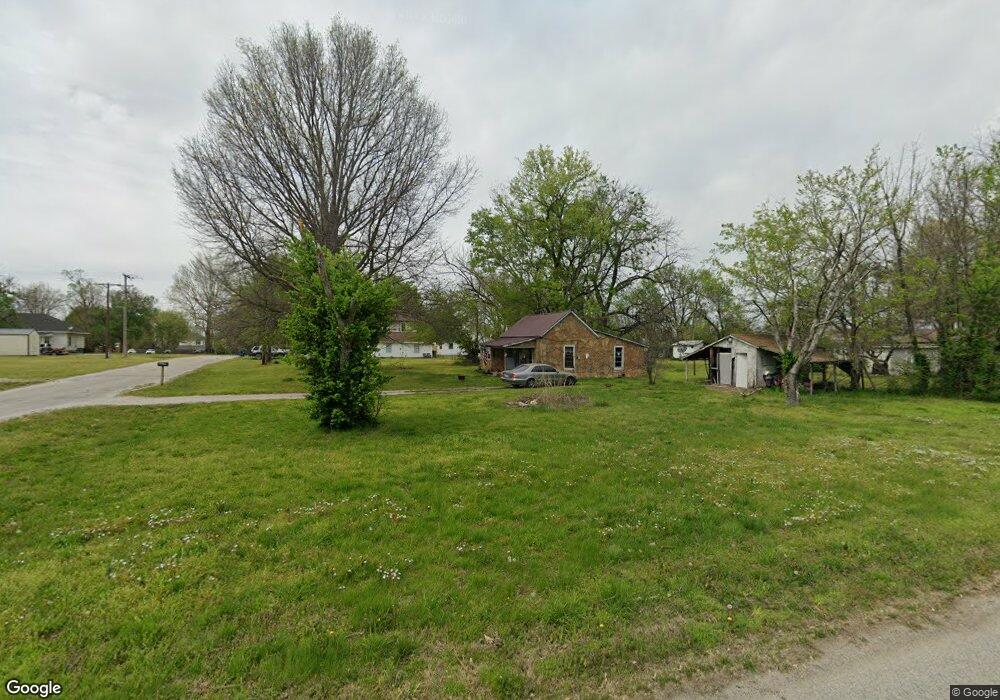
101 Maple Ridge Rd Fairland, OK 74343
Estimated Value: $183,291 - $231,000
3
Beds
2
Baths
1,877
Sq Ft
$109/Sq Ft
Est. Value
About This Home
This home is located at 101 Maple Ridge Rd, Fairland, OK 74343 and is currently estimated at $204,573, approximately $108 per square foot. 101 Maple Ridge Rd is a home located in Ottawa County with nearby schools including Fairland Elementary School and Fairland High School.
Ownership History
Date
Name
Owned For
Owner Type
Purchase Details
Closed on
Apr 9, 2017
Sold by
Merriman Chelsea C
Bought by
Merriman John L
Current Estimated Value
Purchase Details
Closed on
Apr 11, 2014
Bought by
Merriman Johnny L and Merriman Chelsea C
Purchase Details
Closed on
Nov 7, 2013
Bought by
Sec Of Housing & Urban De
Purchase Details
Closed on
Oct 22, 2002
Bought by
Forcum Betty
Purchase Details
Closed on
Aug 23, 2000
Bought by
Cole Jerry
Purchase Details
Closed on
May 3, 2000
Bought by
Cole Jerry and Cole Marilyn
Purchase Details
Closed on
Apr 15, 1999
Bought by
Stelle Thomas W
Create a Home Valuation Report for This Property
The Home Valuation Report is an in-depth analysis detailing your home's value as well as a comparison with similar homes in the area
Purchase History
| Date | Buyer | Sale Price | Title Company |
|---|---|---|---|
| Merriman John L | -- | None Available | |
| Merriman Johnny L | -- | -- | |
| Sec Of Housing & Urban De | -- | -- | |
| Forcum Betty | $76,500 | -- | |
| Cole Jerry | -- | -- | |
| Cole Jerry | $75,000 | -- | |
| Stelle Thomas W | $7,000 | -- |
Source: Public Records
Tax History
| Year | Tax Paid | Tax Assessment Tax Assessment Total Assessment is a certain percentage of the fair market value that is determined by local assessors to be the total taxable value of land and additions on the property. | Land | Improvement |
|---|---|---|---|---|
| 2025 | $904 | $11,540 | $838 | $10,702 |
| 2024 | $921 | $11,204 | $838 | $10,366 |
| 2023 | $876 | $10,878 | $838 | $10,040 |
| 2022 | $862 | $10,561 | $838 | $9,723 |
| 2021 | $794 | $10,253 | $838 | $9,415 |
| 2020 | $711 | $9,955 | $838 | $9,117 |
| 2019 | $698 | $9,665 | $838 | $8,827 |
| 2018 | $706 | $9,665 | $838 | $8,827 |
| 2017 | $709 | $9,665 | $838 | $8,827 |
| 2016 | $698 | $9,432 | $837 | $8,595 |
| 2015 | $676 | $8,721 | $798 | $7,923 |
| 2014 | $770 | $9,157 | $838 | $8,319 |
Source: Public Records
Map
Nearby Homes
- 0 E 180 Rd
- 301 E Church Ave
- 206 E Conner Ave
- 13 Quannah Dr
- 16 E Church Ave
- 107 S Collins St
- 303 W Market Ave
- 344 Stauffer St
- 0 W Conner Ave
- 00000 Oklahoma 125
- 22601 Oklahoma 125
- 59300 E 170 Rd
- 3 N Elm St
- 704 W Conner Ave
- 16901 S Highway 125
- 19510 S 605 Rd
- 20750 S 580 Rd
- 60750 E 200 Rd
- 61215 E 194 Rd
- 20503 S 580 Rd
- 58260 E 180 Rd
- 111 Maple Ridge Rd
- 110 Maple Ridge Rd
- 100 Maple Ridge Rd
- 130 Maple Ridge Rd
- Hwy 125 Maple Ridge
- 0 Maple Ridge
- 58262 U S 60
- 58420 U S 60
- 58565 U S 60
- 58593 E Highway 60
- 58505 E Highway 60
- 58595 E Highway 60
- 58430 E Highway 60
- 58220 E Highway 60
- 58595 U S 60
- 58400 E 180 Rd
- 58625 E Highway 60
- 1224 Ruby Dr
- 58050 E 180 Rd
Your Personal Tour Guide
Ask me questions while you tour the home.