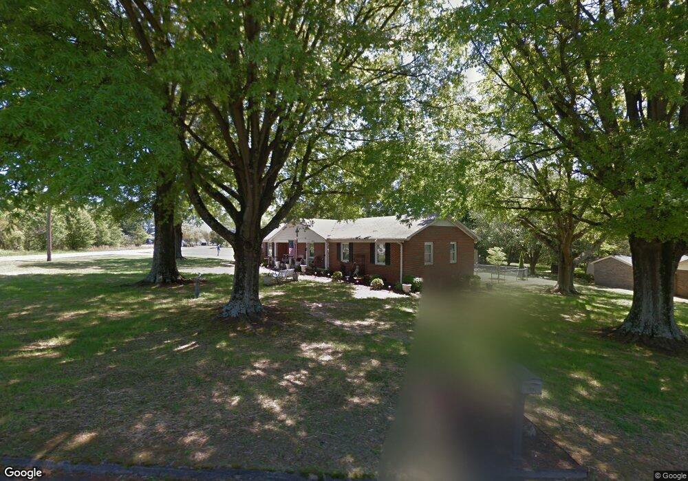
101 Meadowood Dr Mauldin, SC 29662
Estimated Value: $193,000 - $242,000
3
Beds
2
Baths
1,420
Sq Ft
$157/Sq Ft
Est. Value
About This Home
This home is located at 101 Meadowood Dr, Mauldin, SC 29662 and is currently estimated at $222,611, approximately $156 per square foot. 101 Meadowood Dr is a home located in Greenville County with nearby schools including Greenbrier Elementary School, Hillcrest Middle School, and Mauldin High School.
Ownership History
Date
Name
Owned For
Owner Type
Purchase Details
Closed on
Jun 9, 2010
Sold by
Garrett Properties Llc
Bought by
Burns Richard T and Burns Natalie C
Current Estimated Value
Purchase Details
Closed on
Mar 30, 2010
Sold by
Secretary Of Housing & Urban Development
Bought by
Garrett Properties Llc
Home Financials for this Owner
Home Financials are based on the most recent Mortgage that was taken out on this home.
Original Mortgage
$60,000
Interest Rate
5.02%
Mortgage Type
Commercial
Create a Home Valuation Report for This Property
The Home Valuation Report is an in-depth analysis detailing your home's value as well as a comparison with similar homes in the area
Home Values in the Area
Average Home Value in this Area
Purchase History
| Date | Buyer | Sale Price | Title Company |
|---|---|---|---|
| Burns Richard T | $78,500 | -- | |
| Garrett Properties Llc | $60,323 | -- |
Source: Public Records
Mortgage History
| Date | Status | Borrower | Loan Amount |
|---|---|---|---|
| Previous Owner | Garrett Properties Llc | $60,000 |
Source: Public Records
Tax History Compared to Growth
Tax History
| Year | Tax Paid | Tax Assessment Tax Assessment Total Assessment is a certain percentage of the fair market value that is determined by local assessors to be the total taxable value of land and additions on the property. | Land | Improvement |
|---|---|---|---|---|
| 2024 | $2,426 | $6,870 | $1,380 | $5,490 |
| 2023 | $2,343 | $6,870 | $1,380 | $5,490 |
| 2022 | $2,198 | $6,870 | $1,380 | $5,490 |
| 2021 | $2,168 | $6,870 | $1,380 | $5,490 |
| 2020 | $1,992 | $5,970 | $1,200 | $4,770 |
| 2019 | $1,993 | $5,970 | $1,200 | $4,770 |
| 2018 | $1,955 | $5,970 | $1,200 | $4,770 |
| 2017 | $1,924 | $5,970 | $1,200 | $4,770 |
| 2016 | $1,868 | $99,550 | $20,000 | $79,550 |
| 2015 | $1,868 | $99,550 | $20,000 | $79,550 |
| 2014 | $1,932 | $104,230 | $22,000 | $82,230 |
Source: Public Records
Map
Nearby Homes
- 101 Lawnfield St
- 113 Carlton Dr
- 427 Circle Dr
- 306 Thelma Dr
- 8 Chelseabrook Ct
- 242 Santorini Way
- 254 Santorini Way
- 105 Mauldin Cir
- 115 Baldwin Cir
- 24 Poplar Springs Dr
- 26 Sikes Cir
- 511 Fagin Cir
- 309 Garrett St
- 712 Brooks Rd
- 202 N Main St
- 310 Ashmore Bridge Rd
- 215 Hickory Ln
- 219 Baldwin Cir
- 20 Golden Apple Trail
- 4 Natchez Dr
- 103 Meadowood Dr
- 312 New Neely Ferry Rd
- 105 Meadowood Dr
- 107 Meadowood Dr
- 10 Winchester Ct
- 106 Meadowood Dr
- 109 Meadowood Dr
- 2 W Golden Strip Dr
- 4 W Golden Strip Dr
- 310 New Neely Ferry Rd
- 108 Meadowood Dr
- 8 W Golden Strip Dr
- 111 Meadowood Dr
- 10 W Golden Strip Dr
- 12 W Golden Strip Dr
- 100 Lawnfield St
- 113 Meadowood Dr
- 102 Lawnfield St
- 7 W Golden Strip Dr
- 9 W Golden Strip Dr