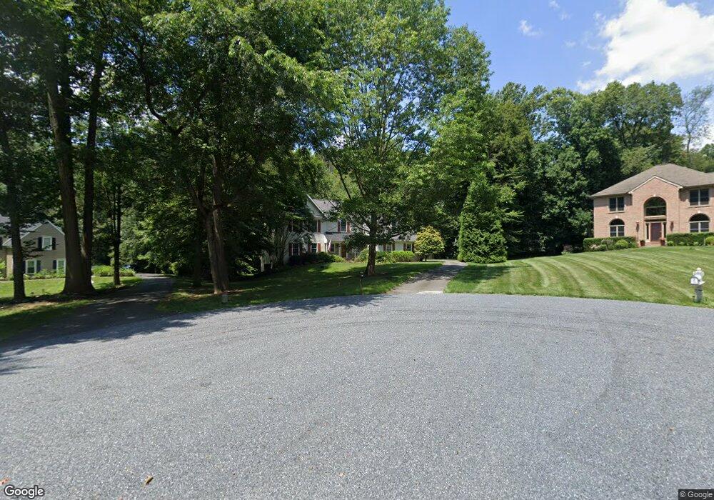
101 Mougins Cir Kennett Square, PA 19348
East Marlborough Township NeighborhoodEstimated Value: $889,865 - $996,000
4
Beds
3
Baths
2,973
Sq Ft
$315/Sq Ft
Est. Value
About This Home
This home is located at 101 Mougins Cir, Kennett Square, PA 19348 and is currently estimated at $937,216, approximately $315 per square foot. 101 Mougins Cir is a home located in Chester County with nearby schools including Unionville Elementary School, Charles F. Patton Middle School, and Unionville High School.
Ownership History
Date
Name
Owned For
Owner Type
Purchase Details
Closed on
Sep 14, 2012
Sold by
Reath Michael G and Reath Sara K
Bought by
Reath Michael G
Current Estimated Value
Home Financials for this Owner
Home Financials are based on the most recent Mortgage that was taken out on this home.
Original Mortgage
$345,200
Outstanding Balance
$239,089
Interest Rate
3.59%
Mortgage Type
New Conventional
Estimated Equity
$698,127
Purchase Details
Closed on
Aug 1, 2006
Sold by
Morton John M and Morton Lynne S
Bought by
Reath Michael G and Reath Sara K
Home Financials for this Owner
Home Financials are based on the most recent Mortgage that was taken out on this home.
Original Mortgage
$370,000
Interest Rate
6.8%
Mortgage Type
Purchase Money Mortgage
Purchase Details
Closed on
May 16, 1994
Sold by
La Reserve Inc
Bought by
Morton John M and Morton Lynne S
Home Financials for this Owner
Home Financials are based on the most recent Mortgage that was taken out on this home.
Original Mortgage
$268,500
Interest Rate
8.44%
Create a Home Valuation Report for This Property
The Home Valuation Report is an in-depth analysis detailing your home's value as well as a comparison with similar homes in the area
Home Values in the Area
Average Home Value in this Area
Purchase History
| Date | Buyer | Sale Price | Title Company |
|---|---|---|---|
| Reath Michael G | -- | None Available | |
| Reath Michael G | $580,000 | None Available | |
| Morton John M | $298,419 | -- |
Source: Public Records
Mortgage History
| Date | Status | Borrower | Loan Amount |
|---|---|---|---|
| Open | Reath Michael G | $345,200 | |
| Closed | Reath Michael G | $370,000 | |
| Previous Owner | Morton John M | $268,500 |
Source: Public Records
Tax History Compared to Growth
Tax History
| Year | Tax Paid | Tax Assessment Tax Assessment Total Assessment is a certain percentage of the fair market value that is determined by local assessors to be the total taxable value of land and additions on the property. | Land | Improvement |
|---|---|---|---|---|
| 2025 | $2,006 | $300,160 | $80,150 | $220,010 |
| 2024 | $2,006 | $297,950 | $80,150 | $217,800 |
| 2023 | $2,006 | $297,950 | $80,150 | $217,800 |
| 2022 | $1,669 | $297,950 | $80,150 | $217,800 |
| 2021 | $2,006 | $297,950 | $80,150 | $217,800 |
| 2020 | $1,615 | $297,950 | $80,150 | $217,800 |
| 2019 | $1,952 | $297,950 | $80,150 | $217,800 |
| 2018 | $1,952 | $297,950 | $80,150 | $217,800 |
| 2017 | $1,871 | $285,600 | $80,150 | $205,450 |
| 2016 | $1,132 | $285,600 | $80,150 | $205,450 |
| 2015 | $1,132 | $285,600 | $80,150 | $205,450 |
| 2014 | $1,132 | $285,600 | $80,150 | $205,450 |
Source: Public Records
Map
Nearby Homes
- 1776 W Doe Run Rd
- 102 Manor Dr
- 907 Mitchell Farm Ln
- 113 Lantana Dr
- 804 Waverly Rd
- 191 W Street Rd
- 347 Astilbe Dr
- 380 Upland Rd
- 312 Riverbirch Cir Unit 802
- 101 Bailey Cir
- 907 Unionville Wawaset Rd
- 213 Katsura Dr
- 617 Unionville Rd
- 1053 Unionville Wawaset Rd
- 505 Wisteria Dr
- 454 Larkspur Dr
- 217 Kirkbrae Rd
- 711 Potter Dr
- 705 Potter Dr
- 2039-2035 Lenape Unionville Rd
- 100 Mougins Cir
- 103 Mougins Cir
- 124 Monitor Place
- 105 Mougins Cir
- 102 Mougins Cir
- 116 Mougins Cir
- 122 Monitor Place
- 119 Soltner Dr
- 127 Monitor Place
- 115 Soltner Dr
- 121 Soltner Dr
- 125 Monitor Place
- 799 Merrimac Ln
- 801 Merrimac Ln
- 797 Merrimac Ln
- 117 Soltner Dr
- 120 Soltner Dr
- 123 Monitor Place
- 803 Merrimac Ln
- 116 Soltner Dr