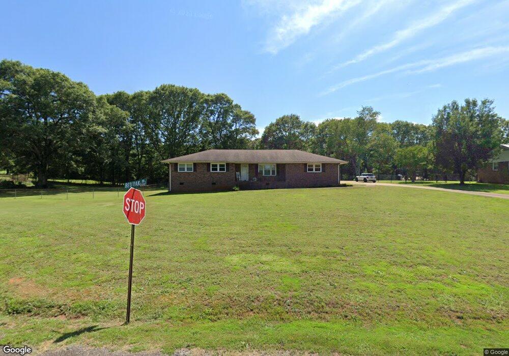
101 Red Oak Dr Anderson, SC 29625
Estimated Value: $227,790 - $275,000
3
Beds
--
Bath
1,422
Sq Ft
$178/Sq Ft
Est. Value
About This Home
This home is located at 101 Red Oak Dr, Anderson, SC 29625 and is currently estimated at $252,448, approximately $177 per square foot. 101 Red Oak Dr is a home located in Anderson County with nearby schools including Centerville Elementary School, Westside High School, and Anderson Institute of Technology.
Ownership History
Date
Name
Owned For
Owner Type
Purchase Details
Closed on
Sep 8, 2022
Sold by
Elizabeth Pitts Mary
Bought by
Pitts Jason Cameron
Current Estimated Value
Home Financials for this Owner
Home Financials are based on the most recent Mortgage that was taken out on this home.
Original Mortgage
$167,902
Outstanding Balance
$160,475
Interest Rate
5.3%
Mortgage Type
FHA
Estimated Equity
$91,973
Purchase Details
Closed on
Feb 17, 2021
Sold by
Estate Of Jimmy Theodore Singleton
Bought by
Pitts Mary Elizabeth and Singleton David Wayne
Purchase Details
Closed on
Jun 13, 2012
Sold by
Singleton Jimmy T and Singleton Elsie Mae
Bought by
Singleton Jimmy T
Create a Home Valuation Report for This Property
The Home Valuation Report is an in-depth analysis detailing your home's value as well as a comparison with similar homes in the area
Home Values in the Area
Average Home Value in this Area
Purchase History
| Date | Buyer | Sale Price | Title Company |
|---|---|---|---|
| Pitts Jason Cameron | $171,000 | -- | |
| Pitts Mary Elizabeth | -- | None Available | |
| Singleton Jimmy T | -- | -- |
Source: Public Records
Mortgage History
| Date | Status | Borrower | Loan Amount |
|---|---|---|---|
| Open | Pitts Jason Cameron | $167,902 |
Source: Public Records
Tax History Compared to Growth
Tax History
| Year | Tax Paid | Tax Assessment Tax Assessment Total Assessment is a certain percentage of the fair market value that is determined by local assessors to be the total taxable value of land and additions on the property. | Land | Improvement |
|---|---|---|---|---|
| 2024 | $865 | $6,800 | $1,000 | $5,800 |
| 2023 | $865 | $6,800 | $1,000 | $5,800 |
| 2022 | $381 | $6,600 | $900 | $5,700 |
| 2021 | $313 | $5,640 | $640 | $5,000 |
| 2020 | $311 | $5,640 | $640 | $5,000 |
| 2019 | $311 | $5,640 | $640 | $5,000 |
| 2018 | $316 | $5,640 | $640 | $5,000 |
| 2017 | -- | $5,640 | $640 | $5,000 |
| 2016 | $249 | $5,150 | $540 | $4,610 |
| 2015 | $255 | $5,150 | $540 | $4,610 |
| 2014 | $255 | $5,150 | $540 | $4,610 |
Source: Public Records
Map
Nearby Homes
- 300 Clearview Dr
- 606B Parkwood Dr
- 323 Tr B Pearman Dairy Rd
- 310 Kingston Way
- 302 Stonehaven Dr
- 301 Elm Ave
- 2026 Avant Cir
- 303 Elm Ave
- 101 Victorian Dr
- 1013 Drakes Crossing
- 410 Kingston Way
- 323 Maria Dr
- 109 Graceview E
- 110 Bean Mill Way
- 126 Coachman Dr
- 112 Lark Ln
- 101 Pleasantburg Rd
- 129 Saddle Brook
- 611 Regency Cir
- 109 Coachman Ct
- 103 Red Oak Dr
- 211 Wilson Rd
- 302 Clearview Dr
- 105 Red Oak Dr
- 208 Wilson Rd
- 301 Clearview Dr
- 304 Clearview Dr
- 102 Bryson Rd
- 303 Clearview Dr
- 106 Bryson Rd
- 106 Red Oak Dr
- 110 Bryson Rd
- 7 Wilson Rd
- 306 Clearview Dr
- 202 Wilson Rd
- 107 Red Oak Dr
- 305 Clearview Dr
- 108 Red Oak Dr
- 112 Bryson Rd
- 308 Clearview Dr