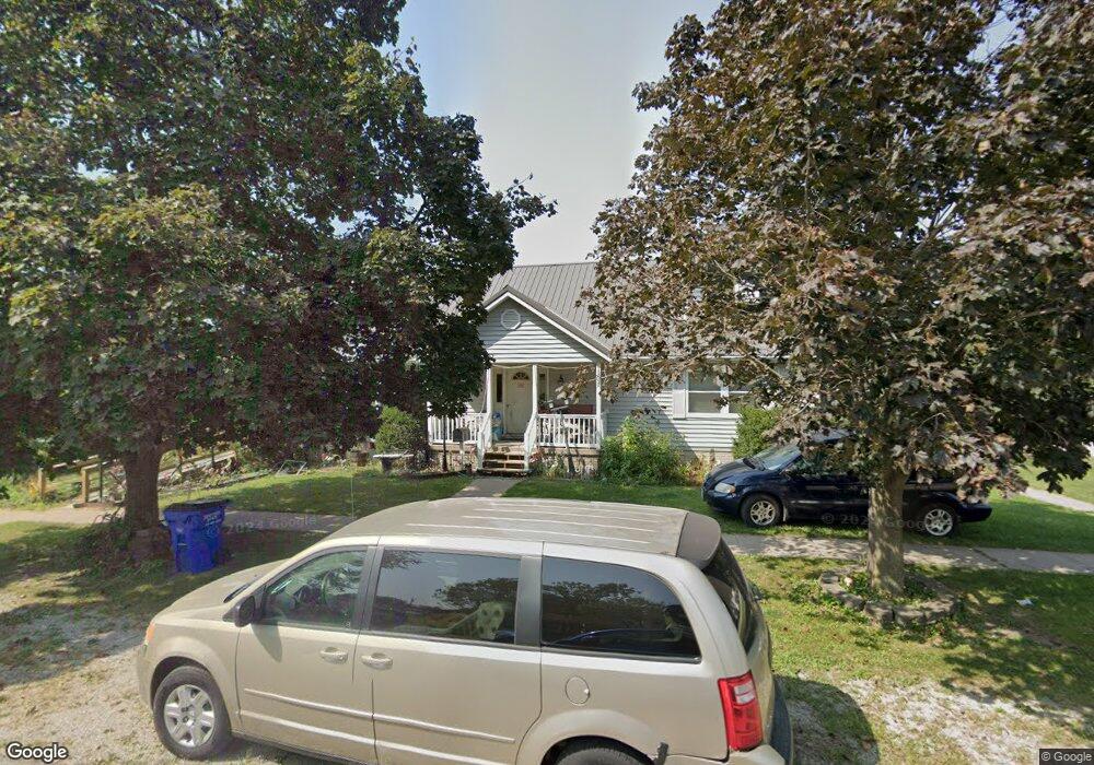
101 S Amlong St Lone Tree, IA 52755
Estimated Value: $188,000 - $336,000
3
Beds
4
Baths
2,570
Sq Ft
$113/Sq Ft
Est. Value
About This Home
This home is located at 101 S Amlong St, Lone Tree, IA 52755 and is currently estimated at $289,630, approximately $112 per square foot. 101 S Amlong St is a home located in Johnson County with nearby schools including Lone Tree Elementary School and Lone Tree Junior/Senior High School.
Ownership History
Date
Name
Owned For
Owner Type
Purchase Details
Closed on
Jan 30, 2014
Sold by
Lenz Delbert P and Lenz Betty Jo
Bought by
Lenz Delbert P and Lenz Betty I
Current Estimated Value
Home Financials for this Owner
Home Financials are based on the most recent Mortgage that was taken out on this home.
Original Mortgage
$177,911
Interest Rate
4.5%
Mortgage Type
FHA
Create a Home Valuation Report for This Property
The Home Valuation Report is an in-depth analysis detailing your home's value as well as a comparison with similar homes in the area
Home Values in the Area
Average Home Value in this Area
Purchase History
| Date | Buyer | Sale Price | Title Company |
|---|---|---|---|
| Lenz Delbert P | -- | None Available |
Source: Public Records
Mortgage History
| Date | Status | Borrower | Loan Amount |
|---|---|---|---|
| Closed | Lenz Delbert P | $177,911 |
Source: Public Records
Tax History Compared to Growth
Tax History
| Year | Tax Paid | Tax Assessment Tax Assessment Total Assessment is a certain percentage of the fair market value that is determined by local assessors to be the total taxable value of land and additions on the property. | Land | Improvement |
|---|---|---|---|---|
| 2025 | $3,658 | $309,300 | $46,600 | $262,700 |
| 2024 | $3,640 | $297,100 | $46,600 | $250,500 |
| 2023 | $3,542 | $297,100 | $46,600 | $250,500 |
| 2022 | $3,502 | $237,100 | $36,800 | $200,300 |
| 2021 | $3,672 | $237,100 | $36,800 | $200,300 |
| 2020 | $3,672 | $237,100 | $36,800 | $200,300 |
| 2019 | $3,298 | $237,100 | $36,800 | $200,300 |
| 2018 | $3,236 | $210,400 | $36,800 | $173,600 |
| 2017 | $3,542 | $210,400 | $36,800 | $173,600 |
| 2016 | $3,386 | $215,500 | $36,800 | $178,700 |
| 2015 | $3,386 | $215,500 | $36,800 | $178,700 |
| 2014 | $3,638 | $234,100 | $35,000 | $199,100 |
Source: Public Records
Map
Nearby Homes
- 221 W Commercial St
- 201 N Devoe St
- 500 S Center St
- 407 E Elm St
- 745 N Perkins St
- 106 Dorothy Ln
- 5888 Sand Rd SE
- 25840 Golden Oak Ln Lot 1
- 25838 Golden Oak Ln Lot 7
- 25836 Golden Oak Ln Lot 8
- 25832 Golden Oak Ln Lot 12
- 25736 Golden Pond Ln Se Lot 17
- 25824 Golden Oak Ln Lot 9
- 25738 Golden Pond Ln Se Lot 16
- 1092 Walnut Ave Unit 209
- 1092 Walnut Ave Unit 114 Bld D
- Lot 2 116th Cir
- Lot 39 Walter Mapp Dr
- 2 Commercial Dr
- 1436 Vine Ave