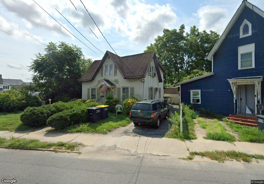
101 West St Laurel, DE 19956
Estimated Value: $119,000 - $198,394
5
Beds
--
Bath
1,224
Sq Ft
$115/Sq Ft
Est. Value
About This Home
This home is located at 101 West St, Laurel, DE 19956 and is currently estimated at $140,599, approximately $114 per square foot. 101 West St is a home located in Sussex County with nearby schools including North Laurel Elementary School, Laurel Elementary School, and Laurel Intermediate Middle School.
Ownership History
Date
Name
Owned For
Owner Type
Purchase Details
Closed on
Sep 9, 2025
Sold by
Trumark Financial Credit Union
Bought by
Mcneese Patricia and Leifheit George Harry
Current Estimated Value
Purchase Details
Closed on
Apr 25, 2025
Sold by
Sheriff Of Sussex County
Bought by
Wilmington Savings Fund Society Fsb
Purchase Details
Closed on
Sep 8, 2021
Sold by
Cc Investment Llc
Bought by
Asumana Cyprian
Purchase Details
Closed on
Feb 9, 2021
Sold by
Asumana Cyprian
Bought by
Cc Investment Llc
Purchase Details
Closed on
Aug 7, 2020
Sold by
Barker Gina J
Bought by
Asumana Cyprian
Create a Home Valuation Report for This Property
The Home Valuation Report is an in-depth analysis detailing your home's value as well as a comparison with similar homes in the area
Home Values in the Area
Average Home Value in this Area
Purchase History
| Date | Buyer | Sale Price | Title Company |
|---|---|---|---|
| Mcneese Patricia | $116,000 | None Listed On Document | |
| Wilmington Savings Fund Society Fsb | $130,000 | None Listed On Document | |
| Asumana Cyprian | -- | Mccabe Weisberg & Conway Pc | |
| Cc Investment Llc | $26,000 | None Available | |
| Asumana Cyprian | $20,000 | None Available |
Source: Public Records
Tax History
| Year | Tax Paid | Tax Assessment Tax Assessment Total Assessment is a certain percentage of the fair market value that is determined by local assessors to be the total taxable value of land and additions on the property. | Land | Improvement |
|---|---|---|---|---|
| 2025 | $416 | $5,250 | $400 | $4,850 |
| 2024 | $267 | $5,250 | $400 | $4,850 |
| 2023 | $305 | $5,250 | $400 | $4,850 |
| 2022 | $264 | $5,250 | $400 | $4,850 |
| 2021 | $262 | $5,250 | $400 | $4,850 |
| 2020 | $265 | $5,250 | $400 | $4,850 |
| 2019 | $269 | $5,250 | $400 | $4,850 |
| 2018 | $294 | $5,250 | $0 | $0 |
| 2017 | $285 | $5,250 | $0 | $0 |
| 2016 | $303 | $5,250 | $0 | $0 |
| 2015 | $261 | $5,250 | $0 | $0 |
| 2014 | $232 | $5,250 | $0 | $0 |
Source: Public Records
Map
Nearby Homes
- 216 W 8th St
- 209 W 7th St
- 402 Pine St
- 223 W 7th St
- 211 W 6th St
- 0 Iona Ave Unit DESU2096064
- 99999 Ionia Ave
- 9269 Sharptown Rd
- 9258 Sharptown Rd
- 533 E 4th St
- 205 W Front St Unit A
- 31566 White St
- 405 Park Ln
- 101 Records Pond Ct Unit 9
- 204 Turtle Cove Unit 115
- 31536 White St
- 10954 E 4th St
- 32076 Gordy Rd
- 62 ACRES Trussum Pond Rd
- 0 Sussex Hwy Unit DESU2086016
- 101 West St
- 101 W 10th St
- 816 S Central Ave
- 812 S Central Ave
- 810 S Central Ave
- 810 S Central Ave
- 810 S Central Ave
- 100 W 10th St
- 102 Deshields St
- 806 S Central Ave
- Vacant Lot S S Central Ave
- 804 S Central Ave
- Lot 1 Oak Ln
- 1001 S Central Ave
- 802 S Central Ave
- 102 W 8th St
- 104 W 8th St
- 800 S Central Ave
- 1014 S Central Ave Unit A
- 1014 S Central Ave
Your Personal Tour Guide
Ask me questions while you tour the home.