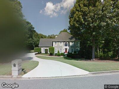
1010 Anston Dr Roswell, GA 30075
Estimated Value: $906,950 - $1,484,000
4
Beds
5
Baths
3,671
Sq Ft
$303/Sq Ft
Est. Value
About This Home
This home is located at 1010 Anston Dr, Roswell, GA 30075 and is currently estimated at $1,112,238, approximately $302 per square foot. 1010 Anston Dr is a home located in Fulton County with nearby schools including Roswell North Elementary School, Crabapple Middle School, and Roswell High School.
Ownership History
Date
Name
Owned For
Owner Type
Purchase Details
Closed on
Mar 31, 2011
Sold by
Carrier Christine D
Bought by
Halan Angela W and Halan Michael S
Current Estimated Value
Home Financials for this Owner
Home Financials are based on the most recent Mortgage that was taken out on this home.
Original Mortgage
$300,922
Interest Rate
3.87%
Mortgage Type
FHA
Purchase Details
Closed on
Dec 15, 1993
Sold by
Omara Robert K Mary E
Bought by
Carrier Christine D
Home Financials for this Owner
Home Financials are based on the most recent Mortgage that was taken out on this home.
Original Mortgage
$203,150
Interest Rate
3.87%
Create a Home Valuation Report for This Property
The Home Valuation Report is an in-depth analysis detailing your home's value as well as a comparison with similar homes in the area
Home Values in the Area
Average Home Value in this Area
Purchase History
| Date | Buyer | Sale Price | Title Company |
|---|---|---|---|
| Halan Angela W | $308,800 | -- | |
| Carrier Christine D | $226,500 | -- |
Source: Public Records
Mortgage History
| Date | Status | Borrower | Loan Amount |
|---|---|---|---|
| Open | Halan Angela W | $100,000 | |
| Open | Halan Angela W | $496,000 | |
| Closed | Halan Angela Ward | $50,000 | |
| Closed | Halan Angela Ward | $424,000 | |
| Closed | Halan Angela Ward | $115,000 | |
| Closed | Halan Angela W | $67,700 | |
| Closed | Halan Angela Ward | $302,000 | |
| Previous Owner | Halan Angela W | $300,922 | |
| Previous Owner | Carrier Christine D | $15,000 | |
| Previous Owner | Carrier Christine D | $203,150 |
Source: Public Records
Tax History Compared to Growth
Tax History
| Year | Tax Paid | Tax Assessment Tax Assessment Total Assessment is a certain percentage of the fair market value that is determined by local assessors to be the total taxable value of land and additions on the property. | Land | Improvement |
|---|---|---|---|---|
| 2023 | $1,459 | $299,080 | $52,080 | $247,000 |
| 2022 | $7,869 | $299,080 | $52,080 | $247,000 |
| 2021 | $7,781 | $244,320 | $44,760 | $199,560 |
| 2020 | $7,324 | $223,640 | $62,880 | $160,760 |
| 2019 | $999 | $201,560 | $42,000 | $159,560 |
| 2018 | $5,555 | $196,800 | $41,000 | $155,800 |
| 2017 | $4,013 | $137,560 | $24,720 | $112,840 |
| 2016 | $4,014 | $137,560 | $24,720 | $112,840 |
| 2015 | $4,781 | $137,560 | $24,720 | $112,840 |
| 2014 | $4,217 | $137,560 | $24,720 | $112,840 |
Source: Public Records
Map
Nearby Homes
- 100 Braxton Way
- 650 Jones Rd
- 3437 Colebrook Trail
- 620 Oakstone Way
- 1010 Allenbrook Ln
- 10845 Shallowford Rd
- 785 Charleston Dr
- 0 Woodstock Rd Unit 10528510
- 0 Woodstock Rd Unit 7582307
- 10765 Shallowford Rd
- 1095 Lyndhurst Way
- 10485 Woodstock Rd
- 5035 Foxberry Ln
- 560 Indigo Dr
- 310 Bloomfield Ct
- 5021 Heatherwood Ct
- 495 Ramsdale Dr
- 5010 Foxberry Ln
- 1010 Anston Dr
- 1020 Anston Dr
- 0 Anston Dr Unit 7195044
- 0 Anston Dr Unit 3204311
- 0 Anston Dr Unit 8593786
- 0 Anston Dr Unit 8534749
- 0 Anston Dr Unit 8145181
- 0 Anston Dr Unit 8106783
- 0 Anston Dr
- 560 Shirerokes Ct
- 570 Shirerokes Ct
- 1030 Anston Dr
- 1025 Anston Dr
- 1035 Anston Dr
- 635 Crossbridge Alley
- 130 Chesnut St
- 1015 Anston Dr
- 580 Shirerokes Ct
- 1005 Anston Dr
- 1040 Anston Dr