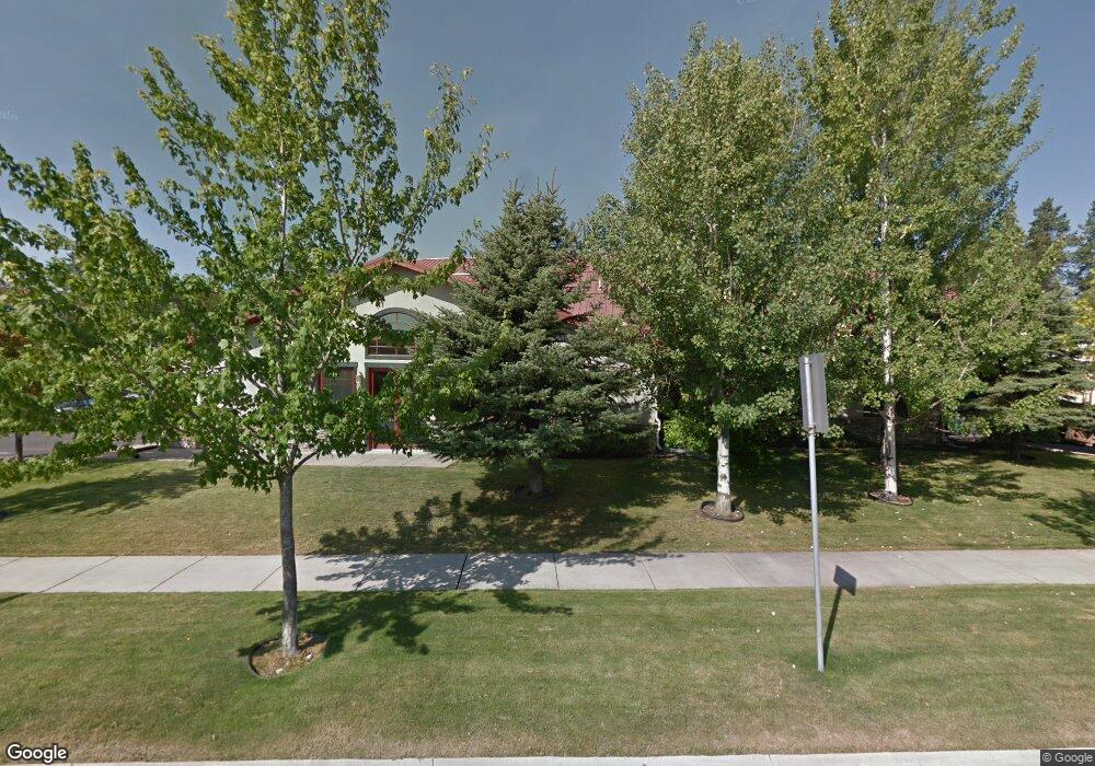
1010 Baker Ave Whitefish, MT 59937
Estimated Value: $2,126,622
Studio
--
Bath
13,180
Sq Ft
$161/Sq Ft
Est. Value
About This Home
This home is located at 1010 Baker Ave, Whitefish, MT 59937 and is currently estimated at $2,126,622, approximately $161 per square foot. 1010 Baker Ave is a home located in Flathead County with nearby schools including L.A. Muldown School, Whitefish Middle School, and Whitefish High School.
Ownership History
Date
Name
Owned For
Owner Type
Purchase Details
Closed on
May 14, 2024
Sold by
Ruis Hldg 35 5Th Street W Llc
Bought by
1010 Baker Investors Llc
Current Estimated Value
Purchase Details
Closed on
Mar 8, 2021
Sold by
Gearhart Christopher S
Bought by
Ruis Holdings 35 5Th Street West Llc
Purchase Details
Closed on
May 31, 2006
Sold by
Gearhart Kathleen E
Bought by
Gearhart Christopher S
Home Financials for this Owner
Home Financials are based on the most recent Mortgage that was taken out on this home.
Original Mortgage
$400,000
Interest Rate
6.55%
Mortgage Type
Commercial
Create a Home Valuation Report for This Property
The Home Valuation Report is an in-depth analysis detailing your home's value as well as a comparison with similar homes in the area
Home Values in the Area
Average Home Value in this Area
Purchase History
| Date | Buyer | Sale Price | Title Company |
|---|---|---|---|
| 1010 Baker Investors Llc | -- | Fidelity National Title Compan | |
| Ruis Holdings 35 5Th Street West Llc | -- | Premier Title | |
| Gearhart Christopher S | -- | Stewart Title Of Flathead Co |
Source: Public Records
Mortgage History
| Date | Status | Borrower | Loan Amount |
|---|---|---|---|
| Previous Owner | Gearhart Christopher S | $400,000 |
Source: Public Records
Tax History Compared to Growth
Tax History
| Year | Tax Paid | Tax Assessment Tax Assessment Total Assessment is a certain percentage of the fair market value that is determined by local assessors to be the total taxable value of land and additions on the property. | Land | Improvement |
|---|---|---|---|---|
| 2025 | $15,493 | $2,263,200 | $0 | $0 |
| 2024 | $12,536 | $1,789,400 | $0 | $0 |
| 2023 | $17,205 | $1,789,400 | $0 | $0 |
| 2022 | $16,733 | $1,396,800 | $0 | $0 |
| 2021 | $12,288 | $1,062,700 | $0 | $0 |
| 2020 | $12,979 | $913,900 | $0 | $0 |
| 2019 | $13,788 | $913,900 | $0 | $0 |
| 2018 | $13,540 | $880,700 | $0 | $0 |
| 2017 | $9,973 | $880,700 | $0 | $0 |
| 2016 | $12,348 | $845,500 | $0 | $0 |
| 2015 | $12,403 | $845,500 | $0 | $0 |
| 2014 | $11,424 | $642,638 | $0 | $0 |
Source: Public Records
Map
Nearby Homes
- 305 Sawtooth Dr
- NHN Baker Ave
- 841, 845, 851 Baker Ave
- 919 Columbia Ave Unit A
- 535 W 9th St
- 824 10th St
- 105 Wildcat Way Unit 304
- 105 Wildcat Way Unit 301
- 105 Wildcat Way Unit 202
- 105 Wildcat Way Unit 303
- 105 Wildcat Way Unit 204
- 105 Wildcat Way Unit 203
- 105 Wildcat Way Unit 201
- 105 Wildcat Way Unit 302
- 711 Park Ave
- 1013 E 7th St Unit D
- 1010 7th St E Unit G
- 555 Park Ave
- 424 Somers Ave
- 713 Clearwater Dr
- 1010 Baker Ave Unit 304
- 1010 Baker Ave Unit 302
- 221 W 10th St
- 1005 Baker Ave
- 1111 Baker Ave
- 1111 Baker Ave
- 235 10th St W
- 1250 Baker Ave
- 900 Baker Ave
- 1003 Obrien Ave
- 1011 Obrien Ave
- 844 Baker Ave
- 1027 Obrien Ave
- 851 Baker Ave
- 6588 U S 93
- 940 Spokane Ave Unit 5
- 940 Spokane Ave Unit 4
- 940 Spokane Ave Unit 3
- 940 Spokane Ave Unit 2
- 940 Spokane Ave Unit 1