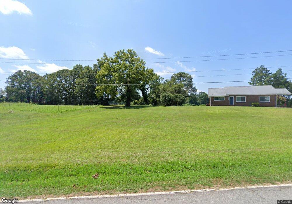
1010 Burns Bridge Rd Anderson, SC 29625
Estimated Value: $181,625 - $248,000
--
Bed
--
Bath
1,400
Sq Ft
$151/Sq Ft
Est. Value
About This Home
This home is located at 1010 Burns Bridge Rd, Anderson, SC 29625 and is currently estimated at $211,208, approximately $150 per square foot. 1010 Burns Bridge Rd is a home with nearby schools including Pendleton High School.
Ownership History
Date
Name
Owned For
Owner Type
Purchase Details
Closed on
May 19, 2022
Sold by
Gaddis Jr Louis E
Bought by
In It Together Llc
Current Estimated Value
Purchase Details
Closed on
Mar 4, 2013
Sold by
T & T Properties Inc
Bought by
Community First Bank
Purchase Details
Closed on
Mar 21, 2003
Sold by
T & T Prop Inc
Bought by
Carroll Howard O
Purchase Details
Closed on
Sep 21, 2001
Sold by
T & T Properties Inc
Bought by
Whitney Dale
Purchase Details
Closed on
Feb 7, 2001
Sold by
T & T Properties Inc
Bought by
Carroll Howard O
Create a Home Valuation Report for This Property
The Home Valuation Report is an in-depth analysis detailing your home's value as well as a comparison with similar homes in the area
Home Values in the Area
Average Home Value in this Area
Purchase History
| Date | Buyer | Sale Price | Title Company |
|---|---|---|---|
| In It Together Llc | $90,000 | Bradley K Richardson Pc | |
| Community First Bank | $10,000 | -- | |
| Carroll Howard O | $22,000 | -- | |
| Whitney Dale | $18,500 | -- | |
| Carroll Howard O | $22,000 | -- |
Source: Public Records
Tax History Compared to Growth
Tax History
| Year | Tax Paid | Tax Assessment Tax Assessment Total Assessment is a certain percentage of the fair market value that is determined by local assessors to be the total taxable value of land and additions on the property. | Land | Improvement |
|---|---|---|---|---|
| 2024 | $1,959 | $5,590 | $1,670 | $3,920 |
| 2023 | $1,959 | $5,410 | $1,670 | $3,740 |
| 2022 | $1,088 | $5,450 | $510 | $4,940 |
| 2021 | $990 | $4,610 | $320 | $4,290 |
| 2020 | $982 | $4,610 | $320 | $4,290 |
| 2019 | $969 | $4,610 | $320 | $4,290 |
| 2018 | $969 | $4,610 | $320 | $4,290 |
| 2017 | -- | $4,610 | $320 | $4,290 |
| 2016 | $834 | $4,420 | $320 | $4,100 |
| 2015 | $835 | $4,420 | $320 | $4,100 |
| 2014 | $832 | $4,420 | $320 | $4,100 |
Source: Public Records
Map
Nearby Homes
- 1103 Burns Bridge Rd
- 5924 S Carolina 187
- 114 Ann Rd
- 108 Grindstone Way
- 04 Gibson Rd
- 03 Gibson Rd
- 02 Gibson Rd
- 01 Gibson Rd
- 5028 Patterson Rd
- 201 Shore Dr
- 00 Lafrance Rd
- 360 Cann Rd
- 208 Branford St Unit SUN0124
- 308 Keeling Ave Unit SUN0138
- 111 Sunrise Ct Unit SUN0006
- Bradbury Plan at Sunrise
- Kingston Plan at Sunrise
- Roanoke Plan at Sunrise
- Abberly Plan at Sunrise
- Weston Plan at Sunrise
- 6200 Highway 187
- 101 Tc-4-145
- 100 Rivolli Dr
- 6206 Highway 187
- 102 Rivolli Dr
- 102 Tc-4-145
- 118 Rivolli Dr
- 6137 Highway 187
- 116 Rivolli Dr Unit ANDERSON
- 116 Rivolli Dr
- 121 Tc-4-145 Unit Rivolli
- 119 Tc-4-145 Unit Rivolli
- 111 Tc-4-145 Unit Rivolli
- 114 Tc-4-145
- 10 Tc-4-145
- 119 Tc-4-145
- 6004 S Carolina 187
- 0 Fants Grove Rd
- 1061 Burns Bridge Rd
- 127 Rivolli Dr Unit Anderson