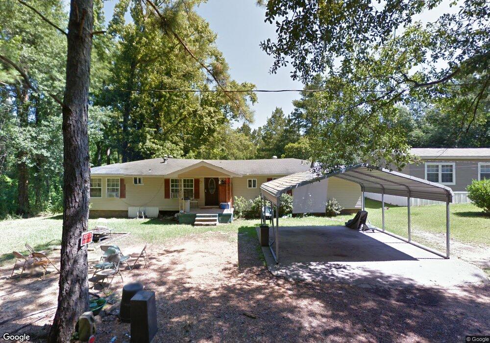
1010 Carrie St McComb, MS 39648
Estimated Value: $75,265 - $256,000
--
Bed
--
Bath
1,662
Sq Ft
$79/Sq Ft
Est. Value
About This Home
This home is located at 1010 Carrie St, McComb, MS 39648 and is currently estimated at $131,566, approximately $79 per square foot. 1010 Carrie St is a home with nearby schools including North Pike Elementary School, North Pike Middle School, and North Pike Senior High School.
Ownership History
Date
Name
Owned For
Owner Type
Purchase Details
Closed on
Jan 11, 2021
Sold by
Chapman Angela S
Bought by
Chapman Ashia
Current Estimated Value
Purchase Details
Closed on
Jul 25, 2008
Sold by
D & L Homebuilders Inc
Bought by
Chapman Angela
Home Financials for this Owner
Home Financials are based on the most recent Mortgage that was taken out on this home.
Original Mortgage
$20,000
Interest Rate
6.27%
Mortgage Type
Seller Take Back
Create a Home Valuation Report for This Property
The Home Valuation Report is an in-depth analysis detailing your home's value as well as a comparison with similar homes in the area
Home Values in the Area
Average Home Value in this Area
Purchase History
| Date | Buyer | Sale Price | Title Company |
|---|---|---|---|
| Chapman Ashia | -- | None Available | |
| Chapman Angela | -- | None Available |
Source: Public Records
Mortgage History
| Date | Status | Borrower | Loan Amount |
|---|---|---|---|
| Closed | Chapman Angela | $20,000 |
Source: Public Records
Tax History Compared to Growth
Tax History
| Year | Tax Paid | Tax Assessment Tax Assessment Total Assessment is a certain percentage of the fair market value that is determined by local assessors to be the total taxable value of land and additions on the property. | Land | Improvement |
|---|---|---|---|---|
| 2025 | $450 | $5,578 | $0 | $0 |
| 2024 | $450 | $4,675 | $0 | $0 |
| 2023 | $436 | $4,675 | $0 | $0 |
| 2022 | $427 | $4,675 | $0 | $0 |
| 2021 | $927 | $7,012 | $0 | $0 |
| 2020 | $983 | $7,405 | $0 | $0 |
| 2019 | $959 | $7,405 | $0 | $0 |
| 2018 | $953 | $7,405 | $0 | $0 |
| 2017 | $932 | $7,405 | $0 | $0 |
| 2016 | $823 | $7,405 | $0 | $0 |
| 2015 | $791 | $7,288 | $0 | $0 |
| 2014 | $774 | $7,288 | $0 | $0 |
| 2013 | -- | $4,764 | $0 | $0 |
Source: Public Records
Map
Nearby Homes
- 0 Summit Holmesville Rd
- 1033 Gertman Hill Rd
- 0 Johnson Ave
- 1078 Mississippi 570
- 1086 Mississippi 570
- XXX Brewer Ln
- 415 N Magnolia St
- 1064 Pine Cone Ln
- 1002 Avenue F
- 1002 Avenue F None
- 600 Jackson Ave
- 900 N James Ave
- 143 N Myrtle St
- 509 Jackson Ave
- 133 N Live Oak St
- 212 Harmony St
- 133 N Chestnut St
- 1004 Hickory Ave
- 507 W Georgia Ave
- 1031 Pearl River Ave
- 1004 Carrie St
- 1005 Eugene Rd
- 1017 Eugene Rd
- 1012 Carrie St
- 1024 Bonds Rd
- 1016 Eugene Rd
- 1085 Higgins Dr
- 1131 N Cherry St
- 1012 Eugene Rd
- 1039 N Cherry St
- 1029 Eugene Rd
- 1031 N Cherry St
- 2006 Summit-Hville Rd
- 1099 Eugene Rd
- 1184 Summit-Hville Rd
- 1029 N Cherry St
- 2004 Summit-Hville Rd
- 1081 Higgins Dr
- 1079 Higgins Dr
- 1027 N Cherry St