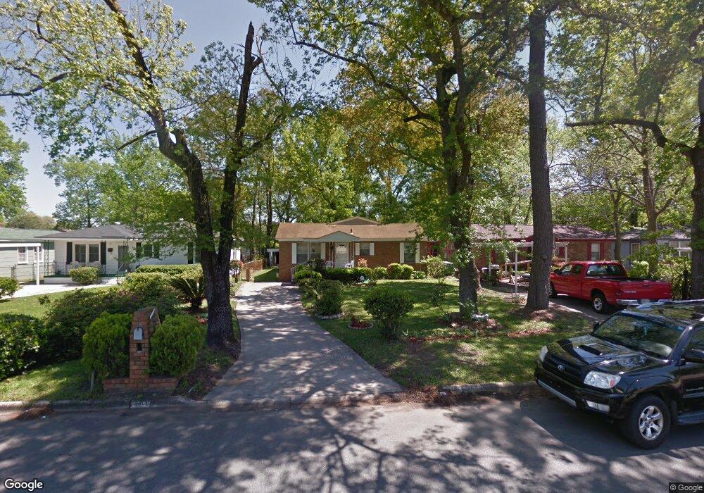
1010 Collat Ave Savannah, GA 31415
Carver Heights NeighborhoodEstimated Value: $186,000 - $276,000
3
Beds
2
Baths
1,681
Sq Ft
$140/Sq Ft
Est. Value
About This Home
This home is located at 1010 Collat Ave, Savannah, GA 31415 and is currently estimated at $235,977, approximately $140 per square foot. 1010 Collat Ave is a home located in Chatham County with nearby schools including Gadsden Elementary School, Derenne Middle School, and Groves High School.
Ownership History
Date
Name
Owned For
Owner Type
Purchase Details
Closed on
May 26, 2023
Sold by
The Marshview Grp Llc
Bought by
Jones Adriane J
Current Estimated Value
Home Financials for this Owner
Home Financials are based on the most recent Mortgage that was taken out on this home.
Original Mortgage
$254,000
Outstanding Balance
$247,257
Interest Rate
6.43%
Mortgage Type
VA
Estimated Equity
-$11,280
Purchase Details
Closed on
Oct 5, 2022
Sold by
Black Mountain Enterprise Llc
Bought by
The Marshview Grp Llc
Purchase Details
Closed on
Feb 17, 2022
Sold by
Boyd Samuel A
Bought by
Black Mountain Enterprise Llc
Home Financials for this Owner
Home Financials are based on the most recent Mortgage that was taken out on this home.
Original Mortgage
$118,900
Interest Rate
3.69%
Mortgage Type
Mortgage Modification
Purchase Details
Closed on
Dec 7, 2005
Sold by
Not Provided
Bought by
Boyd Samuel A
Create a Home Valuation Report for This Property
The Home Valuation Report is an in-depth analysis detailing your home's value as well as a comparison with similar homes in the area
Home Values in the Area
Average Home Value in this Area
Purchase History
| Date | Buyer | Sale Price | Title Company |
|---|---|---|---|
| Jones Adriane J | $254,000 | -- | |
| The Marshview Grp Llc | $80,000 | -- | |
| Black Mountain Enterprise Llc | $70,000 | -- | |
| Boyd Samuel A | -- | -- |
Source: Public Records
Mortgage History
| Date | Status | Borrower | Loan Amount |
|---|---|---|---|
| Open | Jones Adriane J | $254,000 | |
| Previous Owner | Black Mountain Enterprise Llc | $118,900 |
Source: Public Records
Tax History Compared to Growth
Tax History
| Year | Tax Paid | Tax Assessment Tax Assessment Total Assessment is a certain percentage of the fair market value that is determined by local assessors to be the total taxable value of land and additions on the property. | Land | Improvement |
|---|---|---|---|---|
| 2025 | $921 | $104,480 | $12,000 | $92,480 |
| 2024 | $921 | $95,760 | $9,000 | $86,760 |
| 2023 | $535 | $43,880 | $9,000 | $34,880 |
| 2022 | $76 | $36,200 | $6,000 | $30,200 |
| 2021 | $0 | $27,800 | $2,200 | $25,600 |
| 2020 | $0 | $27,800 | $2,200 | $25,600 |
| 2019 | $0 | $27,800 | $2,200 | $25,600 |
| 2018 | $0 | $27,520 | $2,200 | $25,320 |
| 2017 | $0 | $27,840 | $2,200 | $25,640 |
| 2016 | -- | $28,120 | $2,200 | $25,920 |
| 2015 | $5 | $29,160 | $2,280 | $26,880 |
| 2014 | $23 | $30,800 | $0 | $0 |
Source: Public Records
Map
Nearby Homes
- 1501 Dell St
- 0 Carroll St Unit Lot 16
- 0 Carroll St Unit SA341668
- 0 Carroll St Unit Lot 18
- 0 Carroll St Unit 10,12,14
- 915 Porter St
- 1511 Cathy St
- 1504 Cathy St
- 1630 Eleanor St
- 905 Cubbedge St
- 801 Lynah St
- 1642 Eleanor St
- 920 Crosby St
- 1019 Carter St
- 1018 Carter St
- 814 Carter St
- O U S 80
- 725 Fruit St
- 719 Fruit St
- 1025 Elliott Ave
- 1008 Collat Ave
- 1012 Collat Ave
- 1014 Collat Ave
- 1006 Collat Ave
- 1009 Carroll St
- 1007 Carroll St
- 1502 Heron St
- 1004 Collat Ave
- 1016 Collat Ave
- 1013 Carroll St Unit B
- 1013 Carroll St Unit A
- 1013 Carroll St
- 1005 Carroll St
- 1501 Heron St
- 1002 Collat Ave
- 1003 Carroll St
- 1015 Carroll St
- 1018 Collat Ave
- 1504 Heron St
- 1001 Carroll St