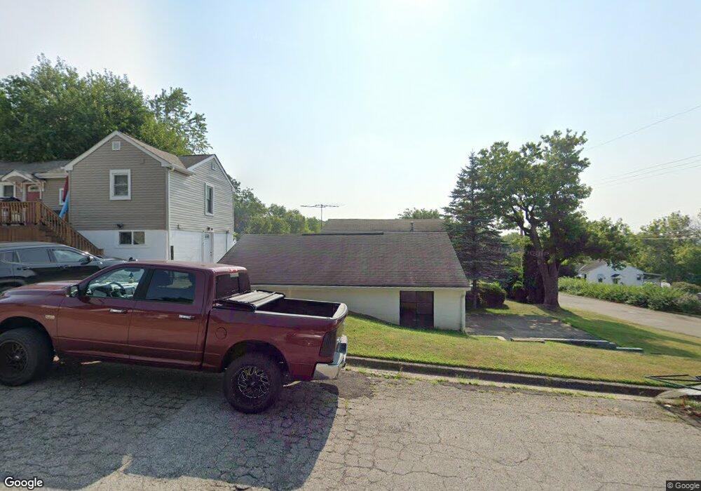
1010 Fay Ave Lancaster, OH 43130
Estimated Value: $180,000 - $208,016
2
Beds
1
Bath
774
Sq Ft
$256/Sq Ft
Est. Value
About This Home
This home is located at 1010 Fay Ave, Lancaster, OH 43130 and is currently estimated at $198,254, approximately $256 per square foot. 1010 Fay Ave is a home located in Fairfield County with nearby schools including Thomas Ewing Junior High School, Lancaster High School, and St Mary Elementary School.
Ownership History
Date
Name
Owned For
Owner Type
Purchase Details
Closed on
Nov 8, 2024
Sold by
Bond Ethan
Bought by
Scott Hunter
Current Estimated Value
Home Financials for this Owner
Home Financials are based on the most recent Mortgage that was taken out on this home.
Original Mortgage
$199,703
Outstanding Balance
$197,789
Interest Rate
6.32%
Mortgage Type
VA
Estimated Equity
$465
Purchase Details
Closed on
Aug 4, 2021
Sold by
Stump Webster N and Stump Dawn L
Bought by
Bond Ethan
Home Financials for this Owner
Home Financials are based on the most recent Mortgage that was taken out on this home.
Original Mortgage
$163,975
Interest Rate
2.7%
Mortgage Type
FHA
Purchase Details
Closed on
May 25, 2017
Sold by
Kitsmiller Michael J and Kitsmiller Cynthia S
Bought by
Stump Webster N and Stump Dawn L
Home Financials for this Owner
Home Financials are based on the most recent Mortgage that was taken out on this home.
Original Mortgage
$40,000
Interest Rate
4.08%
Mortgage Type
Commercial
Create a Home Valuation Report for This Property
The Home Valuation Report is an in-depth analysis detailing your home's value as well as a comparison with similar homes in the area
Home Values in the Area
Average Home Value in this Area
Purchase History
| Date | Buyer | Sale Price | Title Company |
|---|---|---|---|
| Scott Hunter | $195,500 | Valmer Land Title | |
| Scott Hunter | $195,500 | Valmer Land Title | |
| Bond Ethan | -- | None Listed On Document | |
| Stump Webster N | $25,000 | Lanco Title Agency |
Source: Public Records
Mortgage History
| Date | Status | Borrower | Loan Amount |
|---|---|---|---|
| Open | Scott Hunter | $199,703 | |
| Closed | Scott Hunter | $199,703 | |
| Previous Owner | Bond Ethan | $163,975 | |
| Previous Owner | Stump Webster N | $40,000 |
Source: Public Records
Tax History Compared to Growth
Tax History
| Year | Tax Paid | Tax Assessment Tax Assessment Total Assessment is a certain percentage of the fair market value that is determined by local assessors to be the total taxable value of land and additions on the property. | Land | Improvement |
|---|---|---|---|---|
| 2024 | $4,723 | $52,540 | $9,520 | $43,020 |
| 2023 | $1,911 | $52,540 | $9,520 | $43,020 |
| 2022 | $1,919 | $52,540 | $9,520 | $43,020 |
| 2021 | $1,574 | $39,460 | $7,980 | $31,480 |
| 2020 | $1,003 | $26,230 | $7,980 | $18,250 |
| 2019 | $955 | $26,230 | $7,980 | $18,250 |
| 2018 | $801 | $21,380 | $7,980 | $13,400 |
| 2017 | $801 | $20,880 | $7,140 | $13,740 |
| 2016 | $781 | $20,880 | $7,140 | $13,740 |
| 2015 | $784 | $20,340 | $7,140 | $13,200 |
| 2014 | $748 | $20,340 | $7,140 | $13,200 |
| 2013 | $748 | $20,340 | $7,140 | $13,200 |
Source: Public Records
Map
Nearby Homes
- 800 Rutter Ave
- 521 E Allen St
- 700 E Allen St
- 632 N Eastwood Ave
- 831 Franklin Ave
- 619 N Maple St
- 600 N Maple St
- 230 Lake St
- 806 N High St
- 620 E 5th Ave
- 404 E 6th Ave
- 708 N High St
- 737 Medill Ave
- 711 N High St
- 1150 E Fair Ave
- 726 King St
- 534 Overlook Dr NE
- 243 King St
- 608 E Mulberry St
- 608 Sheridan Dr