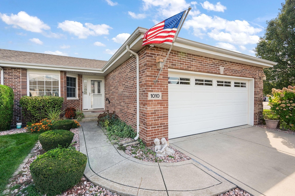
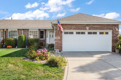
1010 Freedom Cir N Crown Point, IN 46307
Estimated payment $2,202/month
Highlights
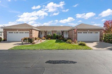
- Home fronts a pond
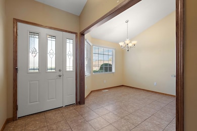
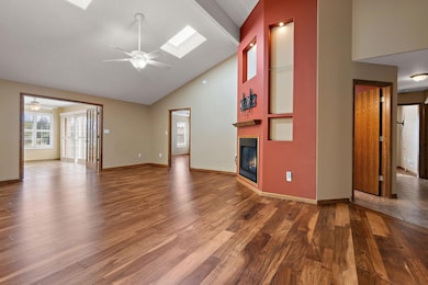
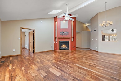
- Vaulted Ceiling
- Corner Lot
- Pond View
- Wood Flooring
- Cul-De-Sac
About This Home
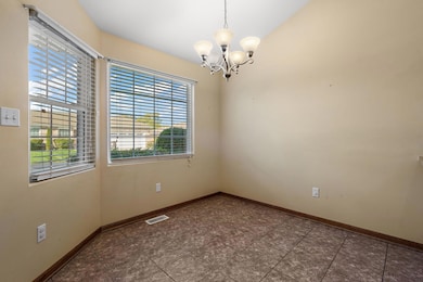
Check out this amazing 3 bed 2 bath duplex with a full basement in the desirable Silver Hawk Subdivision, which is connected to White Hawk Subdivision and golf course. Home boasts vaulted ceilings in the living room, handscraped hardwood flooring, gas fireplace, and access to a beautiful four seasons room complete with custom plantation shutters along with easy access to the back patio which offers an amazing view of the pond. Primary bedroom includes a tray ceiling, large walk in closet, and full bath. Two additional bedrooms offer space for company or an office space. Unfinished basement offers a multitude of uses and possibilities. Main floor laundry is conveniently located when you enter from the garage. The nice sized kitchen also includes stainless steel appliances and space for a table to entertain. All of the big items have been taken care of for you, roof was replaced in 2018, HVAC was replaced in 2023, Water Heater was replaced in 2024. Nothing to do but move in and enjoy, you can't beat the location close to shopping and other amenities. Low HOA fees, which takes care of your lawn maintenance and snow removal. Schedule your showing today!
Townhouse Details
Home Type
- Townhome
Est. Annual Taxes
- $3,339
Year Built
- Built in 2006
Lot Details
- 6,578 Sq Ft Lot
- Home fronts a pond
- Cul-De-Sac
- Landscaped
HOA Fees
- $80 Monthly HOA Fees
Parking
- 2 Car Garage
- Garage Door Opener
Property Views
- Pond
- Neighborhood
Home Design
- Half Duplex
- Brick Foundation
Interior Spaces
- 1,885 Sq Ft Home
- 1-Story Property
- Vaulted Ceiling
- Fireplace Features Blower Fan
- Gas Fireplace
- Plantation Shutters
- Blinds
- Living Room with Fireplace
- Basement
Kitchen
- Gas Range
- Microwave
- Dishwasher
Flooring
- Wood
- Carpet
- Tile
- Vinyl
Bedrooms and Bathrooms
- 3 Bedrooms
Laundry
- Laundry on main level
- Dryer
- Washer
- Sink Near Laundry
Outdoor Features
- Patio
- Porch
Utilities
- Forced Air Heating and Cooling System
- Heating System Uses Natural Gas
Community Details
- Association fees include ground maintenance, snow removal
- Silver Hawk HOA, Phone Number (708) 418-8900
- Silver Hawk Ph 02 Subdivision
Listing and Financial Details
- Assessor Parcel Number 451231251011000029
Map
Home Values in the Area
Average Home Value in this Area
Tax History
| Year | Tax Paid | Tax Assessment Tax Assessment Total Assessment is a certain percentage of the fair market value that is determined by local assessors to be the total taxable value of land and additions on the property. | Land | Improvement |
|---|---|---|---|---|
| 2024 | $8,698 | $350,300 | $46,300 | $304,000 |
| 2023 | $3,164 | $351,300 | $45,000 | $306,300 |
| 2022 | $3,164 | $316,400 | $35,600 | $280,800 |
| 2021 | $2,827 | $291,300 | $35,300 | $256,000 |
| 2020 | $2,410 | $262,900 | $31,500 | $231,400 |
| 2019 | $2,393 | $261,100 | $30,800 | $230,300 |
| 2018 | $2,851 | $246,800 | $30,800 | $216,000 |
| 2017 | $2,878 | $242,900 | $30,800 | $212,100 |
| 2016 | $2,834 | $246,100 | $29,700 | $216,400 |
| 2014 | $2,840 | $248,700 | $29,400 | $219,300 |
| 2013 | $2,967 | $246,500 | $31,000 | $215,500 |
Property History
| Date | Event | Price | List to Sale | Price per Sq Ft |
|---|---|---|---|---|
| 10/28/2025 10/28/25 | Pending | -- | -- | -- |
| 10/22/2025 10/22/25 | For Sale | $349,900 | -- | $186 / Sq Ft |
Purchase History
| Date | Type | Sale Price | Title Company |
|---|---|---|---|
| Interfamily Deed Transfer | -- | None Available | |
| Deed | -- | Ticor So | |
| Corporate Deed | -- | Ticor Title Schererville |
Mortgage History
| Date | Status | Loan Amount | Loan Type |
|---|---|---|---|
| Closed | $50,000 | Unknown |
Source: Northwest Indiana Association of REALTORS®
MLS Number: 829699
APN: 45-12-31-251-011.000-029
Disclaimer: Certain information contained herein is derived from information provided by parties other than Homes.com. All information provided is deemed reliable, but is not guaranteed to be accurate and should be independently verified.
![]() Copyright 2025 MuItiple Listing Service of the Northwest Indiana Realtors Association Multiple Listing Service (NIRA MLS). All rights reserved. IDX information is provided exclusively for personal, non-commercial use, and may not be used for any purpose other than to identify prospective properties consumers may be interested in purchasing. Information is deemed reliable but not guaranteed.
Copyright 2025 MuItiple Listing Service of the Northwest Indiana Realtors Association Multiple Listing Service (NIRA MLS). All rights reserved. IDX information is provided exclusively for personal, non-commercial use, and may not be used for any purpose other than to identify prospective properties consumers may be interested in purchasing. Information is deemed reliable but not guaranteed.
- 841 Veterans Ln
- 1667 Chalone Ct
- 9204 Wright St
- 4229 W 92nd Place
- 9195 Williams St
- 4862 W 92nd Ave
- 515 Holley Dr
- 340 Cochran Dr
- 3604 W 104th Place
- 221 Cedar St
- 4944 W 89th Terrace
- 9542 Roosevelt Place
- 9380 Roosevelt Place
- 9017 Mathews St
- 5063 W 89th Ct
- 1692 Carroll Ct
- 3725 W 105th Ave
- 222 Maple St
- 2150 W 95th Ave
- 1206 Sycamore St
