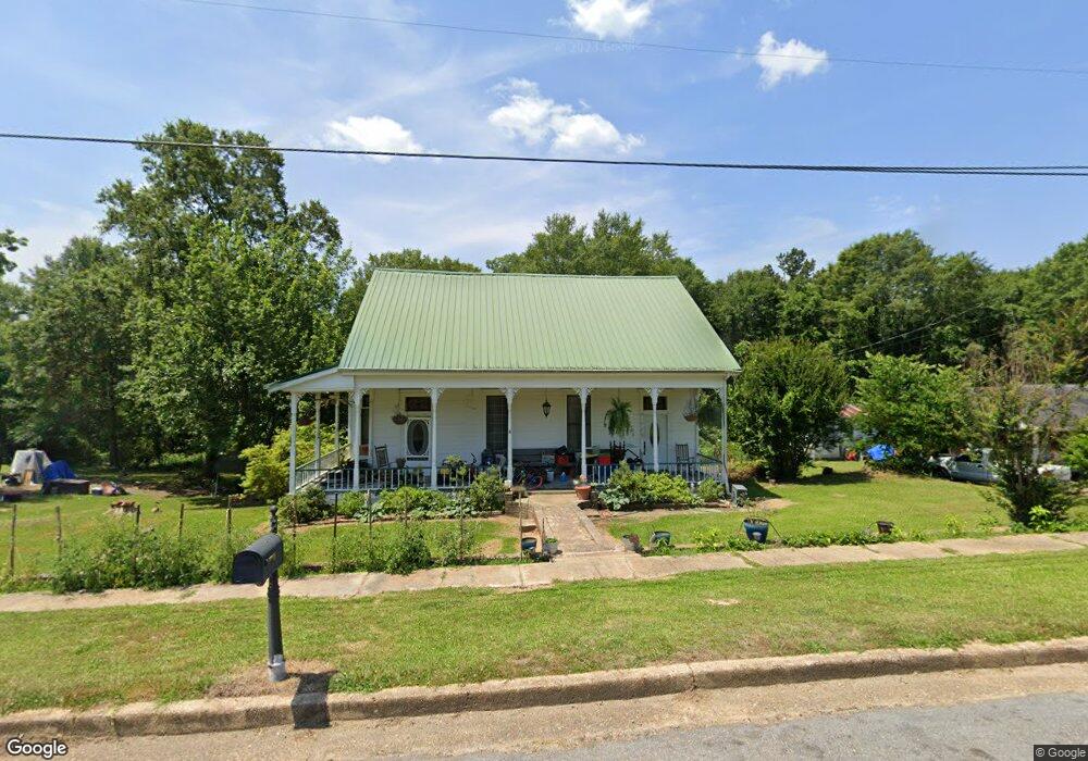
1010 Hotel St Wesson, MS 39191
Estimated Value: $155,000 - $303,000
3
Beds
2
Baths
2,307
Sq Ft
$86/Sq Ft
Est. Value
About This Home
This home is located at 1010 Hotel St, Wesson, MS 39191 and is currently estimated at $197,800, approximately $85 per square foot. 1010 Hotel St is a home located in Copiah County.
Ownership History
Date
Name
Owned For
Owner Type
Purchase Details
Closed on
Oct 11, 2013
Sold by
Secretary Of Housing And Urban Developme
Bought by
Stephens Jamie J
Current Estimated Value
Home Financials for this Owner
Home Financials are based on the most recent Mortgage that was taken out on this home.
Original Mortgage
$59,981
Outstanding Balance
$44,121
Interest Rate
4.12%
Mortgage Type
FHA
Estimated Equity
$153,679
Purchase Details
Closed on
Aug 31, 2009
Sold by
Baird Robert G and Baird Sharron H
Bought by
Dorris Shonda M
Home Financials for this Owner
Home Financials are based on the most recent Mortgage that was taken out on this home.
Original Mortgage
$122,735
Interest Rate
5.19%
Mortgage Type
FHA
Create a Home Valuation Report for This Property
The Home Valuation Report is an in-depth analysis detailing your home's value as well as a comparison with similar homes in the area
Purchase History
| Date | Buyer | Sale Price | Title Company |
|---|---|---|---|
| Stephens Jamie J | -- | -- | |
| Dorris Shonda M | -- | -- | |
| Dorris Shonda M | -- | -- |
Source: Public Records
Mortgage History
| Date | Status | Borrower | Loan Amount |
|---|---|---|---|
| Open | Stephens Jamie J | $59,981 | |
| Previous Owner | Dorris Shonda M | $122,735 | |
| Previous Owner | Dorris Shonda M | $3,682 |
Source: Public Records
Tax History
| Year | Tax Paid | Tax Assessment Tax Assessment Total Assessment is a certain percentage of the fair market value that is determined by local assessors to be the total taxable value of land and additions on the property. | Land | Improvement |
|---|---|---|---|---|
| 2025 | $796 | $9,065 | $0 | $0 |
| 2024 | $8 | $7,658 | $0 | $0 |
| 2023 | $806 | $7,658 | $0 | $0 |
| 2022 | $816 | $7,658 | $0 | $0 |
| 2021 | $789 | $7,658 | $0 | $0 |
| 2020 | $738 | $7,101 | $0 | $0 |
| 2019 | $749 | $7,101 | $0 | $0 |
| 2018 | $491 | $7,101 | $0 | $0 |
| 2017 | $453 | $7,101 | $0 | $0 |
| 2016 | $453 | $6,789 | $0 | $0 |
| 2015 | -- | $10,184 | $0 | $0 |
| 2014 | -- | $10,184 | $0 | $0 |
Source: Public Records
Map
Nearby Homes
- 1079 Beech St
- 1119 Milltowne Dr
- 0 00 Milltowne Dr
- 0 Milltownte Dr
- 1001 Lumley Ln
- 0 Sawders Ln
- 0 David Britt St
- 0 Loom St
- 596 Mount Zion Rd
- 589 Mount Zion Rd
- 594 Mount Zion Rd
- 0 Furrs Mill Dr NE
- 2038 Rocky Hill Rd
- 2548 Furrs Mill Dr NE
- 3066 New Sight Dr NE
- 3085 Beauregard Rd
- 0 Anderson Rd
- 4001 Stegall Rd
- 0 Linwood Ln NE
- 0 Old Hwy 51 NE
- 1010 Hotel St
- 1008 Hotel St
- 1013 Hotel St
- 1024 E Railroad St
- 1022 E Railroad St
- 1022 E Railroad Ave
- 1021 Collier St
- 1017 Hotel St
- 1024 E Railroad Ave
- 1022 Hotel St
- 1021 Hotel St
- 1024 Hotel St
- 3954 NW Highway 550
- 1023 Hotel St
- 1026 Hotel St
- 1020 Collier St
- 1035 Collier St
- 1022 Collier St
- 1014 E Railroad St
- 1014 E Railroad Ave
Your Personal Tour Guide
Ask me questions while you tour the home.