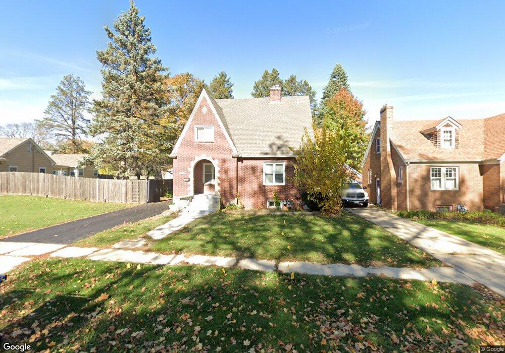
1010 Lawrence Ave Elgin, IL 60123
Grant Park NeighborhoodEstimated Value: $295,000 - $310,000
4
Beds
2
Baths
1,448
Sq Ft
$208/Sq Ft
Est. Value
About This Home
This home is located at 1010 Lawrence Ave, Elgin, IL 60123 and is currently estimated at $301,421, approximately $208 per square foot. 1010 Lawrence Ave is a home located in Kane County with nearby schools including Highland Elementary School, Kimball Middle School, and Larkin High School.
Ownership History
Date
Name
Owned For
Owner Type
Purchase Details
Closed on
Jul 28, 2015
Sold by
Bltrejv3 Chicago Llc
Bought by
Csma Blt Llc
Current Estimated Value
Purchase Details
Closed on
Oct 7, 2013
Sold by
Proulx Todd A
Bought by
Bltrejv3 Chicago Llc
Purchase Details
Closed on
Nov 21, 2003
Sold by
Anderson Paul L
Bought by
Proulx Todd A and Proulx Rachel P
Home Financials for this Owner
Home Financials are based on the most recent Mortgage that was taken out on this home.
Original Mortgage
$156,750
Interest Rate
5.5%
Mortgage Type
Purchase Money Mortgage
Create a Home Valuation Report for This Property
The Home Valuation Report is an in-depth analysis detailing your home's value as well as a comparison with similar homes in the area
Home Values in the Area
Average Home Value in this Area
Purchase History
| Date | Buyer | Sale Price | Title Company |
|---|---|---|---|
| Csma Blt Llc | $13,744,500 | Attorney | |
| Bltrejv3 Chicago Llc | $83,000 | None Available | |
| Proulx Todd A | $165,000 | -- |
Source: Public Records
Mortgage History
| Date | Status | Borrower | Loan Amount |
|---|---|---|---|
| Previous Owner | Proulx Todd A | $156,750 |
Source: Public Records
Tax History
| Year | Tax Paid | Tax Assessment Tax Assessment Total Assessment is a certain percentage of the fair market value that is determined by local assessors to be the total taxable value of land and additions on the property. | Land | Improvement |
|---|---|---|---|---|
| 2024 | $6,716 | $83,919 | $20,651 | $63,268 |
| 2023 | $6,463 | $75,815 | $18,657 | $57,158 |
| 2022 | $5,994 | $69,130 | $17,012 | $52,118 |
| 2021 | $5,766 | $64,632 | $15,905 | $48,727 |
| 2020 | $5,627 | $61,701 | $15,184 | $46,517 |
| 2019 | $5,489 | $58,774 | $14,464 | $44,310 |
| 2018 | $5,474 | $55,369 | $13,626 | $41,743 |
| 2017 | $5,384 | $52,343 | $12,881 | $39,462 |
| 2016 | $5,179 | $48,560 | $11,950 | $36,610 |
| 2015 | -- | $44,509 | $10,953 | $33,556 |
| 2014 | -- | $43,960 | $10,818 | $33,142 |
| 2013 | -- | $45,119 | $11,103 | $34,016 |
Source: Public Records
Map
Nearby Homes
- 1103 Lawrence Ave
- 1017 W Highland Ave
- 308 N Clifton Ave
- 44 Monroe St
- 12 N Du Bois Ave
- 221 Heine Ave
- 705 W Highland Ave
- 78 S Edison Ave
- 50 Sheridan St
- 118 Wilcox Ave
- 161 S Aldine Ave
- 1630 Maple Ln
- 1419 Harlan Ave
- 9 N Jackson St
- 761 South St
- 70 S Weston Ave
- 801 N Mclean Blvd Unit 324
- 801 N Mclean Blvd Unit 320
- 756 Walnut Ave
- 764 Scott Dr
- 1000 Lawrence Ave
- 305 Wing Park Blvd
- 304 Hubbard Ave
- 309 Wing Park Blvd
- 306 Hubbard Ave
- 302 Hubbard Ave
- 316 Hubbard Ave
- 322 Hubbard Ave
- 255 Wing Park Blvd
- 328 Hubbard Ave
- 1011 Lawrence Ave
- 321 Wing Park Blvd
- 334 Hubbard Ave
- 309 Hubbard Ave
- 315 Hubbard Ave
- 239 Wing Park Blvd
- 970 Lawrence Ave
- 321 Hubbard Ave
- 345 Wing Park Blvd
- 975 Lawrence Ave
Your Personal Tour Guide
Ask me questions while you tour the home.