Estimated Value: $171,000 - $189,000
2
Beds
2
Baths
1,200
Sq Ft
$148/Sq Ft
Est. Value
About This Home
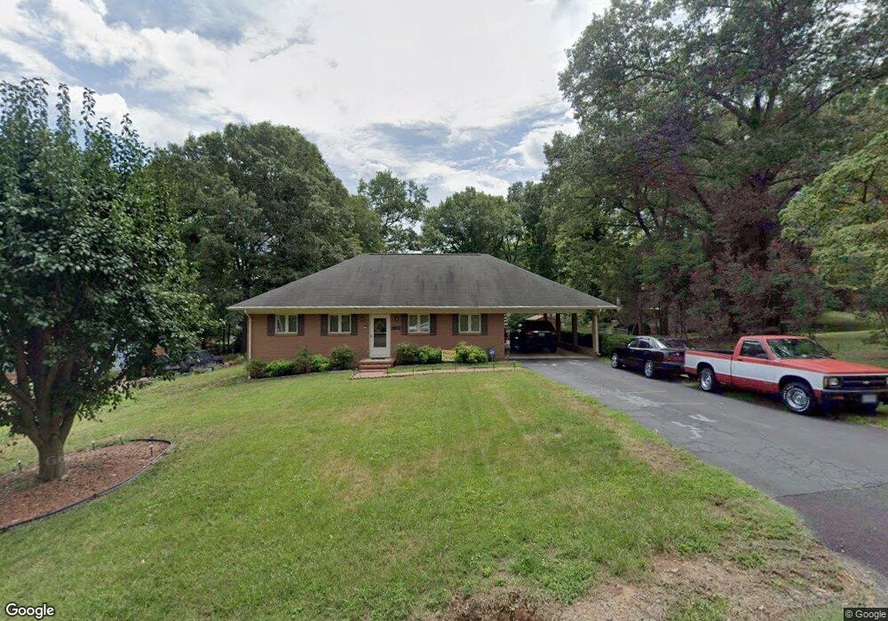
This home is located at 1010 Manning St, Eden, NC 27288 and is currently estimated at $177,650, approximately $148 per square foot. 1010 Manning St is a home located in Rockingham County with nearby schools including Leaksville-Spray Elementary School, J.E. Holmes Middle School, and John M. Morehead High School.
Ownership History
Date
Name
Owned For
Owner Type
Purchase Details
Closed on
Oct 8, 2014
Sold by
Hutcherson Harold G and Hutcherson Anita C
Bought by
Hampton Valarie D
Current Estimated Value
Home Financials for this Owner
Home Financials are based on the most recent Mortgage that was taken out on this home.
Original Mortgage
$83,460
Outstanding Balance
$64,125
Interest Rate
4.16%
Mortgage Type
FHA
Estimated Equity
$113,525
Purchase Details
Closed on
Nov 3, 2006
Sold by
Baker Elizabeth B
Bought by
Hutcherson Harold and Hutcherson Anita
Create a Home Valuation Report for This Property
The Home Valuation Report is an in-depth analysis detailing your home's value as well as a comparison with similar homes in the area
Home Values in the Area
Average Home Value in this Area
Purchase History
| Date | Buyer | Sale Price | Title Company |
|---|---|---|---|
| Hampton Valarie D | $85,000 | None Available | |
| Hutcherson Harold | $78,500 | None Available |
Source: Public Records
Mortgage History
| Date | Status | Borrower | Loan Amount |
|---|---|---|---|
| Open | Hampton Valarie D | $83,460 |
Source: Public Records
Tax History
| Year | Tax Paid | Tax Assessment Tax Assessment Total Assessment is a certain percentage of the fair market value that is determined by local assessors to be the total taxable value of land and additions on the property. | Land | Improvement |
|---|---|---|---|---|
| 2025 | $1,686 | $153,274 | $11,113 | $142,161 |
| 2024 | $1,686 | $153,274 | $11,113 | $142,161 |
| 2023 | $1,686 | $90,141 | $10,143 | $79,998 |
| 2022 | $1,175 | $90,141 | $10,143 | $79,998 |
| 2021 | $1,175 | $90,141 | $10,143 | $79,998 |
| 2020 | $1,175 | $90,141 | $10,143 | $79,998 |
| 2019 | $1,175 | $90,141 | $10,143 | $79,998 |
| 2018 | $1,104 | $84,584 | $13,643 | $70,941 |
| 2017 | $1,104 | $84,584 | $13,643 | $70,941 |
| 2015 | $1,031 | $78,192 | $13,643 | $64,549 |
| 2014 | -- | $78,192 | $13,643 | $64,549 |
Source: Public Records
Map
Nearby Homes
- 816 Elm St
- 1111 Harris St
- 994 Burton St
- 1142 Manning St
- 608 Cedar St
- 503 Cedar St
- 904 Branch St
- 1007 Haled St
- 925 Harris St
- 1313 Rivercrest Dr
- 1226 Lewis St
- 1021 Louise Ave
- 516 S Hamilton St
- 535 Patrick St
- 521 Patrick St
- 000 Nc Highway 770
- 814 Martin St
- 511 Patrick St
- 410 S Hamilton St
- 1200 Center Church Rd
- 1008 Manning St
- 802 Oakwood Dr
- 1006 Manning St
- 806 Oakwood Dr
- 1037 Harris St
- 714 Oakwood Dr
- 1031 Harris St
- 810 Oakwood Dr
- 710 Oakwood Dr
- 1025 Harris St
- 1102 Manning St
- 801 Oakwood Dr
- 803 Oakwood Dr
- 807 Oakwood Dr
- 818 Oakwood Dr
- 811 Oakwood Dr
- 1036 Harris St
- 723 Reynolds St
- 1021 Harris St
- 1020 Washington St
Your Personal Tour Guide
Ask me questions while you tour the home.