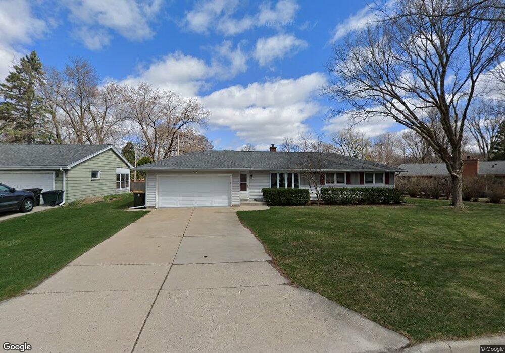
1010 N 121st St Milwaukee, WI 53226
Estimated Value: $396,000 - $423,000
3
Beds
1
Bath
1,690
Sq Ft
$240/Sq Ft
Est. Value
About This Home
This home is located at 1010 N 121st St, Milwaukee, WI 53226 and is currently estimated at $405,685, approximately $240 per square foot. 1010 N 121st St is a home located in Milwaukee County with nearby schools including Underwood Elementary School, Whitman Middle School, and West High School.
Ownership History
Date
Name
Owned For
Owner Type
Purchase Details
Closed on
Dec 17, 1997
Sold by
Felkner Dale M and Felkner Ronald M
Bought by
Whitney Tom R and Whitney Debra J
Current Estimated Value
Home Financials for this Owner
Home Financials are based on the most recent Mortgage that was taken out on this home.
Original Mortgage
$96,800
Outstanding Balance
$16,449
Interest Rate
7.28%
Estimated Equity
$389,236
Create a Home Valuation Report for This Property
The Home Valuation Report is an in-depth analysis detailing your home's value as well as a comparison with similar homes in the area
Home Values in the Area
Average Home Value in this Area
Purchase History
| Date | Buyer | Sale Price | Title Company |
|---|---|---|---|
| Whitney Tom R | $121,000 | -- |
Source: Public Records
Mortgage History
| Date | Status | Borrower | Loan Amount |
|---|---|---|---|
| Open | Whitney Tom R | $96,800 |
Source: Public Records
Tax History Compared to Growth
Tax History
| Year | Tax Paid | Tax Assessment Tax Assessment Total Assessment is a certain percentage of the fair market value that is determined by local assessors to be the total taxable value of land and additions on the property. | Land | Improvement |
|---|---|---|---|---|
| 2024 | $5,575 | $258,200 | $87,100 | $171,100 |
| 2023 | $4,731 | $234,300 | $87,100 | $147,200 |
| 2022 | $4,854 | $234,300 | $87,100 | $147,200 |
| 2021 | $4,614 | $234,300 | $87,100 | $147,200 |
| 2020 | $4,951 | $234,300 | $87,100 | $147,200 |
| 2019 | $5,000 | $234,300 | $87,100 | $147,200 |
| 2018 | $4,612 | $182,000 | $72,200 | $109,800 |
| 2017 | $4,146 | $182,000 | $72,200 | $109,800 |
| 2016 | $4,146 | $182,000 | $72,200 | $109,800 |
| 2015 | $4,104 | $182,000 | $72,200 | $109,800 |
| 2014 | $4,110 | $182,000 | $72,200 | $109,800 |
| 2013 | $4,158 | $182,000 | $72,200 | $109,800 |
Source: Public Records
Map
Nearby Homes
- 11722 W Diane Dr
- 1239 N 122nd St
- 12855 Stephen Place
- 12000 W Bluemound Rd Unit 111
- 744 N 115th St
- 11510 W Wisconsin Ave
- 12207 W Bluemound Rd
- 1409 N 116th St
- 328 N 115th St
- 441 N 112th St
- 13130 Watertown Plank Rd Unit 312
- 12990 W Bluemound Rd Unit 205
- 13050 W Bluemound Rd Unit 303
- 12980 W Bluemound Rd Unit 308
- 242 N 116th St
- 10915 W Wisconsin Ave
- 11040 W Bluemound Rd
- 580 N 108th Place
- 10900 W Bluemound Rd Unit 207
- 10900 W Bluemound Rd Unit 208
- 12042 W Diane Dr
- 1014 N 121st St
- 12024 W Diane Dr
- 1018 N 121st St
- 1007 N 121st St
- 1011 N 121st St
- 12016 W Diane Dr
- 1015 N 121st St
- 1011 N 120th St
- 1024 N 121st St
- 1019 N 121st St
- 12035 W Diane Dr
- 12045 W Diane Dr
- 12027 W Diane Dr
- 12106 W Diane Dr
- 12055 W Diane Dr
- 1025 N 120th St
- 12017 W Diane Dr
- 1025 N 121st St
- 1010 N 122nd St