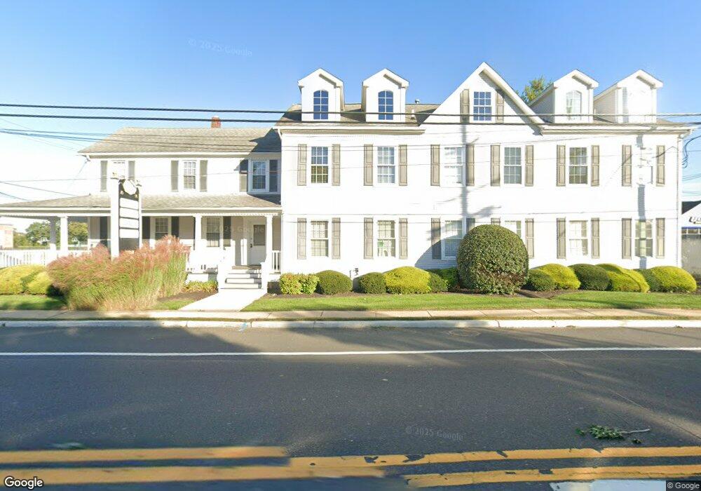
1010 New Jersey 71 Unit 2 Spring Lake, NJ 07762
--
Bed
--
Bath
4,648
Sq Ft
0.28
Acres
About This Home
This home is located at 1010 New Jersey 71 Unit 2, Spring Lake, NJ 07762. 1010 New Jersey 71 Unit 2 is a home located in Monmouth County with nearby schools including Spring Lake Heights Elementary School and St. Catharine School.
Ownership History
Date
Name
Owned For
Owner Type
Purchase Details
Closed on
Jan 28, 2020
Sold by
1010Hwy 71 L L C
Bought by
1010 Route 71 Llc
Home Financials for this Owner
Home Financials are based on the most recent Mortgage that was taken out on this home.
Original Mortgage
$750,000
Outstanding Balance
$664,072
Interest Rate
3.6%
Mortgage Type
Commercial
Create a Home Valuation Report for This Property
The Home Valuation Report is an in-depth analysis detailing your home's value as well as a comparison with similar homes in the area
Home Values in the Area
Average Home Value in this Area
Purchase History
| Date | Buyer | Sale Price | Title Company |
|---|---|---|---|
| 1010 Route 71 Llc | $104,000 | All Ahead Title Agency |
Source: Public Records
Mortgage History
| Date | Status | Borrower | Loan Amount |
|---|---|---|---|
| Open | 1010 Route 71 Llc | $750,000 |
Source: Public Records
Tax History Compared to Growth
Tax History
| Year | Tax Paid | Tax Assessment Tax Assessment Total Assessment is a certain percentage of the fair market value that is determined by local assessors to be the total taxable value of land and additions on the property. | Land | Improvement |
|---|---|---|---|---|
| 2025 | $14,855 | $1,506,600 | $837,000 | $669,600 |
| 2024 | $14,156 | $1,410,700 | $744,000 | $666,700 |
| 2023 | $14,156 | $1,263,900 | $604,500 | $659,400 |
| 2022 | $14,066 | $1,136,400 | $462,700 | $673,700 |
| 2021 | $14,066 | $1,041,900 | $399,900 | $642,000 |
| 2020 | $15,724 | $1,157,900 | $399,900 | $758,000 |
| 2019 | $15,678 | $1,142,700 | $399,900 | $742,800 |
| 2018 | $15,709 | $1,114,100 | $399,900 | $714,200 |
| 2017 | $14,911 | $1,096,400 | $386,000 | $710,400 |
| 2016 | $15,097 | $1,096,400 | $386,000 | $710,400 |
| 2015 | $14,926 | $1,087,100 | $376,700 | $710,400 |
| 2014 | $14,037 | $1,045,200 | $334,800 | $710,400 |
Source: Public Records
Map
Nearby Homes
- 613 Warren Ave
- 513 Mercer Ave
- 530 Highway 71 Unit 4
- 12 Wyckham Rd
- 15 Wyckham Rd
- 19 Willow Ln
- 418 Monmouth Ave
- 905 Wall Rd
- 418 Salem Ave
- 118 Warren Ave
- 305 4th Ave
- 1905 3rd Ave
- 1301 Warren Ave Unit 5
- 200 Monmouth Ave Unit 21
- 200 Monmouth Ave Unit 19
- 200 Monmouth Ave Unit 27
- 200 Monmouth Ave Unit 23
- 200 Monmouth Ave Unit 5
- 2419 Kipling Ave
- 601 Central Ave