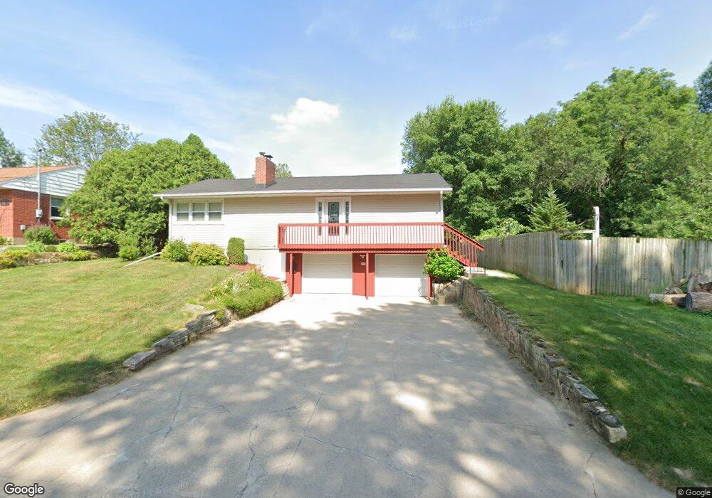
1010 Norwood Dr SE Cedar Rapids, IA 52403
Estimated Value: $208,000 - $231,000
3
Beds
2
Baths
1,885
Sq Ft
$116/Sq Ft
Est. Value
About This Home
This home is located at 1010 Norwood Dr SE, Cedar Rapids, IA 52403 and is currently estimated at $218,305, approximately $115 per square foot. 1010 Norwood Dr SE is a home located in Linn County with nearby schools including Grant Wood Elementary School, Summit Elementary School, and McKinley STEAM Academy.
Ownership History
Date
Name
Owned For
Owner Type
Purchase Details
Closed on
Oct 14, 2009
Sold by
Kemp Aaron G and Kemp Virginia L
Bought by
Volesky Michael S
Current Estimated Value
Home Financials for this Owner
Home Financials are based on the most recent Mortgage that was taken out on this home.
Original Mortgage
$103,000
Outstanding Balance
$67,223
Interest Rate
5.07%
Mortgage Type
New Conventional
Estimated Equity
$151,082
Purchase Details
Closed on
Jun 26, 2007
Sold by
Greenlee Kyle J
Bought by
Kemp Aaron G and Kemp Virginia L
Home Financials for this Owner
Home Financials are based on the most recent Mortgage that was taken out on this home.
Original Mortgage
$108,750
Interest Rate
6.26%
Mortgage Type
Purchase Money Mortgage
Purchase Details
Closed on
Nov 26, 2006
Sold by
Broadston Gerald A
Bought by
Greenlee Kyle J
Home Financials for this Owner
Home Financials are based on the most recent Mortgage that was taken out on this home.
Original Mortgage
$95,000
Interest Rate
9%
Mortgage Type
Purchase Money Mortgage
Create a Home Valuation Report for This Property
The Home Valuation Report is an in-depth analysis detailing your home's value as well as a comparison with similar homes in the area
Home Values in the Area
Average Home Value in this Area
Purchase History
| Date | Buyer | Sale Price | Title Company |
|---|---|---|---|
| Volesky Michael S | $142,500 | None Available | |
| Kemp Aaron G | $144,500 | None Available | |
| Greenlee Kyle J | $94,500 | None Available |
Source: Public Records
Mortgage History
| Date | Status | Borrower | Loan Amount |
|---|---|---|---|
| Open | Volesky Michael S | $103,000 | |
| Previous Owner | Kemp Aaron G | $108,750 | |
| Previous Owner | Greenlee Kyle J | $95,000 |
Source: Public Records
Tax History Compared to Growth
Tax History
| Year | Tax Paid | Tax Assessment Tax Assessment Total Assessment is a certain percentage of the fair market value that is determined by local assessors to be the total taxable value of land and additions on the property. | Land | Improvement |
|---|---|---|---|---|
| 2025 | $2,974 | $214,200 | $40,400 | $173,800 |
| 2024 | $3,188 | $186,800 | $37,100 | $149,700 |
| 2023 | $3,188 | $178,500 | $37,100 | $141,400 |
| 2022 | $3,050 | $160,000 | $32,300 | $127,700 |
| 2021 | $3,200 | $156,200 | $32,300 | $123,900 |
| 2020 | $3,200 | $153,600 | $32,300 | $121,300 |
| 2019 | $2,804 | $138,600 | $27,400 | $111,200 |
| 2018 | $2,722 | $138,600 | $27,400 | $111,200 |
| 2017 | $2,746 | $134,600 | $27,400 | $107,200 |
| 2016 | $2,862 | $134,600 | $27,400 | $107,200 |
| 2015 | $2,916 | $137,057 | $32,291 | $104,766 |
| 2014 | $2,916 | $137,057 | $32,291 | $104,766 |
| 2013 | $2,854 | $137,057 | $32,291 | $104,766 |
Source: Public Records
Map
Nearby Homes
- 914 25th St SE
- 2600 Mount Vernon Rd SE
- 705 Grant Wood Dr SE
- 700 Memorial Dr SE
- 1117 Crestview Dr SE
- 1158 28th St SE
- 1135 Crestview Dr SE
- 2420 11th Ave SE
- 637 Grant Wood Dr SE
- 654 26th St SE
- 2700 Mount Vernon Rd SE
- 2861 Seely Ave SE
- 549 Vernon Dr SE
- 505 Forest Dr SE
- 639 32nd St SE
- 3200 Mound Ave SE
- 3223 Mound Ave SE
- 1521 Oak Ridge Ln SE Unit 3
- 2323 Upland Dr SE
- 435 Forest Dr SE
- 950 Norwood Dr SE
- 1005 Memorial Dr SE
- 1001 Memorial Dr SE
- 1017 Memorial Dr SE
- 1007 Norwood Dr SE
- 932 Norwood Dr SE
- 937 Memorial Dr SE
- 1015 Norwood Dr SE
- 1001 Norwood Dr SE
- 1023 Memorial Dr SE
- 941 Norwood Dr SE
- 933 Memorial Dr SE
- 1021 Norwood Dr SE
- 924 Norwood Dr SE
- 1027 Memorial Dr SE
- 933 Norwood Dr SE
- 927 Memorial Dr SE
- 1010 26th St SE
- 927 Norwood Dr SE
- 1016 26th St SE