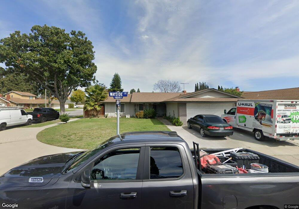
1010 S Wayside St Anaheim, CA 92805
Southeast Anaheim NeighborhoodEstimated Value: $877,000 - $915,000
4
Beds
2
Baths
1,317
Sq Ft
$679/Sq Ft
Est. Value
About This Home
This home is located at 1010 S Wayside St, Anaheim, CA 92805 and is currently estimated at $894,406, approximately $679 per square foot. 1010 S Wayside St is a home located in Orange County with nearby schools including Theodore Roosevelt Elementary School, South Junior High School, and Katella High School.
Ownership History
Date
Name
Owned For
Owner Type
Purchase Details
Closed on
Sep 6, 2002
Sold by
Littlefield Ronald J and Littlefield Kimberly A
Bought by
Gomez Teresa Dejesus
Current Estimated Value
Home Financials for this Owner
Home Financials are based on the most recent Mortgage that was taken out on this home.
Original Mortgage
$166,100
Interest Rate
6.09%
Purchase Details
Closed on
Nov 20, 1999
Sold by
Phillips Michael P
Bought by
Littlefield Ronald J and Littlefield Kimberly A
Purchase Details
Closed on
Dec 1, 1997
Sold by
Phillips Michael P and Littlefield Ronald J
Bought by
Phillips Michael P and Littlefield Ronald J
Home Financials for this Owner
Home Financials are based on the most recent Mortgage that was taken out on this home.
Original Mortgage
$150,406
Interest Rate
7.33%
Mortgage Type
FHA
Purchase Details
Closed on
Nov 24, 1997
Sold by
Phillips Denise Theresa Trust and Dwayne Gerald Dwayne
Bought by
Phillips Michael P and Littlefield Ronald J
Home Financials for this Owner
Home Financials are based on the most recent Mortgage that was taken out on this home.
Original Mortgage
$150,406
Interest Rate
7.33%
Mortgage Type
FHA
Purchase Details
Closed on
Nov 12, 1997
Sold by
Phillips Gerald Dwayne
Bought by
Phillips Gerald Dwayne and The Denise Theresa Phillips Trust
Home Financials for this Owner
Home Financials are based on the most recent Mortgage that was taken out on this home.
Original Mortgage
$150,406
Interest Rate
7.33%
Mortgage Type
FHA
Purchase Details
Closed on
Nov 9, 1997
Sold by
Sanmiguel Deborah Ann
Bought by
Phillips Gerald Dwayne and The Denise Theresa Phillips Trust
Home Financials for this Owner
Home Financials are based on the most recent Mortgage that was taken out on this home.
Original Mortgage
$150,406
Interest Rate
7.33%
Mortgage Type
FHA
Create a Home Valuation Report for This Property
The Home Valuation Report is an in-depth analysis detailing your home's value as well as a comparison with similar homes in the area
Home Values in the Area
Average Home Value in this Area
Purchase History
| Date | Buyer | Sale Price | Title Company |
|---|---|---|---|
| Gomez Teresa Dejesus | $319,000 | -- | |
| Littlefield Ronald J | $10,000 | -- | |
| Phillips Michael P | -- | -- | |
| Phillips Michael P | $20,500 | Old Republic Title Company | |
| Phillips Gerald Dwayne | $20,500 | Old Republic Title Company | |
| Phillips Gerald Dwayne | $20,500 | Old Republic Title Company | |
| Phillips Gerald Dwayne | $20,500 | Old Republic Title Company | |
| Phillips Gerald Dwayne | $20,500 | Old Republic Title Company | |
| Phillips Gerald Dwayne | $20,500 | Old Republic Title Company | |
| Phillips Gerald Dwayne | $20,500 | Old Republic Title Company | |
| Phillips Gerald Dwayne | $20,500 | Old Republic Title Company | |
| Phillips Gerald Dwayne | $20,500 | Old Republic Title Company |
Source: Public Records
Mortgage History
| Date | Status | Borrower | Loan Amount |
|---|---|---|---|
| Previous Owner | Gomez Teresa Dejesus | $166,100 | |
| Previous Owner | Phillips Michael P | $150,406 |
Source: Public Records
Tax History
| Year | Tax Paid | Tax Assessment Tax Assessment Total Assessment is a certain percentage of the fair market value that is determined by local assessors to be the total taxable value of land and additions on the property. | Land | Improvement |
|---|---|---|---|---|
| 2025 | $5,292 | $462,009 | $369,381 | $92,628 |
| 2024 | $5,292 | $452,950 | $362,138 | $90,812 |
| 2023 | $5,179 | $444,069 | $355,037 | $89,032 |
| 2022 | $5,112 | $435,362 | $348,075 | $87,287 |
| 2021 | $5,120 | $426,826 | $341,250 | $85,576 |
| 2020 | $5,098 | $422,450 | $337,751 | $84,699 |
| 2019 | $4,945 | $414,167 | $331,128 | $83,039 |
| 2018 | $4,842 | $406,047 | $324,636 | $81,411 |
| 2017 | $4,650 | $398,086 | $318,271 | $79,815 |
| 2016 | $4,635 | $390,281 | $312,031 | $78,250 |
| 2015 | $4,594 | $384,419 | $307,344 | $77,075 |
| 2014 | $4,309 | $376,889 | $301,323 | $75,566 |
Source: Public Records
Map
Nearby Homes
- 1817 E Alcove Way
- 1071 S Avocado Way
- 1425 E Vermont Ave
- 1269 E Vermont Ave
- 1804 E South St
- 1215 S Athena Way
- 1221 S Sunburst Way
- 568 S Grove Ave
- 629 S Kinney Way
- 539 S Lexington Place
- 1187 S Hilda St
- 617 E Eton Place
- 611 E Eton Place
- 537 S Priscilla Way
- 516 S State College Blvd
- 728 S Vale Ave
- 629 S Mosaic St
- 755 S Kroeger St Unit 202
- 2113 E Westport Dr
- 2321 E Puritan Ln
- 1014 S Wayside St
- 1916 E Cortney Way
- 1018 S Wayside St
- 1920 E Cortney Way
- 1921 E Turin Ave
- 1909 E Cortney Way
- 1913 E Cortney Way
- 1009 S Wayside St
- 1905 E Cortney Way
- 1005 S Wayside St
- 1925 E Turin Ave
- 1013 S Wayside St
- 1917 E Cortney Way
- 1924 E Cortney Way
- 1001 S Wayside St
- 1901 E Cortney Way
- 1017 S Wayside St
- 1929 E Turin Ave
- 1026 S Wayside St
- 1928 E Cortney Way
Your Personal Tour Guide
Ask me questions while you tour the home.