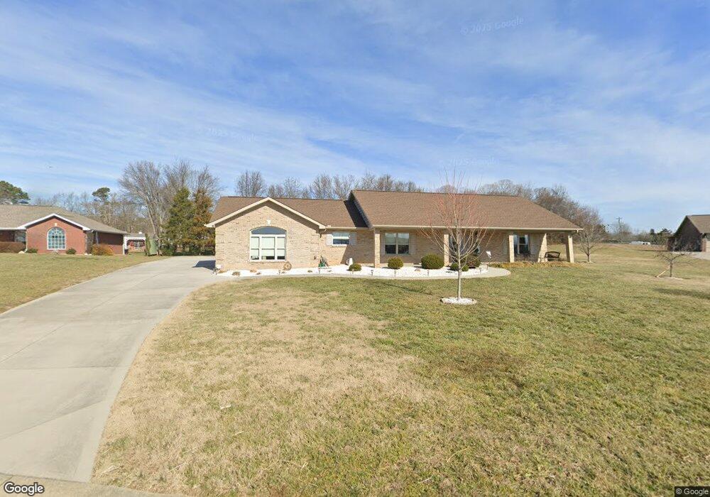
1010 Southwind Cir Dandridge, TN 37725
Estimated Value: $591,971 - $710,000
--
Bed
--
Bath
2,446
Sq Ft
$267/Sq Ft
Est. Value
About This Home
This home is located at 1010 Southwind Cir, Dandridge, TN 37725 and is currently estimated at $652,993, approximately $266 per square foot. 1010 Southwind Cir is a home located in Jefferson County.
Ownership History
Date
Name
Owned For
Owner Type
Purchase Details
Closed on
Feb 9, 2017
Sold by
Chad Dixon Construction In
Bought by
Riley William D and Riley Carolyn F
Current Estimated Value
Purchase Details
Closed on
Sep 16, 2016
Sold by
Southview Development Llc
Bought by
Chad Dixon Construction Inc
Purchase Details
Closed on
Feb 2, 2007
Bought by
Southview Development Llc
Purchase Details
Closed on
Aug 22, 2005
Bought by
Woods Kent
Purchase Details
Closed on
Oct 23, 1982
Bought by
Kyte Byrl and Kyte Mildred L
Purchase Details
Closed on
Oct 23, 1961
Create a Home Valuation Report for This Property
The Home Valuation Report is an in-depth analysis detailing your home's value as well as a comparison with similar homes in the area
Home Values in the Area
Average Home Value in this Area
Purchase History
| Date | Buyer | Sale Price | Title Company |
|---|---|---|---|
| Riley William D | $40,000 | -- | |
| Chad Dixon Construction Inc | $213,000 | -- | |
| Southview Development Llc | $1,575,000 | -- | |
| Woods Kent | $764,000 | -- | |
| Kyte Byrl | -- | -- | |
| -- | -- | -- |
Source: Public Records
Tax History Compared to Growth
Tax History
| Year | Tax Paid | Tax Assessment Tax Assessment Total Assessment is a certain percentage of the fair market value that is determined by local assessors to be the total taxable value of land and additions on the property. | Land | Improvement |
|---|---|---|---|---|
| 2025 | $1,690 | $147,225 | $16,250 | $130,975 |
| 2023 | $1,690 | $73,475 | $0 | $0 |
| 2022 | $1,609 | $73,475 | $10,000 | $63,475 |
| 2021 | $1,609 | $73,475 | $10,000 | $63,475 |
| 2020 | $1,609 | $73,475 | $10,000 | $63,475 |
| 2019 | $1,609 | $73,475 | $10,000 | $63,475 |
| 2018 | $1,499 | $63,775 | $7,500 | $56,275 |
| 2017 | $1,499 | $63,775 | $7,500 | $56,275 |
| 2016 | $176 | $7,500 | $7,500 | $0 |
| 2015 | $176 | $7,500 | $7,500 | $0 |
| 2014 | $176 | $7,500 | $7,500 | $0 |
Source: Public Records
Map
Nearby Homes
- 1045 Southwind Cir
- 1018 Southwind Cir
- 136 Crosslake Ln
- 344 Economy Cir
- 312 Economy Cir
- 1614 Sams Dr
- 1635 Sams Dr
- 1710 Ferry Hill Rd
- 417 Little Cove Dr
- 1806 Pheasant Crossing Dr
- 1988 Lakebrook Cir
- 1991 Lakebrook Cir
- 1830 Pheasant Crossing Dr
- Lots 1&2 Ferry Hill Rd
- 1928 Bouldercrest Dr
- 1887 Lakebrook Cir
- 1920 Mountain Lake Dr
- 539 Morie Rd
- 626 Briarwood Dr
- 1737 Doc Terry Rd
- 359 Morie Rd
- 1008 Southwind Cr
- Lot 3 Southwind Cir
- 35 Southwind Cir
- LOT 23 Southwind Cir
- 20 Southwind Cir
- 12 Southwind Cir
- 1008 Southwind Cir
- 1012 Southwind Cir
- 1009 Southwind Cir
- 1013 Southwind Cir
- 1005 Southwind Cir
- 1014 Southwind Cir
- 364 Morie Rd
- 1047 Southwind Cir
- 356 Morie Rd
- 1004 Southwind Cir
- 1015 Southwind Cir
- 1016 Southwind Cir
- 380 Economy Cir