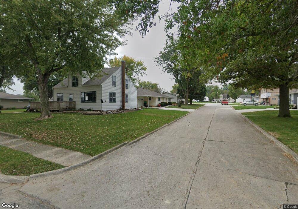
1010 Spruce Dr Manning, IA 51455
Estimated Value: $151,000 - $157,701
3
Beds
1
Bath
1,612
Sq Ft
$96/Sq Ft
Est. Value
About This Home
This home is located at 1010 Spruce Dr, Manning, IA 51455 and is currently estimated at $154,425, approximately $95 per square foot. 1010 Spruce Dr is a home with nearby schools including Ikm-Manning High School, IKM-Manning Middle School, and Irwin Elementary School.
Ownership History
Date
Name
Owned For
Owner Type
Purchase Details
Closed on
Nov 16, 2015
Sold by
Buhr Dewayne A and Buhr Cheral A
Bought by
Buhr Dewayne A and Buhr Cheral A
Current Estimated Value
Home Financials for this Owner
Home Financials are based on the most recent Mortgage that was taken out on this home.
Original Mortgage
$40,000
Interest Rate
3.74%
Mortgage Type
New Conventional
Create a Home Valuation Report for This Property
The Home Valuation Report is an in-depth analysis detailing your home's value as well as a comparison with similar homes in the area
Home Values in the Area
Average Home Value in this Area
Purchase History
| Date | Buyer | Sale Price | Title Company |
|---|---|---|---|
| Buhr Dewayne A | -- | None Available |
Source: Public Records
Mortgage History
| Date | Status | Borrower | Loan Amount |
|---|---|---|---|
| Closed | Buhr Dewayne A | $40,000 |
Source: Public Records
Tax History Compared to Growth
Tax History
| Year | Tax Paid | Tax Assessment Tax Assessment Total Assessment is a certain percentage of the fair market value that is determined by local assessors to be the total taxable value of land and additions on the property. | Land | Improvement |
|---|---|---|---|---|
| 2025 | $1,694 | $135,620 | $14,060 | $121,560 |
| 2024 | $1,616 | $115,200 | $14,060 | $101,140 |
| 2023 | $1,088 | $115,200 | $14,060 | $101,140 |
| 2022 | $1,072 | $65,190 | $12,500 | $52,690 |
| 2021 | $1,072 | $65,190 | $12,500 | $52,690 |
| 2020 | $1,092 | $65,190 | $12,500 | $52,690 |
| 2019 | $1,046 | $65,190 | $12,500 | $52,690 |
| 2018 | $1,000 | $65,190 | $12,500 | $52,690 |
| 2017 | $1,000 | $60,284 | $9,363 | $50,921 |
| 2016 | $936 | $56,340 | $0 | $0 |
| 2015 | $936 | $49,980 | $0 | $0 |
| 2014 | $834 | $49,980 | $0 | $0 |
Source: Public Records
Map
Nearby Homes