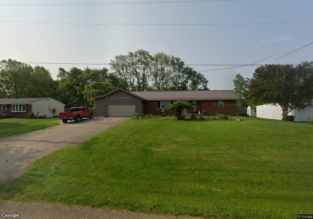
1010 Taylor Rd Mansfield, OH 44903
Estimated Value: $247,000 - $336,000
3
Beds
2
Baths
2,028
Sq Ft
$138/Sq Ft
Est. Value
About This Home
This home is located at 1010 Taylor Rd, Mansfield, OH 44903 and is currently estimated at $280,044, approximately $138 per square foot. 1010 Taylor Rd is a home located in Richland County with nearby schools including Lucas Elementary School, Lucas Heritage Middle School, and Lucas High School.
Ownership History
Date
Name
Owned For
Owner Type
Purchase Details
Closed on
Oct 22, 2002
Sold by
Reynolds Larry E
Bought by
Fightel Barbara
Current Estimated Value
Home Financials for this Owner
Home Financials are based on the most recent Mortgage that was taken out on this home.
Original Mortgage
$112,113
Outstanding Balance
$47,277
Interest Rate
6.24%
Mortgage Type
FHA
Estimated Equity
$232,767
Purchase Details
Closed on
Apr 1, 1985
Create a Home Valuation Report for This Property
The Home Valuation Report is an in-depth analysis detailing your home's value as well as a comparison with similar homes in the area
Home Values in the Area
Average Home Value in this Area
Purchase History
| Date | Buyer | Sale Price | Title Company |
|---|---|---|---|
| Fightel Barbara | $113,000 | -- | |
| -- | $48,900 | -- |
Source: Public Records
Mortgage History
| Date | Status | Borrower | Loan Amount |
|---|---|---|---|
| Open | Fightel Barbara | $112,113 |
Source: Public Records
Tax History
| Year | Tax Paid | Tax Assessment Tax Assessment Total Assessment is a certain percentage of the fair market value that is determined by local assessors to be the total taxable value of land and additions on the property. | Land | Improvement |
|---|---|---|---|---|
| 2024 | $3,844 | $89,580 | $8,740 | $80,840 |
| 2023 | $3,931 | $89,580 | $8,740 | $80,840 |
| 2022 | $3,324 | $67,620 | $7,500 | $60,120 |
| 2021 | $3,371 | $67,620 | $7,500 | $60,120 |
| 2020 | $3,177 | $67,620 | $7,500 | $60,120 |
| 2019 | $2,962 | $56,700 | $6,290 | $50,410 |
| 2018 | $2,935 | $56,700 | $6,290 | $50,410 |
| 2017 | $2,804 | $56,700 | $6,290 | $50,410 |
| 2016 | $2,730 | $52,290 | $5,360 | $46,930 |
| 2015 | $1,963 | $39,840 | $5,360 | $34,480 |
| 2014 | $1,956 | $39,840 | $5,360 | $34,480 |
| 2012 | $948 | $41,070 | $5,520 | $35,550 |
Source: Public Records
Map
Nearby Homes
- 1715 Mansfield Lucas Rd
- 744 E Hanley Rd
- 0 Woodville Rd Unit Lot 14952, 14953
- 0 Woodville Rd Unit Lot 14954, 14955
- 0 Woodville Rd Unit Lot 14956, 14957,
- 1851 State Route 39
- 1599 S Main St
- 50 Lilac Ct E
- 794 Mansfield Washington Rd
- 2011 Ohio 39
- 0 State Route 39 & I-71 Southeast Quadrant
- 0 State Route 39 & I-71 Northeast Quadrant
- 625 Mansfield Lucas Rd
- 400 Garver Rd
- 2130 State Route 39
- 83 Mccullough Blvd Unit 52
- 104 Elmridge Rd
- 138 Cliffbrook Dr
- 33 Rambleside Dr
- 1510 Cape Cod Dr Unit 1504
- 996 Taylor Rd
- 976 Taylor Rd
- 1020 Taylor Rd
- 986 Taylor Rd
- 1015 Taylor Rd
- 1044 Taylor Rd
- 960 Taylor Rd
- 1798 Washington North Rd
- 975 Taylor Rd
- 1754 Mansfield Washington Rd
- 964 Taylor Rd
- 1812 Mansfield Washington Rd
- 0 Washington-North Rd
- 1818 Washington North Rd
- 1724 Washington North Rd
- 1755 Washington North Rd
- 945 Taylor Rd
- 934 Taylor Rd
- 931 Taylor Rd
- 1824 Washington North Rd
Your Personal Tour Guide
Ask me questions while you tour the home.