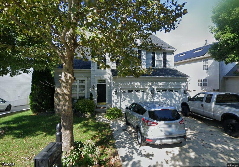
10105 Wilnor Way Laurel, MD 20723
North Laurel NeighborhoodEstimated Value: $706,000 - $789,000
--
Bed
3
Baths
2,818
Sq Ft
$267/Sq Ft
Est. Value
About This Home
This home is located at 10105 Wilnor Way, Laurel, MD 20723 and is currently estimated at $752,167, approximately $266 per square foot. 10105 Wilnor Way is a home located in Howard County with nearby schools including Gorman Crossing Elementary School, Hammond Middle School, and Reservoir High School.
Ownership History
Date
Name
Owned For
Owner Type
Purchase Details
Closed on
Mar 17, 2025
Sold by
Celestine Kurt Joel and Celestine Monica
Bought by
Prosperity Trust and Gelestine
Current Estimated Value
Purchase Details
Closed on
Jun 25, 2003
Sold by
Patriot Homes Inc
Bought by
Celestine Kurt J and Celestine Monica Monica
Purchase Details
Closed on
Aug 26, 2002
Sold by
Springland Ii Llc
Bought by
Patriot Homes Inc
Create a Home Valuation Report for This Property
The Home Valuation Report is an in-depth analysis detailing your home's value as well as a comparison with similar homes in the area
Home Values in the Area
Average Home Value in this Area
Purchase History
| Date | Buyer | Sale Price | Title Company |
|---|---|---|---|
| Prosperity Trust | -- | None Listed On Document | |
| Celestine Kurt J | $317,110 | -- | |
| Patriot Homes Inc | $85,000 | -- |
Source: Public Records
Mortgage History
| Date | Status | Borrower | Loan Amount |
|---|---|---|---|
| Closed | Celestine Kurt J | -- |
Source: Public Records
Tax History Compared to Growth
Tax History
| Year | Tax Paid | Tax Assessment Tax Assessment Total Assessment is a certain percentage of the fair market value that is determined by local assessors to be the total taxable value of land and additions on the property. | Land | Improvement |
|---|---|---|---|---|
| 2025 | $8,961 | $610,200 | $163,200 | $447,000 |
| 2024 | $8,961 | $580,367 | $0 | $0 |
| 2023 | $8,437 | $550,533 | $0 | $0 |
| 2022 | $7,968 | $520,700 | $168,200 | $352,500 |
| 2021 | $7,265 | $496,233 | $0 | $0 |
| 2020 | $7,265 | $471,767 | $0 | $0 |
| 2019 | $6,914 | $447,300 | $110,200 | $337,100 |
| 2018 | $6,437 | $437,800 | $0 | $0 |
| 2017 | $6,284 | $447,300 | $0 | $0 |
| 2016 | -- | $418,800 | $0 | $0 |
| 2015 | -- | $418,800 | $0 | $0 |
| 2014 | -- | $418,800 | $0 | $0 |
Source: Public Records
Map
Nearby Homes
- 9256 Laurens Way
- 9260 Old Scaggsville Rd
- 9420 Fairview Ave
- 9422 Fairview Ave
- 211 Patuxent Rd
- 7709 Brooklyn Bridge Rd
- 9401 Riverbrink Ct
- 200 1/2 11th St
- 1103 Montgomery St
- 9351 Cabot Ct
- 9786 Whiskey Run
- 8719 Susini Dr
- 1106 Snowden Place
- 1210 Westview Terrace
- 9743 Whiskey Run
- 7209 Brooklyn Bridge Rd
- Dorchester IV Plan at Cole's Manor
- Tidewater Plan at Cole's Manor
- Stratton Plan at Cole's Manor
- Adrienne's Honneur II Plan at Cole's Manor
- 10101 Wilnor Way
- 9120 Old Scaggsville Rd
- 9120 Scaggsville Rd
- 10113 Wilnor Way
- 10110 Wilnor Way
- 10114 Wilnor Way
- 9160 Old Scaggsville Rd
- 9141 Old Scaggsville Rd
- 9141 Old Scaggsville Rd Unit 9143
- 9141 Old Scaggsville Rd Unit 9145 B
- 9141 Old Scaggsville Rd Unit 9145 A
- 10118 Wilnor Way
- 10115 Stansfield Rd
- 9181 Old Scaggsville Rd
- 9121 Old Scaggsville Rd
- 9107 Old Scaggsville Rd
- 9086 Old Scaggsville Rd
- 10102 Stansfield Rd
- 9115 Old Scaggsville Rd
- 9145 Old Scaggsville Rd Unit 9145 A