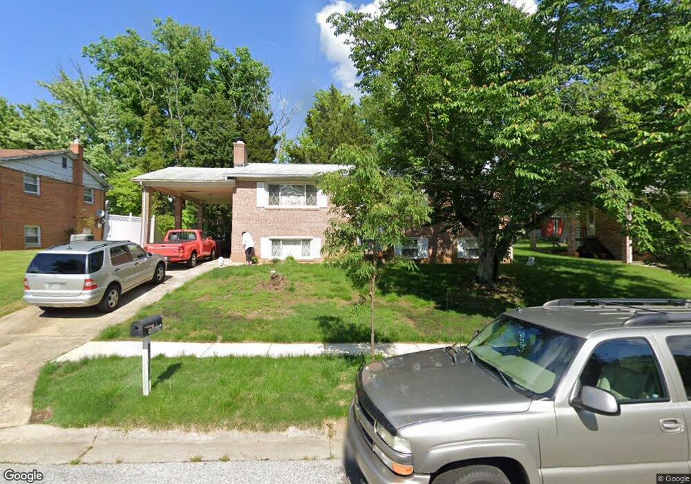
10106 White Ave Clinton, MD 20735
Estimated Value: $358,542 - $468,000
Studio
3
Baths
1,242
Sq Ft
$344/Sq Ft
Est. Value
About This Home
This home is located at 10106 White Ave, Clinton, MD 20735 and is currently estimated at $426,636, approximately $343 per square foot. 10106 White Ave is a home located in Prince George's County with nearby schools including Waldon Woods Elementary School, Stephen Decatur Middle School, and Surrattsville High School.
Ownership History
Date
Name
Owned For
Owner Type
Purchase Details
Closed on
Apr 4, 1995
Sold by
Lane Richard L
Bought by
Lawrence Mack B
Current Estimated Value
Home Financials for this Owner
Home Financials are based on the most recent Mortgage that was taken out on this home.
Original Mortgage
$133,000
Interest Rate
8.8%
Purchase Details
Closed on
Aug 3, 1971
Sold by
Robert L Welch Inc
Bought by
Lane Richard L and Lane Betty J
Create a Home Valuation Report for This Property
The Home Valuation Report is an in-depth analysis detailing your home's value as well as a comparison with similar homes in the area
Home Values in the Area
Average Home Value in this Area
Purchase History
| Date | Buyer | Sale Price | Title Company |
|---|---|---|---|
| Lawrence Mack B | $140,000 | -- | |
| Lane Richard L | $36,000 | -- |
Source: Public Records
Mortgage History
| Date | Status | Borrower | Loan Amount |
|---|---|---|---|
| Closed | Lawrence Mack B | $133,000 |
Source: Public Records
Tax History
| Year | Tax Paid | Tax Assessment Tax Assessment Total Assessment is a certain percentage of the fair market value that is determined by local assessors to be the total taxable value of land and additions on the property. | Land | Improvement |
|---|---|---|---|---|
| 2025 | $4,653 | $396,800 | $101,200 | $295,600 |
| 2024 | $4,653 | $376,233 | -- | -- |
| 2023 | $4,481 | $355,667 | $0 | $0 |
| 2022 | $4,269 | $335,100 | $101,200 | $233,900 |
| 2021 | $4,105 | $323,267 | $0 | $0 |
| 2020 | $4,026 | $311,433 | $0 | $0 |
| 2019 | $3,927 | $299,600 | $100,600 | $199,000 |
| 2018 | $3,768 | $279,367 | $0 | $0 |
| 2017 | $3,631 | $259,133 | $0 | $0 |
| 2016 | -- | $238,900 | $0 | $0 |
| 2015 | $3,171 | $238,867 | $0 | $0 |
| 2014 | $3,171 | $238,833 | $0 | $0 |
Source: Public Records
Map
Nearby Homes
- 6107 Buckler Rd
- 10309 Brandywine Rd
- 6410 Killarney St
- 6309 Gredinger Dr
- 9618 Small Dr
- 6206 Clinton Way
- F Gwynndale Dr
- 9505 Pryde Dr
- 6702 Purple Lilac Ln
- 9501 Juliette Dr
- 6706 Surratts Rd
- 7202 Redwood Branch Ct
- 7001 Killarney St
- 7002 Killarney St
- 6608 Horseshoe Rd
- 11313 Marlee Ave
- 6617 Northgate Pkwy
- 10604 Sir Brendan Ave
- 9515 Piscataway Rd
- 6710 Eilerson St
Your Personal Tour Guide
Ask me questions while you tour the home.